Star Valley Topo Map Idaho
To zoom in, hover over the map of Star Valley
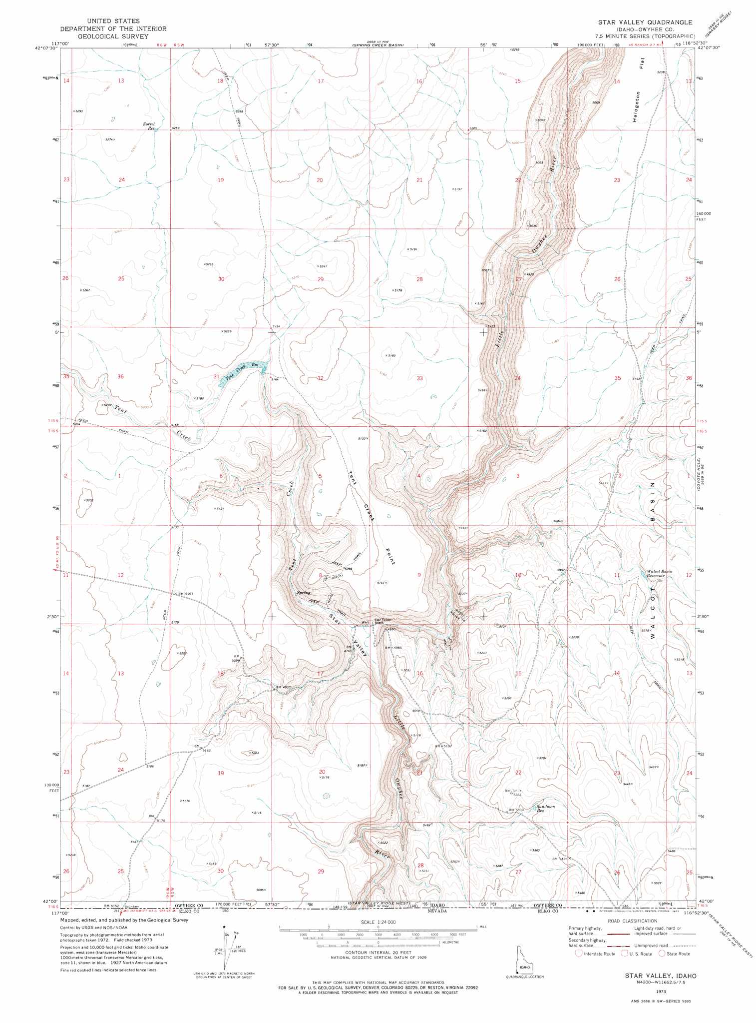
USGS Topo Quad 42116a8 - 1:24,000 scale
| Topo Map Name: | Star Valley |
| USGS Topo Quad ID: | 42116a8 |
| Print Size: | ca. 21 1/4" wide x 27" high |
| Southeast Coordinates: | 42° N latitude / 116.875° W longitude |
| Map Center Coordinates: | 42.0625° N latitude / 116.9375° W longitude |
| U.S. State: | ID |
| Filename: | o42116a8.jpg |
| Download Map JPG Image: | Star Valley topo map 1:24,000 scale |
| Map Type: | Topographic |
| Topo Series: | 7.5´ |
| Map Scale: | 1:24,000 |
| Source of Map Images: | United States Geological Survey (USGS) |
| Alternate Map Versions: |
Star Valley ID 1973, updated 1977 Download PDF Buy paper map Star Valley ID 2011 Download PDF Buy paper map Star Valley ID 2013 Download PDF Buy paper map |
1:24,000 Topo Quads surrounding Star Valley
Rawhide Pocket |
Beaver Charlie Breaks |
Bull Basin Camp |
Red Basin |
Brace Flat |
Stoney Corral |
Defeat Butte |
Spring Creek Basin |
Grassy Ridge |
Piute Basin West |
Lookout Lake |
Star Valley Knoll |
Star Valley |
Coyote Hole |
Bull Camp Butte |
Calico Butte |
Nadine Butte |
Star Valley Ridge West |
Star Valley Ridge East |
Rubber Hill |
Maiden Butte |
Maiden Butte Se |
Star Valley Ridge Sw |
Star Valley Ridge Se |
Twelvemile Flat |
> Back to 42116a1 at 1:100,000 scale
> Back to 42116a1 at 1:250,000 scale
> Back to U.S. Topo Maps home
Star Valley topo map: Gazetteer
Star Valley: Cliffs
Tent Creek Point elevation 1568m 5144′Star Valley: Dams
Nougue Dam elevation 1580m 5183′Star Valley: Reservoirs
Sorrel Reservoir elevation 1604m 5262′Sundown Reservoir elevation 1611m 5285′
Tent Creek Reservoir elevation 1569m 5147′
Walcot Basin Reservoir elevation 1578m 5177′
Star Valley: Streams
Tent Creek elevation 1443m 4734′Star Valley: Trails
Red Trail elevation 1470m 4822′Rough Trail elevation 1488m 4881′
White Trail elevation 1533m 5029′
Star Valley: Valleys
Star Valley elevation 1443m 4734′Star Valley digital topo map on disk
Buy this Star Valley topo map showing relief, roads, GPS coordinates and other geographical features, as a high-resolution digital map file on DVD: