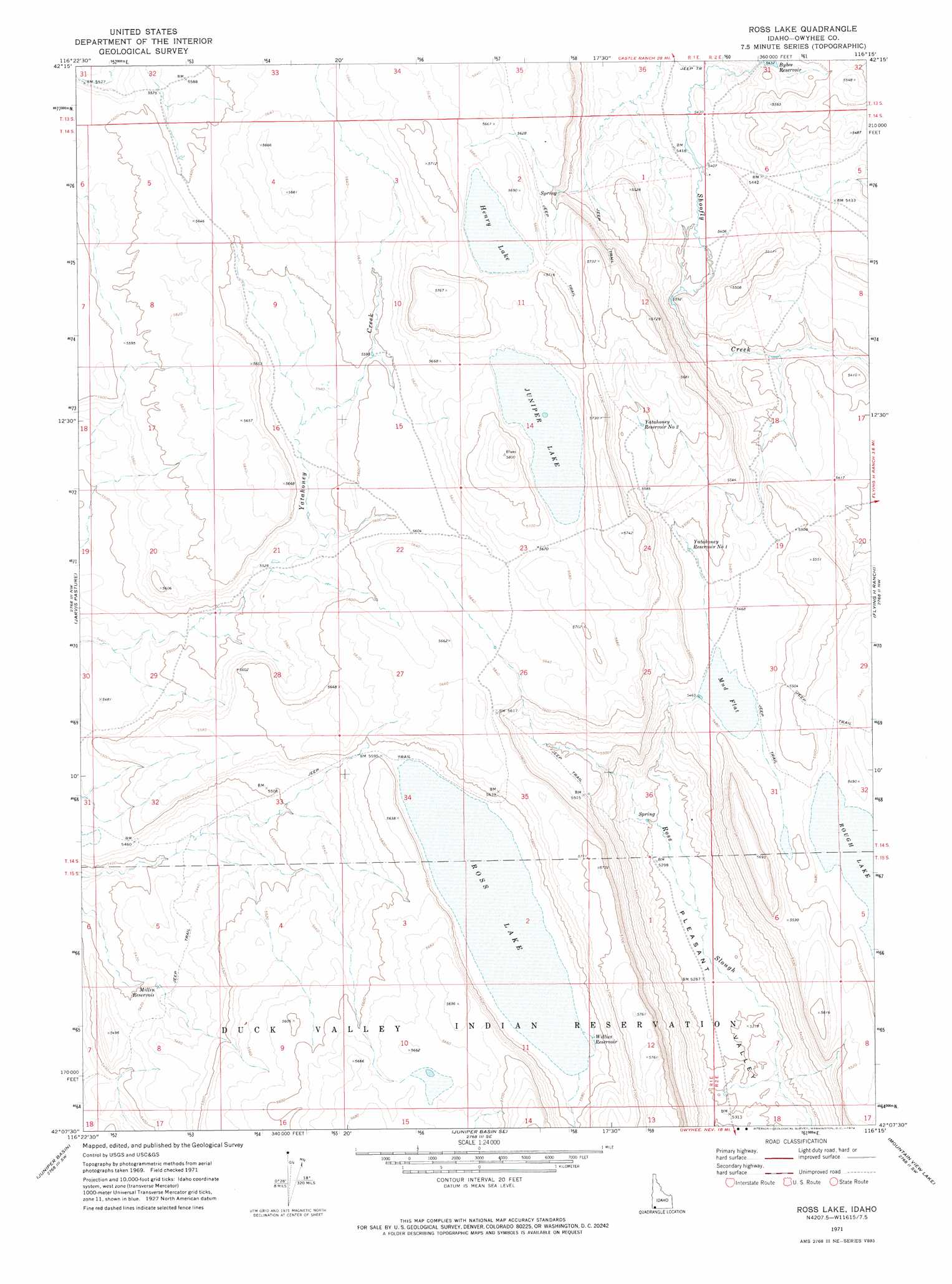
Ross Lake Topo Map Idaho
To zoom in, hover over the map of Ross Lake
USGS Topo Quad 42116b3 - 1:24,000 scale
| Topo Map Name: | Ross Lake |
| USGS Topo Quad ID: | 42116b3 |
| Print Size: | ca. 21 1/4" wide x 27" high |
| Southeast Coordinates: | 42.125° N latitude / 116.25° W longitude |
| Map Center Coordinates: | 42.1875° N latitude / 116.3125° W longitude |
| U.S. State: | ID |
| Filename: | o42116b3.jpg |
| Download Map JPG Image: | Ross Lake topo map 1:24,000 scale |
| Map Type: | Topographic |
| Topo Series: | 7.5´ |
| Map Scale: | 1:24,000 |
| Source of Map Images: | United States Geological Survey (USGS) |
| Alternate Map Versions: |
Ross Lake ID 1971, updated 1974 Download PDF Buy paper map Ross Lake ID 2010 Download PDF Buy paper map Ross Lake ID 2013 Download PDF Buy paper map |
1:24,000 Topo Quads surrounding Ross Lake
Dickshooter Reservoir |
Frying Pan Basin |
Lost Valley |
Turner Table |
Wickahoney Point |
Dickshooter Ridge |
Battle Creek Lakes |
Shoofly Springs |
Nichol Flat |
Little Blue Table |
Piute Basin East |
Jarvis Pasture |
Ross Lake |
Flying H Ranch |
Riddle |
Four Corners |
Juniper Basin |
Juniper Basin Se |
Mountain View Lake |
Three Forks |
State Line Camp |
Hat Peak |
Groundhog Reservoir |
The Point |
Owyhee |
> Back to 42116a1 at 1:100,000 scale
> Back to 42116a1 at 1:250,000 scale
> Back to U.S. Topo Maps home
Ross Lake topo map: Gazetteer
Ross Lake: Flats
Mud Flat elevation 1667m 5469′Ross Lake: Lakes
Henry Lake elevation 1726m 5662′Juniper Lake elevation 1725m 5659′
Ross Lake elevation 1699m 5574′
Rough Lake elevation 1666m 5465′
Ross Lake: Reservoirs
Millin Reservoir elevation 1650m 5413′Willies Reservoir elevation 1703m 5587′
Yatahoney Reservoir Number 1 elevation 1671m 5482′
Yatahoney Reservoir Number 2 elevation 1706m 5597′
Ross Lake digital topo map on disk
Buy this Ross Lake topo map showing relief, roads, GPS coordinates and other geographical features, as a high-resolution digital map file on DVD: