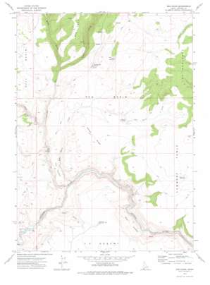
Red Basin Topo Map Idaho
To zoom in, hover over the map of Red Basin
USGS Topo Quad 42116c7 - 1:24,000 scale
| Topo Map Name: | Red Basin |
| USGS Topo Quad ID: | 42116c7 |
| Print Size: | ca. 21 1/4" wide x 27" high |
| Southeast Coordinates: | 42.25° N latitude / 116.75° W longitude |
| Map Center Coordinates: | 42.3125° N latitude / 116.8125° W longitude |
| U.S. State: | ID |
| Filename: | o42116c7.jpg |
| Download Map JPG Image: | Red Basin topo map 1:24,000 scale |
| Map Type: | Topographic |
| Topo Series: | 7.5´ |
| Map Scale: | 1:24,000 |
| Source of Map Images: | United States Geological Survey (USGS) |
| Alternate Map Versions: |
Red Basin ID 1973, updated 1976 Download PDF Buy paper map Red Basin ID 2010 Download PDF Buy paper map Red Basin ID 2013 Download PDF Buy paper map |
1:24,000 Topo Quads surrounding Red Basin
> Back to 42116a1 at 1:100,000 scale
> Back to 42116a1 at 1:250,000 scale
> Back to U.S. Topo Maps home
Red Basin topo map: Gazetteer
Red Basin: Basins
Red Basin elevation 1497m 4911′Red Basin: Flats
Ryan Pasture elevation 1462m 4796′Red Basin: Reservoirs
Big Bend Reservoir elevation 1562m 5124′Flat Top Reservoir elevation 1641m 5383′
Potter Reservoir elevation 1643m 5390′
Red Basin: Ridges
Big Tree elevation 1748m 5734′Defeat Ridge elevation 1588m 5209′
Red Basin: Slopes
The Badlands elevation 1611m 5285′Red Basin: Springs
Craig Spring elevation 1709m 5606′Dougal Waterhole elevation 1520m 4986′
Rattlesnake Spring elevation 1530m 5019′
Red Basin: Streams
Petes Creek elevation 1354m 4442′Red Basin Creek elevation 1342m 4402′
Red Basin: Summits
Lambert Table elevation 1712m 5616′The Tongue elevation 1471m 4826′
Red Basin: Valleys
Chilly Gulch elevation 1326m 4350′East Fork Red Canyon elevation 1429m 4688′
Red Canyon elevation 1311m 4301′
West Fork Red Canyon elevation 1429m 4688′
Red Basin digital topo map on disk
Buy this Red Basin topo map showing relief, roads, GPS coordinates and other geographical features, as a high-resolution digital map file on DVD:


