Rough Mountain Topo Map Idaho
To zoom in, hover over the map of Rough Mountain
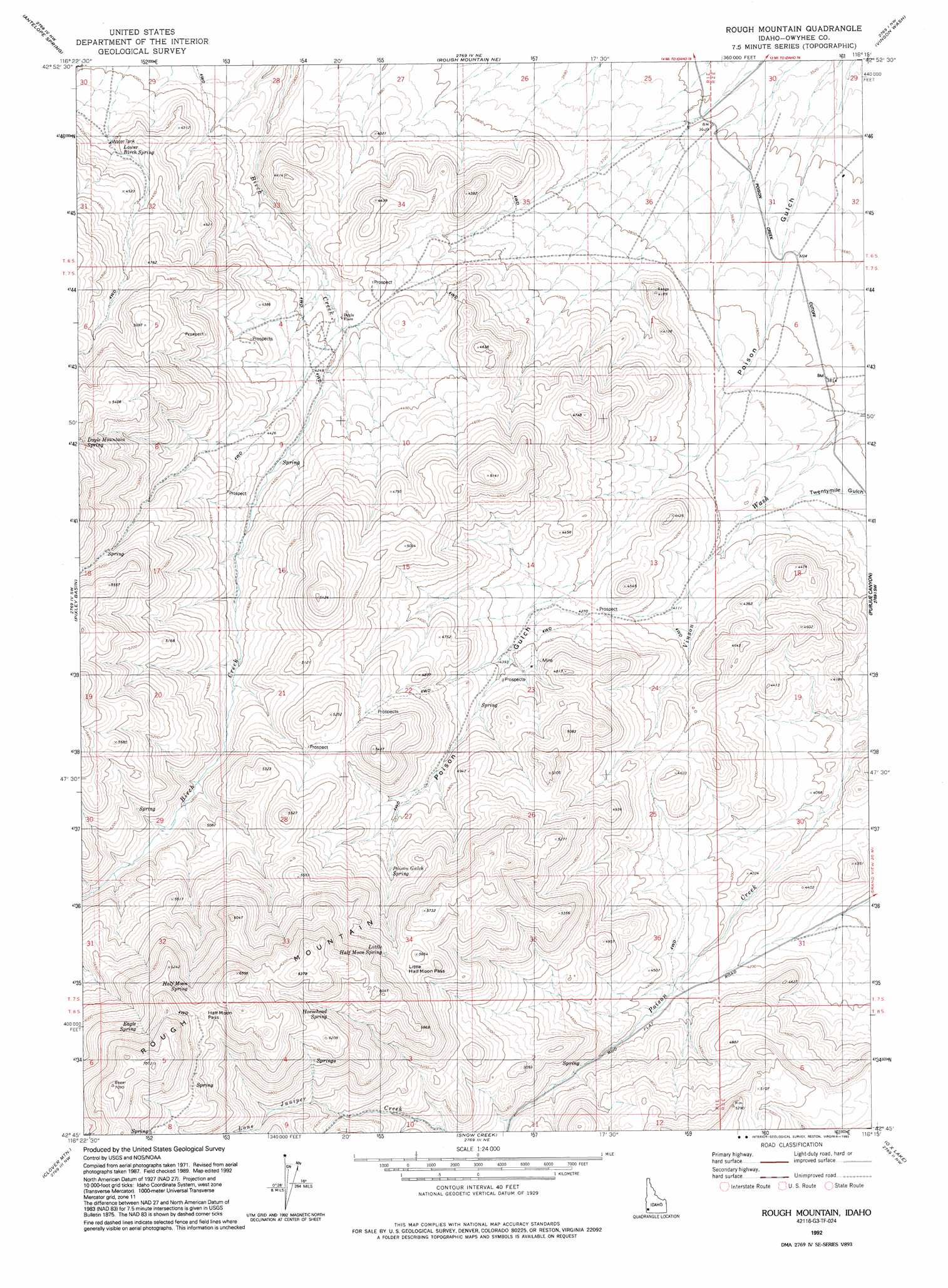
USGS Topo Quad 42116g3 - 1:24,000 scale
| Topo Map Name: | Rough Mountain |
| USGS Topo Quad ID: | 42116g3 |
| Print Size: | ca. 21 1/4" wide x 27" high |
| Southeast Coordinates: | 42.75° N latitude / 116.25° W longitude |
| Map Center Coordinates: | 42.8125° N latitude / 116.3125° W longitude |
| U.S. State: | ID |
| Filename: | o42116g3.jpg |
| Download Map JPG Image: | Rough Mountain topo map 1:24,000 scale |
| Map Type: | Topographic |
| Topo Series: | 7.5´ |
| Map Scale: | 1:24,000 |
| Source of Map Images: | United States Geological Survey (USGS) |
| Alternate Map Versions: |
Rough Mountain ID 1972, updated 1975 Download PDF Buy paper map Rough Mountain ID 1992, updated 1992 Download PDF Buy paper map Rough Mountain ID 2010 Download PDF Buy paper map Rough Mountain ID 2013 Download PDF Buy paper map |
1:24,000 Topo Quads surrounding Rough Mountain
Sinker Canyon |
Oreana |
Castle Butte |
Jackass Butte |
Dorsey Butte |
Toy Pass |
Antelope Spring |
Rough Mountain Ne |
Vinson Wash |
Grand View |
Triangle Reservoir |
Pixley Basin |
Rough Mountain |
Perjue Canyon |
Chalk Hills |
Hurry Up Creek |
Clover Mountain |
Snow Creek |
O X Lake |
Big Horse Basin Gap |
Wagon Box Basin |
Big Springs Ranch |
Crab Spring Butte |
Sugarloaf |
Hill Pasture |
> Back to 42116e1 at 1:100,000 scale
> Back to 42116a1 at 1:250,000 scale
> Back to U.S. Topo Maps home
Rough Mountain topo map: Gazetteer
Rough Mountain: Gaps
Half Moon Pass elevation 1924m 6312′Little Half Moon Pass elevation 1696m 5564′
Rough Mountain: Populated Places
Doyle Place elevation 1264m 4146′Rough Mountain: Springs
Eagle Spring elevation 1915m 6282′Half Moon Spring elevation 1841m 6040′
Horsehead Spring elevation 1797m 5895′
Little Half Moon Spring elevation 1704m 5590′
Lower Birch Spring elevation 1283m 4209′
Poison Gulch Spring elevation 1518m 4980′
Rough Mountain: Summits
Rough Mountain elevation 2148m 7047′Rough Mountain digital topo map on disk
Buy this Rough Mountain topo map showing relief, roads, GPS coordinates and other geographical features, as a high-resolution digital map file on DVD: