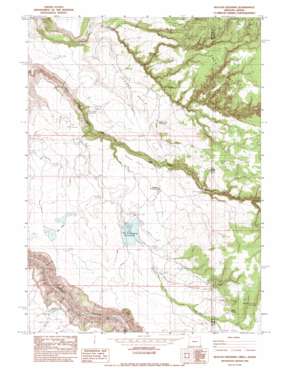
Deacon Crossing Topo Map Oregon
To zoom in, hover over the map of Deacon Crossing
USGS Topo Quad 42117d1 - 1:24,000 scale
| Topo Map Name: | Deacon Crossing |
| USGS Topo Quad ID: | 42117d1 |
| Print Size: | ca. 21 1/4" wide x 27" high |
| Southeast Coordinates: | 42.375° N latitude / 117° W longitude |
| Map Center Coordinates: | 42.4375° N latitude / 117.0625° W longitude |
| U.S. States: | OR, ID |
| Filename: | o42117d1.jpg |
| Download Map JPG Image: | Deacon Crossing topo map 1:24,000 scale |
| Map Type: | Topographic |
| Topo Series: | 7.5´ |
| Map Scale: | 1:24,000 |
| Source of Map Images: | United States Geological Survey (USGS) |
| Alternate Map Versions: |
Deacon Crossing OR 1982, updated 1983 Download PDF Buy paper map Deacon Crossing OR 2011 Download PDF Buy paper map Deacon Crossing OR 2014 Download PDF Buy paper map |
1:24,000 Topo Quads surrounding Deacon Crossing
> Back to 42117a1 at 1:100,000 scale
> Back to 42116a1 at 1:250,000 scale
> Back to U.S. Topo Maps home
Deacon Crossing topo map: Gazetteer
Deacon Crossing: Areas
The Difficulty elevation 1496m 4908′Deacon Crossing: Basins
Pole Creek Basin elevation 1451m 4760′Deacon Crossing: Crossings
Deacon Crossing elevation 1474m 4835′Deacon Crossing: Dams
Maher Dam elevation 1525m 5003′Deacon Crossing: Flats
Deacon Field elevation 1510m 4954′Dry Lakes elevation 1534m 5032′
Rentile Field elevation 1608m 5275′
Deacon Crossing: Reservoirs
Deacon Reservoir elevation 1525m 5003′Dry Pit Lake elevation 1414m 4639′
Maher Reservoir elevation 1525m 5003′
Pole Creek Reservoir elevation 1491m 4891′
Sharon Creek Reservoir elevation 1551m 5088′
State Line Reservoir elevation 1478m 4849′
Deacon Crossing: Springs
Idaho Spring elevation 1621m 5318′Saddlehorse Spring elevation 1669m 5475′
Deacon Crossing: Streams
Bull Creek elevation 1253m 4110′Field Creek elevation 1497m 4911′
Sharon Creek elevation 1250m 4101′
Soldier Meadows Creek elevation 1407m 4616′
Deacon Crossing: Summits
Pole Creek Breaks elevation 1634m 5360′Deacon Crossing: Valleys
Berry Gulch elevation 1582m 5190′Deacon Crossing digital topo map on disk
Buy this Deacon Crossing topo map showing relief, roads, GPS coordinates and other geographical features, as a high-resolution digital map file on DVD:


