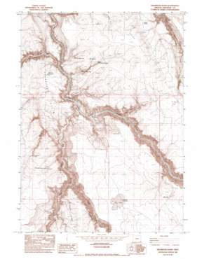
Drummond Basin Topo Map Oregon
To zoom in, hover over the map of Drummond Basin
USGS Topo Quad 42117d2 - 1:24,000 scale
| Topo Map Name: | Drummond Basin |
| USGS Topo Quad ID: | 42117d2 |
| Print Size: | ca. 21 1/4" wide x 27" high |
| Southeast Coordinates: | 42.375° N latitude / 117.125° W longitude |
| Map Center Coordinates: | 42.4375° N latitude / 117.1875° W longitude |
| U.S. State: | OR |
| Filename: | o42117d2.jpg |
| Download Map JPG Image: | Drummond Basin topo map 1:24,000 scale |
| Map Type: | Topographic |
| Topo Series: | 7.5´ |
| Map Scale: | 1:24,000 |
| Source of Map Images: | United States Geological Survey (USGS) |
| Alternate Map Versions: |
Drummond Basin OR 1982, updated 1983 Download PDF Buy paper map Drummond Basin OR 2011 Download PDF Buy paper map Drummond Basin OR 2014 Download PDF Buy paper map |
1:24,000 Topo Quads surrounding Drummond Basin
> Back to 42117a1 at 1:100,000 scale
> Back to 42116a1 at 1:250,000 scale
> Back to U.S. Topo Maps home
Drummond Basin topo map: Gazetteer
Drummond Basin: Areas
Toppin Creek V elevation 1503m 4931′Drummond Basin: Basins
Drummond Basin elevation 1390m 4560′Drummond Basin: Crossings
Lower Crossing Big Antelope Creek elevation 1236m 4055′Drummond Basin: Flats
Dry Lake elevation 1540m 5052′Drummond Basin: Reservoirs
Dry Lake Reservoir elevation 1541m 5055′Five Bar Reservoir elevation 1408m 4619′
Overtime Reservoir elevation 1434m 4704′
South Drummond Basin Reservoir elevation 1485m 4872′
Drummond Basin: Ridges
Brown Ridge elevation 1526m 5006′Drummond Basin: Springs
Brown Spring elevation 1452m 4763′Lower Drummond Waterhole elevation 1370m 4494′
Upper Drummond Waterhole elevation 1442m 4730′
Drummond Basin: Streams
Big Antelope Creek elevation 1217m 3992′Cave Creek elevation 1238m 4061′
Juniper Creek elevation 1224m 4015′
Toppin Creek elevation 1274m 4179′
West Little Owyhee River elevation 1333m 4373′
Drummond Basin: Summits
The Butte elevation 1513m 4963′Drummond Basin: Valleys
Big Antelope Canyon elevation 1270m 4166′Hanson Canyon elevation 1367m 4484′
North Cross Canyon elevation 1303m 4274′
South Cross Canyon elevation 1266m 4153′
Drummond Basin: Woods
Half Way Tree elevation 1495m 4904′Drummond Basin digital topo map on disk
Buy this Drummond Basin topo map showing relief, roads, GPS coordinates and other geographical features, as a high-resolution digital map file on DVD:


