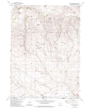
Payne Creek Topo Map Oregon
To zoom in, hover over the map of Payne Creek
USGS Topo Quad 42118a1 - 1:24,000 scale
| Topo Map Name: | Payne Creek |
| USGS Topo Quad ID: | 42118a1 |
| Print Size: | ca. 21 1/4" wide x 27" high |
| Southeast Coordinates: | 42° N latitude / 118° W longitude |
| Map Center Coordinates: | 42.0625° N latitude / 118.0625° W longitude |
| U.S. State: | OR |
| Filename: | o42118a1.jpg |
| Download Map JPG Image: | Payne Creek topo map 1:24,000 scale |
| Map Type: | Topographic |
| Topo Series: | 7.5´ |
| Map Scale: | 1:24,000 |
| Source of Map Images: | United States Geological Survey (USGS) |
| Alternate Map Versions: |
Payne Creek OR 1982, updated 1982 Download PDF Buy paper map Payne Creek OR 2011 Download PDF Buy paper map Payne Creek OR 2014 Download PDF Buy paper map |
1:24,000 Topo Quads surrounding Payne Creek
> Back to 42118a1 at 1:100,000 scale
> Back to 42118a1 at 1:250,000 scale
> Back to U.S. Topo Maps home
Payne Creek topo map: Gazetteer
Payne Creek: Mines
Opalite Mine elevation 1630m 5347′Payne Creek: Reservoirs
Beaver Reservoir elevation 1734m 5688′Dry Draw Reservoir elevation 1572m 5157′
Fifteenmile Reservoir elevation 1938m 6358′
Long Ridge Reservoir elevation 1781m 5843′
McDermitt Creek Reservoir elevation 1650m 5413′
Opal Reservoir elevation 1710m 5610′
West Cherokee Reservoir elevation 1930m 6332′
West Mine Reservoir elevation 1705m 5593′
Payne Creek: Springs
Beaver Log Spring elevation 2207m 7240′Gopher Spring elevation 1965m 6446′
Grove Spring elevation 2042m 6699′
Mahogany Spring elevation 1982m 6502′
Rose Spring Number 1 elevation 1686m 5531′
Rose Spring Number 2 elevation 1685m 5528′
Sheepline Canyon Spring elevation 2115m 6938′
Payne Creek: Streams
Cherokee Creek elevation 1504m 4934′Dry Creek elevation 1609m 5278′
East Mine Creek elevation 1600m 5249′
Hot Creek elevation 1635m 5364′
Lasa Creek elevation 1610m 5282′
Mine Creek elevation 1529m 5016′
Payne Creek elevation 1512m 4960′
Riser Creek elevation 1504m 4934′
Riser Creek elevation 1576m 5170′
Sage Creek elevation 1531m 5022′
Sage Creek elevation 1531m 5022′
Turner Creek elevation 1593m 5226′
West Mine Creek elevation 1600m 5249′
Payne Creek: Valleys
Cherokee Canyon elevation 1765m 5790′Dry Draw elevation 1563m 5127′
Lasa Canyon elevation 1767m 5797′
Rattlesnake Canyon elevation 1568m 5144′
Payne Creek digital topo map on disk
Buy this Payne Creek topo map showing relief, roads, GPS coordinates and other geographical features, as a high-resolution digital map file on DVD:


