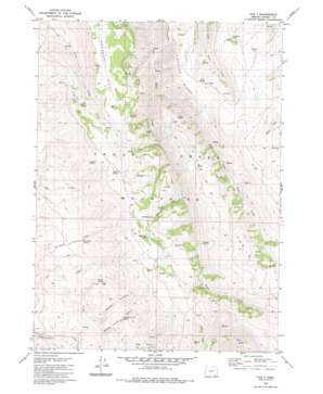
The V Topo Map Oregon
To zoom in, hover over the map of The V
USGS Topo Quad 42118a3 - 1:24,000 scale
| Topo Map Name: | The V |
| USGS Topo Quad ID: | 42118a3 |
| Print Size: | ca. 21 1/4" wide x 27" high |
| Southeast Coordinates: | 42° N latitude / 118.25° W longitude |
| Map Center Coordinates: | 42.0625° N latitude / 118.3125° W longitude |
| U.S. State: | OR |
| Filename: | o42118a3.jpg |
| Download Map JPG Image: | The V topo map 1:24,000 scale |
| Map Type: | Topographic |
| Topo Series: | 7.5´ |
| Map Scale: | 1:24,000 |
| Source of Map Images: | United States Geological Survey (USGS) |
| Alternate Map Versions: |
The V OR 1982, updated 1982 Download PDF Buy paper map The V OR 2011 Download PDF Buy paper map The V OR 2014 Download PDF Buy paper map |
1:24,000 Topo Quads surrounding The V
> Back to 42118a1 at 1:100,000 scale
> Back to 42118a1 at 1:250,000 scale
> Back to U.S. Topo Maps home
The V topo map: Gazetteer
The V: Basins
East Basin elevation 1835m 6020′The V: Ranges
Trout Creek Mountains elevation 2152m 7060′The V: Ridges
Mahogany Ridge elevation 2082m 6830′The V elevation 1998m 6555′
The V: Springs
Amos Spring elevation 2121m 6958′Burro Spring elevation 1892m 6207′
Deer Spring elevation 2246m 7368′
Government Spring elevation 2233m 7326′
Marking Corral Spring elevation 2174m 7132′
No Name Spring elevation 1882m 6174′
Sagehen Spring elevation 2039m 6689′
Stony Spring elevation 2203m 7227′
The V: Streams
Burro Creek elevation 1595m 5232′Coffee Creek elevation 1959m 6427′
East Fork Big Trout Creek elevation 1731m 5679′
Rock Cabin Creek elevation 1946m 6384′
The V: Summits
Catlow Peak elevation 2326m 7631′The V: Valleys
Marking Corral Canyon elevation 1707m 5600′Middle Canyon elevation 1692m 5551′
The V digital topo map on disk
Buy this The V topo map showing relief, roads, GPS coordinates and other geographical features, as a high-resolution digital map file on DVD:


