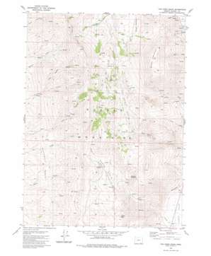
Van Horn Basin Topo Map Oregon
To zoom in, hover over the map of Van Horn Basin
USGS Topo Quad 42118a6 - 1:24,000 scale
| Topo Map Name: | Van Horn Basin |
| USGS Topo Quad ID: | 42118a6 |
| Print Size: | ca. 21 1/4" wide x 27" high |
| Southeast Coordinates: | 42° N latitude / 118.625° W longitude |
| Map Center Coordinates: | 42.0625° N latitude / 118.6875° W longitude |
| U.S. State: | OR |
| Filename: | o42118a6.jpg |
| Download Map JPG Image: | Van Horn Basin topo map 1:24,000 scale |
| Map Type: | Topographic |
| Topo Series: | 7.5´ |
| Map Scale: | 1:24,000 |
| Source of Map Images: | United States Geological Survey (USGS) |
| Alternate Map Versions: |
Van Horn Basin OR 1981, updated 1981 Download PDF Buy paper map Van Horn Basin OR 2011 Download PDF Buy paper map Van Horn Basin OR 2014 Download PDF Buy paper map |
1:24,000 Topo Quads surrounding Van Horn Basin
> Back to 42118a1 at 1:100,000 scale
> Back to 42118a1 at 1:250,000 scale
> Back to U.S. Topo Maps home
Van Horn Basin topo map: Gazetteer
Van Horn Basin: Basins
Monument Basin elevation 1665m 5462′Van Horn Basin elevation 1829m 6000′
Van Horn Basin: Flats
Propeller Meadows elevation 1987m 6519′Stergen Meadows elevation 1994m 6541′
Ten Cent Meadows elevation 2126m 6975′
Van Horn Basin: Parks
Pueblo Mountains Wilderness Study Area elevation 1986m 6515′Van Horn Basin: Post Offices
Denio Post Office (historical) elevation 1302m 4271′Van Horn Basin: Ranges
Pueblo Mountains elevation 2047m 6715′Van Horn Basin: Springs
Mapes Springs elevation 1350m 4429′Van Horn Basin: Streams
Crickett Creek elevation 1719m 5639′Little Stonehouse Creek elevation 1785m 5856′
Van Horn Basin: Summits
Pueblo Mountain elevation 2625m 8612′Van Horn Basin: Valleys
Denio Basin elevation 1693m 5554′Van Horn Basin digital topo map on disk
Buy this Van Horn Basin topo map showing relief, roads, GPS coordinates and other geographical features, as a high-resolution digital map file on DVD:


