Black Rock Springs Topo Map Oregon
To zoom in, hover over the map of Black Rock Springs
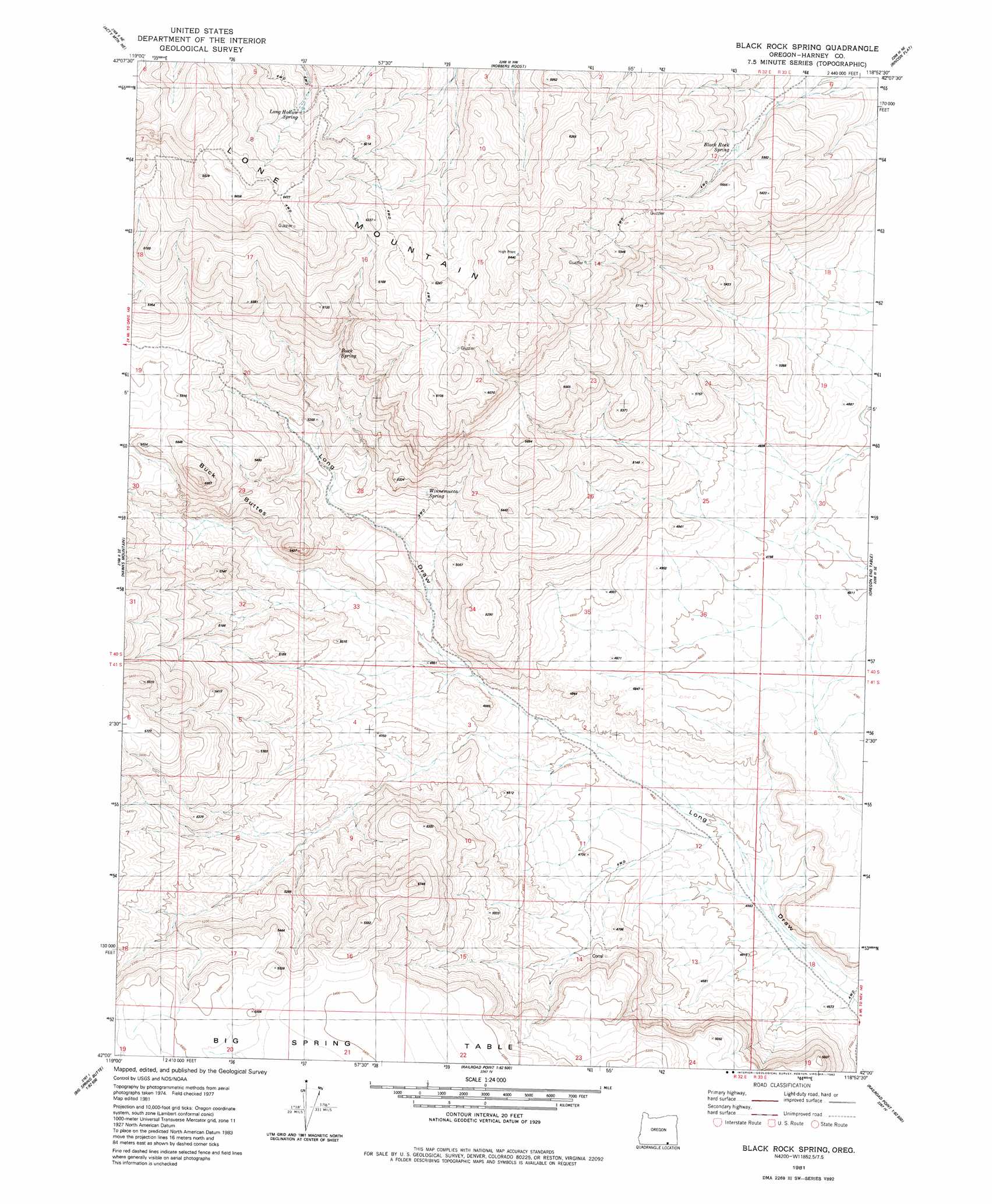
USGS Topo Quad 42118a8 - 1:24,000 scale
| Topo Map Name: | Black Rock Springs |
| USGS Topo Quad ID: | 42118a8 |
| Print Size: | ca. 21 1/4" wide x 27" high |
| Southeast Coordinates: | 42° N latitude / 118.875° W longitude |
| Map Center Coordinates: | 42.0625° N latitude / 118.9375° W longitude |
| U.S. State: | OR |
| Filename: | o42118a8.jpg |
| Download Map JPG Image: | Black Rock Springs topo map 1:24,000 scale |
| Map Type: | Topographic |
| Topo Series: | 7.5´ |
| Map Scale: | 1:24,000 |
| Source of Map Images: | United States Geological Survey (USGS) |
| Alternate Map Versions: |
Black Rock Spring OR 1981, updated 1982 Download PDF Buy paper map Black Rock Springs OR 2011 Download PDF Buy paper map Black Rock Springs OR 2014 Download PDF Buy paper map |
1:24,000 Topo Quads surrounding Black Rock Springs
Surveyors Lake |
Coyote Gap Se |
Square Mountain |
Fields Basin |
Fields |
Acty Mountain Nw |
Acty Mountain Ne |
Robbers Roost |
Rincon Flat |
Ladycomb Peak |
Acty Mountain |
Hawks Mountain |
Black Rock Springs |
Oregon End Table |
Van Horn Basin |
Big Spring Butte |
Thousand Creek Spring |
Thousand Creek Gorge |
Bog Hot Springs |
Denio |
Gooch Lake |
Virgin Valley |
Mcgee Mountain |
Alder Creek Ranch |
Vicksburg Canyon |
> Back to 42118a1 at 1:100,000 scale
> Back to 42118a1 at 1:250,000 scale
> Back to U.S. Topo Maps home
Black Rock Springs topo map: Gazetteer
Black Rock Springs: Summits
Lone Mountain elevation 1892m 6207′Black Rock Springs digital topo map on disk
Buy this Black Rock Springs topo map showing relief, roads, GPS coordinates and other geographical features, as a high-resolution digital map file on DVD: