Tumtum Lake Topo Map Oregon
To zoom in, hover over the map of Tumtum Lake
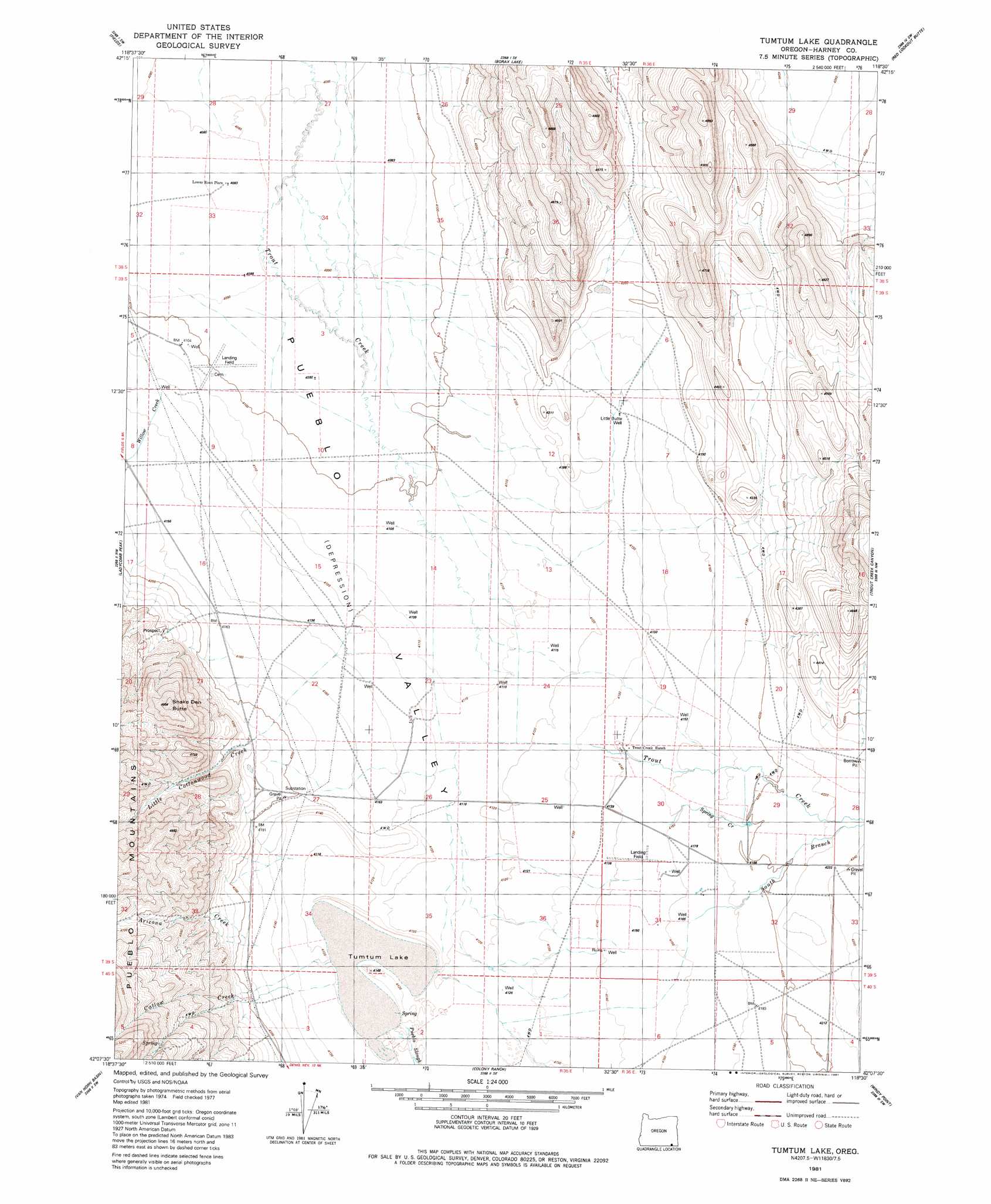
USGS Topo Quad 42118b5 - 1:24,000 scale
| Topo Map Name: | Tumtum Lake |
| USGS Topo Quad ID: | 42118b5 |
| Print Size: | ca. 21 1/4" wide x 27" high |
| Southeast Coordinates: | 42.125° N latitude / 118.5° W longitude |
| Map Center Coordinates: | 42.1875° N latitude / 118.5625° W longitude |
| U.S. State: | OR |
| Filename: | o42118b5.jpg |
| Download Map JPG Image: | Tumtum Lake topo map 1:24,000 scale |
| Map Type: | Topographic |
| Topo Series: | 7.5´ |
| Map Scale: | 1:24,000 |
| Source of Map Images: | United States Geological Survey (USGS) |
| Alternate Map Versions: |
Tumtum Lake OR 1981, updated 1981 Download PDF Buy paper map Tumtum Lake OR 2011 Download PDF Buy paper map Tumtum Lake OR 2014 Download PDF Buy paper map |
1:24,000 Topo Quads surrounding Tumtum Lake
Skull Creek Butte |
V Lake |
Andrews |
Tule Springs |
Tule Springs Ne |
Fields Basin |
Fields |
Borax Lake |
Red Lookout Butte |
Red Mountain |
Rincon Flat |
Ladycomb Peak |
Tumtum Lake |
Trout Creek Canyon |
Pole Canyon |
Oregon End Table |
Van Horn Basin |
Colony Ranch |
Windy Point |
The V |
Bog Hot Springs |
Denio |
Wilder Creek Ranch |
Trident Peak |
Holloway Mountain |
> Back to 42118a1 at 1:100,000 scale
> Back to 42118a1 at 1:250,000 scale
> Back to U.S. Topo Maps home
Tumtum Lake topo map: Gazetteer
Tumtum Lake: Lakes
Tumtum Lake elevation 1257m 4124′Tumtum Lake: Post Offices
Oroville Post Office (historical) elevation 1268m 4160′Tumtum Lake: Ranges
White Horse Mountains elevation 1407m 4616′Tumtum Lake: Streams
Arizona Creek elevation 1257m 4124′Catlow Creek elevation 1257m 4124′
Little Cottonwood Creek elevation 1260m 4133′
Spring Creek elevation 1269m 4163′
Willow Creek elevation 1256m 4120′
Tumtum Lake: Summits
Snake Den Butte elevation 1508m 4947′Tumtum Lake: Valleys
Alvord Valley elevation 1295m 4248′Tumtum Lake: Wells
Little Butte Well elevation 1263m 4143′McLean Well elevation 1263m 4143′
Smith Wells elevation 1254m 4114′
Tumtum Lake digital topo map on disk
Buy this Tumtum Lake topo map showing relief, roads, GPS coordinates and other geographical features, as a high-resolution digital map file on DVD: