Dry Creek Bench Topo Map Oregon
To zoom in, hover over the map of Dry Creek Bench
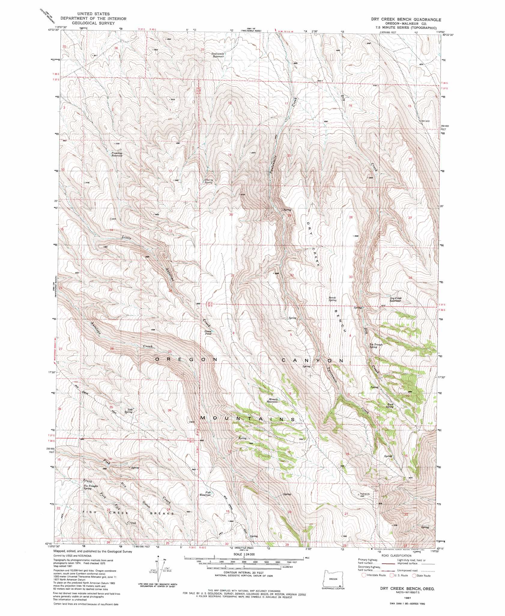
USGS Topo Quad 42118c1 - 1:24,000 scale
| Topo Map Name: | Dry Creek Bench |
| USGS Topo Quad ID: | 42118c1 |
| Print Size: | ca. 21 1/4" wide x 27" high |
| Southeast Coordinates: | 42.25° N latitude / 118° W longitude |
| Map Center Coordinates: | 42.3125° N latitude / 118.0625° W longitude |
| U.S. State: | OR |
| Filename: | o42118c1.jpg |
| Download Map JPG Image: | Dry Creek Bench topo map 1:24,000 scale |
| Map Type: | Topographic |
| Topo Series: | 7.5´ |
| Map Scale: | 1:24,000 |
| Source of Map Images: | United States Geological Survey (USGS) |
| Alternate Map Versions: |
Dry Creek Bench OR 1981, updated 1982 Download PDF Buy paper map Dry Creek Bench OR 2011 Download PDF Buy paper map Dry Creek Bench OR 2014 Download PDF Buy paper map |
1:24,000 Topo Quads surrounding Dry Creek Bench
Miranda Flat Se |
Coyote Lake West |
Coyote Lake East |
Rome State Airport |
Flat Top Mountain Se |
Tule Springs Ne |
Coyote Meadows |
Twelvemile Ridge |
Three Man Butte Well |
Basque |
Red Mountain |
Whitehorse Ranch |
Dry Creek Bench |
Blue Mountain Basin |
Blue Mountain Pass |
Pole Canyon |
Little Whitehorse Creek |
Doolittle Creek |
Oregon Canyon Ranch |
Bowden Waterhole |
The V |
Chicken Spring |
Payne Creek |
Bretz Mine |
Boghole Spring |
> Back to 42118a1 at 1:100,000 scale
> Back to 42118a1 at 1:250,000 scale
> Back to U.S. Topo Maps home
Dry Creek Bench topo map: Gazetteer
Dry Creek Bench: Areas
Fish Creek Breaks elevation 1839m 6033′Dry Creek Bench: Benches
Dry Creek Bench elevation 1830m 6003′Dry Creek Bench: Reservoirs
Dry Creek Reservoir elevation 1889m 6197′Fish Reservoir elevation 1953m 6407′
Frenchys Reservoir elevation 1536m 5039′
Green Pond elevation 1899m 6230′
Miracle Reservoir elevation 2062m 6765′
Twelvemile Reservoir elevation 1483m 4865′
Dry Creek Bench: Springs
Aspen Spring elevation 1863m 6112′Bench Spring elevation 1823m 5980′
Buck Spring elevation 1958m 6423′
Cherry Spring elevation 1743m 5718′
Side Spring elevation 1799m 5902′
Tin Trough Spring elevation 1837m 6026′
Tin Troughs Spring elevation 1674m 5492′
Dry Creek Bench: Valleys
Dry Gulch elevation 1685m 5528′Dry Creek Bench digital topo map on disk
Buy this Dry Creek Bench topo map showing relief, roads, GPS coordinates and other geographical features, as a high-resolution digital map file on DVD: