Wildhorse Lake Topo Map Oregon
To zoom in, hover over the map of Wildhorse Lake
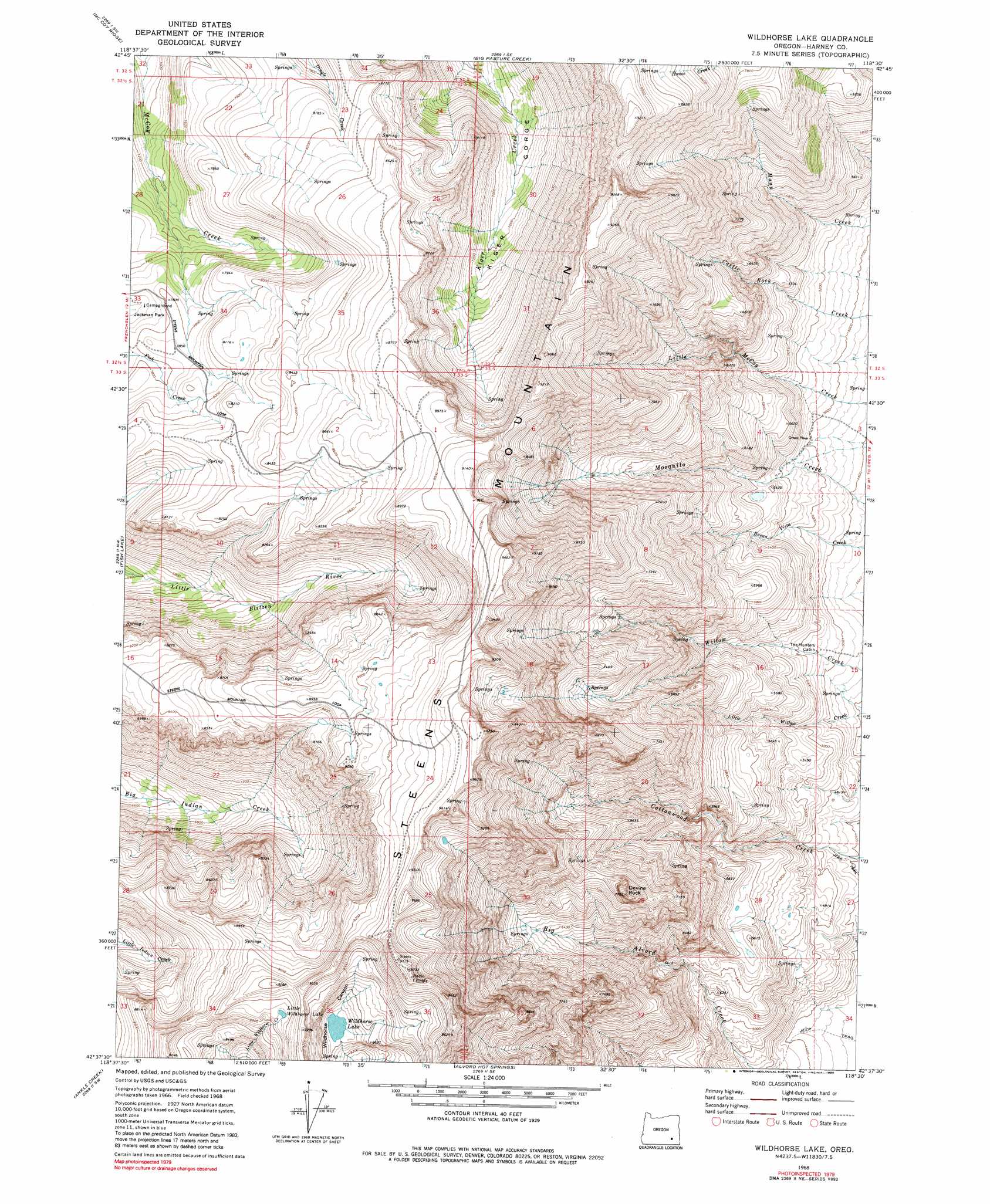
USGS Topo Quad 42118f5 - 1:24,000 scale
| Topo Map Name: | Wildhorse Lake |
| USGS Topo Quad ID: | 42118f5 |
| Print Size: | ca. 21 1/4" wide x 27" high |
| Southeast Coordinates: | 42.625° N latitude / 118.5° W longitude |
| Map Center Coordinates: | 42.6875° N latitude / 118.5625° W longitude |
| U.S. State: | OR |
| Filename: | o42118f5.jpg |
| Download Map JPG Image: | Wildhorse Lake topo map 1:24,000 scale |
| Map Type: | Topographic |
| Topo Series: | 7.5´ |
| Map Scale: | 1:24,000 |
| Source of Map Images: | United States Geological Survey (USGS) |
| Alternate Map Versions: |
Wildhorse Lake OR 1968, updated 1972 Download PDF Buy paper map Wildhorse Lake OR 1968, updated 1980 Download PDF Buy paper map Wildhorse Lake OR 1968, updated 1990 Download PDF Buy paper map Wildhorse Lake OR 2011 Download PDF Buy paper map Wildhorse Lake OR 2014 Download PDF Buy paper map |
1:24,000 Topo Quads surrounding Wildhorse Lake
Krumbo Reservoir |
Krumbo Ridge |
Poison Springs |
Comegys Lake |
Juniper Lake |
Page Springs |
Mccoy Ridge |
Big Pasture Creek |
Mann Lake |
Coffin Butte |
Tombstone Canyon |
Fish Lake |
Wildhorse Lake |
Miranda Flat |
Mickey Springs |
Roaring Springs Se |
Ankle Creek |
Alvord Hot Springs |
Miranda Flat Sw |
Miranda Flat Se |
Skull Creek Butte |
V Lake |
Andrews |
Tule Springs |
Tule Springs Ne |
> Back to 42118e1 at 1:100,000 scale
> Back to 42118a1 at 1:250,000 scale
> Back to U.S. Topo Maps home
Wildhorse Lake topo map: Gazetteer
Wildhorse Lake: Lakes
Little Wildhorse Lake elevation 2720m 8923′Wildhorse Lake elevation 2569m 8428′
Wildhorse Lake: Summits
Devine Rock elevation 2357m 7732′Steens Mountain elevation 2360m 7742′
Wildhorse Lake digital topo map on disk
Buy this Wildhorse Lake topo map showing relief, roads, GPS coordinates and other geographical features, as a high-resolution digital map file on DVD: