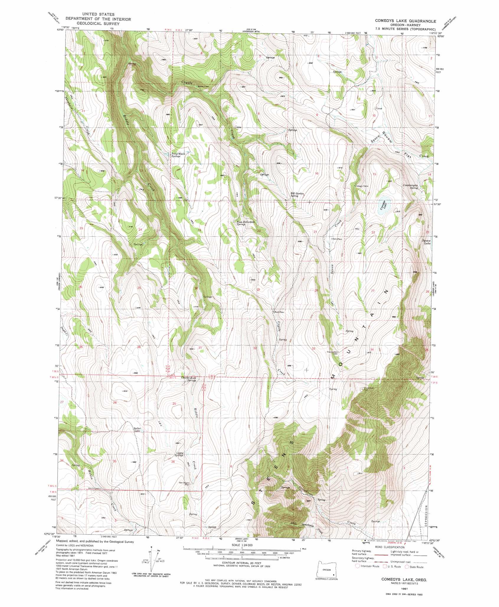
Comegys Lake Topo Map Oregon
To zoom in, hover over the map of Comegys Lake
USGS Topo Quad 42118h4 - 1:24,000 scale
| Topo Map Name: | Comegys Lake |
| USGS Topo Quad ID: | 42118h4 |
| Print Size: | ca. 21 1/4" wide x 27" high |
| Southeast Coordinates: | 42.875° N latitude / 118.375° W longitude |
| Map Center Coordinates: | 42.9375° N latitude / 118.4375° W longitude |
| U.S. State: | OR |
| Filename: | o42118h4.jpg |
| Download Map JPG Image: | Comegys Lake topo map 1:24,000 scale |
| Map Type: | Topographic |
| Topo Series: | 7.5´ |
| Map Scale: | 1:24,000 |
| Source of Map Images: | United States Geological Survey (USGS) |
| Alternate Map Versions: |
Comegys Lake OR 1981, updated 1981 Download PDF Buy paper map Comegys Lake OR 2011 Download PDF Buy paper map Comegys Lake OR 2014 Download PDF Buy paper map |
1:24,000 Topo Quads surrounding Comegys Lake
Barton Lake |
Adobe Flat |
Sand Gap |
South Fork Reservoir |
Duck Creek Butte |
Diamond |
Happy Valley |
Anderson Mountain |
Lambing Canyon |
Folly Farm |
Krumbo Ridge |
Poison Springs |
Comegys Lake |
Juniper Lake |
Ryegrass Butte |
Mccoy Ridge |
Big Pasture Creek |
Mann Lake |
Coffin Butte |
Johnny Creek Sw |
Fish Lake |
Wildhorse Lake |
Miranda Flat |
Mickey Springs |
Ancient Lake Well |
> Back to 42118e1 at 1:100,000 scale
> Back to 42118a1 at 1:250,000 scale
> Back to U.S. Topo Maps home
Comegys Lake topo map: Gazetteer
Comegys Lake: Lakes
Comegys Lake elevation 1899m 6230′Dollar Lake elevation 1957m 6420′
Comegys Lake: Springs
Bill Gordon Spring elevation 1826m 5990′Charles Kuhl Springs elevation 1892m 6207′
Courtwrights Spring elevation 1791m 5875′
Leppy Springs elevation 1929m 6328′
Ross Dollarhide Springs elevation 1818m 5964′
Comegys Lake: Streams
Coyote Creek elevation 1616m 5301′Comegys Lake: Summits
Bald Mountain elevation 1856m 6089′Comegys Lake: Valleys
Squaw Flat elevation 1742m 5715′Comegys Lake digital topo map on disk
Buy this Comegys Lake topo map showing relief, roads, GPS coordinates and other geographical features, as a high-resolution digital map file on DVD: