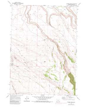
Krumbo Ridge Topo Map Oregon
To zoom in, hover over the map of Krumbo Ridge
USGS Topo Quad 42118h6 - 1:24,000 scale
| Topo Map Name: | Krumbo Ridge |
| USGS Topo Quad ID: | 42118h6 |
| Print Size: | ca. 21 1/4" wide x 27" high |
| Southeast Coordinates: | 42.875° N latitude / 118.625° W longitude |
| Map Center Coordinates: | 42.9375° N latitude / 118.6875° W longitude |
| U.S. State: | OR |
| Filename: | o42118h6.jpg |
| Download Map JPG Image: | Krumbo Ridge topo map 1:24,000 scale |
| Map Type: | Topographic |
| Topo Series: | 7.5´ |
| Map Scale: | 1:24,000 |
| Source of Map Images: | United States Geological Survey (USGS) |
| Alternate Map Versions: |
Krumbo Ridge OR 1968, updated 1972 Download PDF Buy paper map Krumbo Ridge OR 1968, updated 1980 Download PDF Buy paper map Krumbo Ridge OR 2011 Download PDF Buy paper map Krumbo Ridge OR 2014 Download PDF Buy paper map |
1:24,000 Topo Quads surrounding Krumbo Ridge
> Back to 42118e1 at 1:100,000 scale
> Back to 42118a1 at 1:250,000 scale
> Back to U.S. Topo Maps home
Krumbo Ridge topo map: Gazetteer
Krumbo Ridge: Flats
Moon Hill Lakebed elevation 1680m 5511′Krumbo Ridge: Reservoirs
Basin Reservoir elevation 1409m 4622′Bird Fence Reservoir Number One elevation 1429m 4688′
Bird Fence Reservoir Number Two elevation 1516m 4973′
Frazier Lake Waterhole elevation 1651m 5416′
Krumbo Mountain Reservoir elevation 1837m 6026′
Moon Hill Reservoir elevation 1714m 5623′
Section Nineteen Reservoir elevation 1455m 4773′
Whiskey Creek Reservoir elevation 1631m 5351′
Whiskey Creek Reservoir Number Two elevation 1510m 4954′
Krumbo Ridge: Ridges
Krumbo Mountain elevation 1868m 6128′Krumbo Ridge elevation 1700m 5577′
Krumbo Ridge: Springs
Antler Seep elevation 1663m 5456′Hidden Seep elevation 1651m 5416′
Krumbo Springs elevation 1498m 4914′
Ruby Springs elevation 1445m 4740′
Krumbo Ridge: Streams
Whiskey Creek elevation 1366m 4481′Krumbo Ridge: Summits
Krumbo Butte elevation 1490m 4888′Krumbo Ridge: Wells
Ruby Springs Well elevation 1377m 4517′Krumbo Ridge digital topo map on disk
Buy this Krumbo Ridge topo map showing relief, roads, GPS coordinates and other geographical features, as a high-resolution digital map file on DVD:


