Sage Hen Flats Topo Map Oregon
To zoom in, hover over the map of Sage Hen Flats
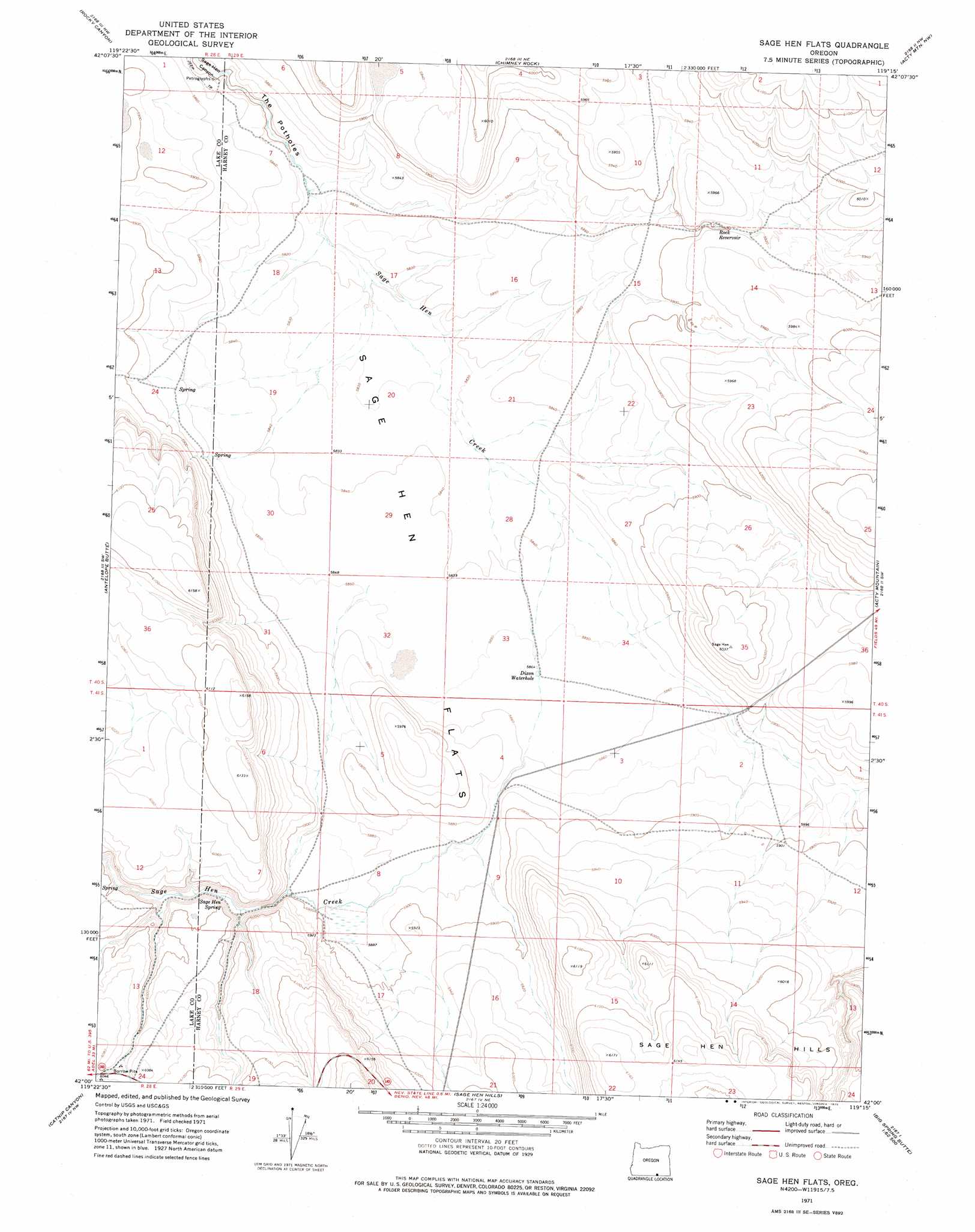
USGS Topo Quad 42119a3 - 1:24,000 scale
| Topo Map Name: | Sage Hen Flats |
| USGS Topo Quad ID: | 42119a3 |
| Print Size: | ca. 21 1/4" wide x 27" high |
| Southeast Coordinates: | 42° N latitude / 119.25° W longitude |
| Map Center Coordinates: | 42.0625° N latitude / 119.3125° W longitude |
| U.S. State: | OR |
| Filename: | o42119a3.jpg |
| Download Map JPG Image: | Sage Hen Flats topo map 1:24,000 scale |
| Map Type: | Topographic |
| Topo Series: | 7.5´ |
| Map Scale: | 1:24,000 |
| Source of Map Images: | United States Geological Survey (USGS) |
| Alternate Map Versions: |
Sage Hen Flats OR 1971, updated 1975 Download PDF Buy paper map Sage Hen Flats OR 2011 Download PDF Buy paper map Sage Hen Flats OR 2014 Download PDF Buy paper map |
1:24,000 Topo Quads surrounding Sage Hen Flats
Alger Lake |
Lone Grave Butte |
Mahogany Butte |
Surveyors Lake |
Coyote Gap Se |
Guano Lake |
Rocky Canyon |
Chimney Rock |
Acty Mountain Nw |
Acty Mountain Ne |
Piute Reservoir |
Antelope Butte |
Sage Hen Flats |
Acty Mountain |
Hawks Mountain |
Rye Creek |
Catnip Canyon |
Sage Hen Hills |
Big Spring Butte |
Thousand Creek Spring |
Bald Mountain |
Swan Lake |
Catnip Mountain Se |
Gooch Lake |
Virgin Valley |
> Back to 42119a1 at 1:100,000 scale
> Back to 42118a1 at 1:250,000 scale
> Back to U.S. Topo Maps home
Sage Hen Flats topo map: Gazetteer
Sage Hen Flats: Basins
The Potholes elevation 1769m 5803′Sage Hen Flats: Flats
Sage Hen Flats elevation 1782m 5846′Sage Hen Flats: Reservoirs
Dixon Waterhole elevation 1785m 5856′Rock Reservoir elevation 1800m 5905′
Sage Hen Flats: Springs
Sage Hen Spring elevation 1806m 5925′Sage Hen Flats digital topo map on disk
Buy this Sage Hen Flats topo map showing relief, roads, GPS coordinates and other geographical features, as a high-resolution digital map file on DVD: