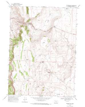
Blizzard Gap Topo Map Oregon
To zoom in, hover over the map of Blizzard Gap
USGS Topo Quad 42119a6 - 1:24,000 scale
| Topo Map Name: | Blizzard Gap |
| USGS Topo Quad ID: | 42119a6 |
| Print Size: | ca. 21 1/4" wide x 27" high |
| Southeast Coordinates: | 42° N latitude / 119.625° W longitude |
| Map Center Coordinates: | 42.0625° N latitude / 119.6875° W longitude |
| U.S. State: | OR |
| Filename: | o42119a6.jpg |
| Download Map JPG Image: | Blizzard Gap topo map 1:24,000 scale |
| Map Type: | Topographic |
| Topo Series: | 7.5´ |
| Map Scale: | 1:24,000 |
| Source of Map Images: | United States Geological Survey (USGS) |
| Alternate Map Versions: |
Blizzard Gap OR 1968, updated 1972 Download PDF Buy paper map Blizzard Gap OR 2011 Download PDF Buy paper map Blizzard Gap OR 2014 Download PDF Buy paper map |
1:24,000 Topo Quads surrounding Blizzard Gap
> Back to 42119a1 at 1:100,000 scale
> Back to 42118a1 at 1:250,000 scale
> Back to U.S. Topo Maps home
Blizzard Gap topo map: Gazetteer
Blizzard Gap: Basins
Greaser Basin elevation 1734m 5688′Blizzard Gap: Cliffs
Coleman Rim elevation 1910m 6266′Blizzard Gap: Dams
Ornoname 4 Dam elevation 1820m 5971′Blizzard Gap: Flats
Antelope Flat elevation 1764m 5787′Blizzard Gap: Gaps
Blizzard Gap elevation 1867m 6125′Blizzard Gap: Lakes
Moon Lake elevation 1942m 6371′Pinto Lake elevation 1964m 6443′
Blizzard Gap: Reservoirs
Big Hole Reservoir elevation 1876m 6154′East Barry Reservoir elevation 1908m 6259′
L J H Reservoir elevation 1746m 5728′
North Barry Reservoir elevation 1963m 6440′
Blizzard Gap: Ridges
Greaser Ridge elevation 1878m 6161′Blizzard Gap: Springs
Chukar Spring elevation 1473m 4832′Hidden Spring elevation 1996m 6548′
Hill Camp Spring elevation 1819m 5967′
Rosebriar Spring elevation 1932m 6338′
Tim Spring elevation 1976m 6482′
Blizzard Gap digital topo map on disk
Buy this Blizzard Gap topo map showing relief, roads, GPS coordinates and other geographical features, as a high-resolution digital map file on DVD:


