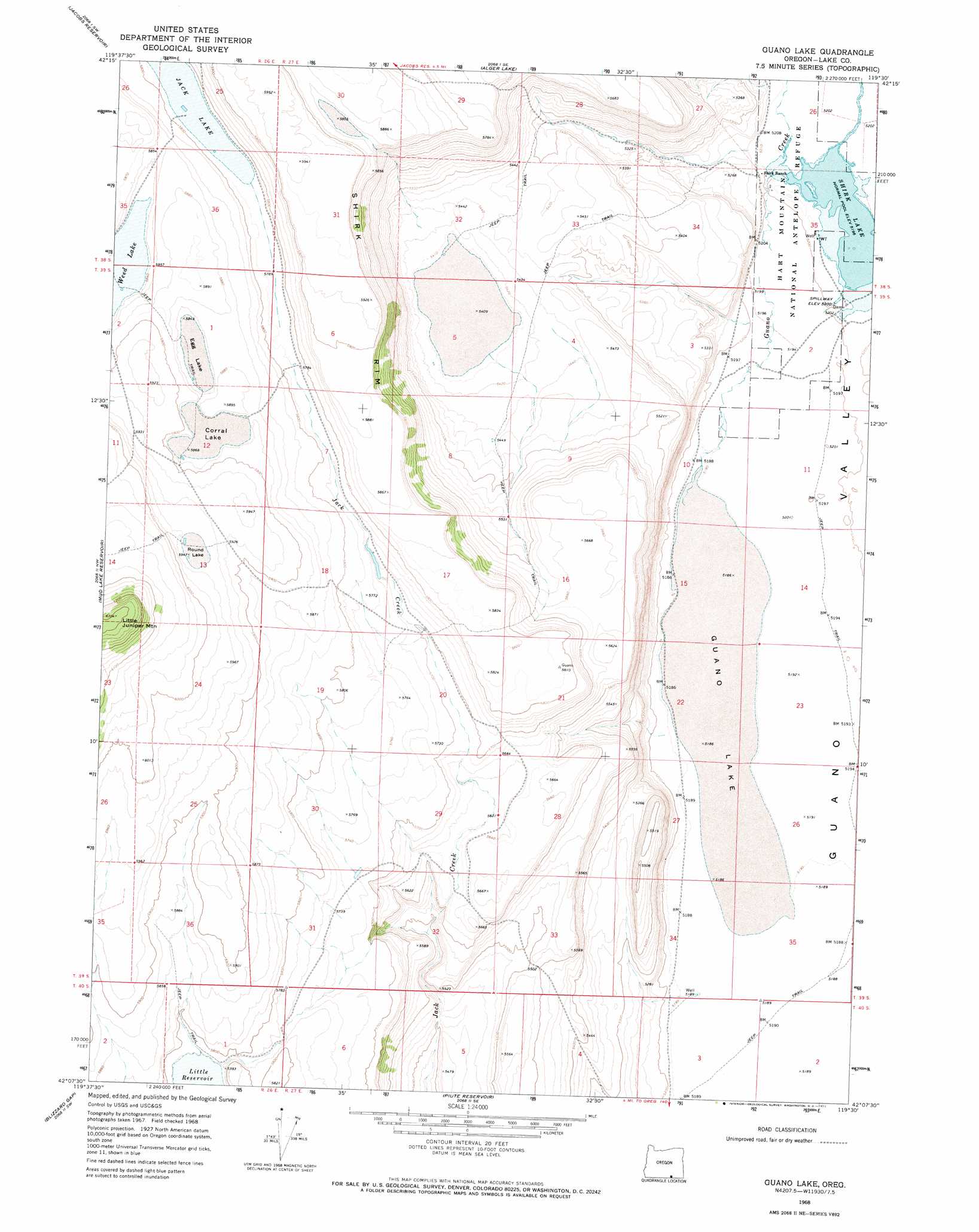
Guano Lake Topo Map Oregon
To zoom in, hover over the map of Guano Lake
USGS Topo Quad 42119b5 - 1:24,000 scale
| Topo Map Name: | Guano Lake |
| USGS Topo Quad ID: | 42119b5 |
| Print Size: | ca. 21 1/4" wide x 27" high |
| Southeast Coordinates: | 42.125° N latitude / 119.5° W longitude |
| Map Center Coordinates: | 42.1875° N latitude / 119.5625° W longitude |
| U.S. State: | OR |
| Filename: | o42119b5.jpg |
| Download Map JPG Image: | Guano Lake topo map 1:24,000 scale |
| Map Type: | Topographic |
| Topo Series: | 7.5´ |
| Map Scale: | 1:24,000 |
| Source of Map Images: | United States Geological Survey (USGS) |
| Alternate Map Versions: |
Guano Lake OR 1968, updated 1971 Download PDF Buy paper map Guano Lake OR 2011 Download PDF Buy paper map Guano Lake OR 2014 Download PDF Buy paper map |
1:24,000 Topo Quads surrounding Guano Lake
Hart Lake |
Warner Peak |
Swede Knoll |
Beatys Butte Nw |
Beatys Butte |
Crump Lake |
Jacobs Reservoir |
Alger Lake |
Lone Grave Butte |
Mahogany Butte |
Calderwood Reservoir |
Mud Lake Reservoir |
Guano Lake |
Rocky Canyon |
Chimney Rock |
Coleman Lake |
Blizzard Gap |
Piute Reservoir |
Antelope Butte |
Sage Hen Flats |
Little Coleman Canyon |
Coleman Canyon |
Rye Creek |
Catnip Canyon |
Sage Hen Hills |
> Back to 42119a1 at 1:100,000 scale
> Back to 42118a1 at 1:250,000 scale
> Back to U.S. Topo Maps home
Guano Lake topo map: Gazetteer
Guano Lake: Cliffs
Shirk Rim elevation 1781m 5843′Guano Lake: Flats
Corral Lake elevation 1791m 5875′Egg Lake elevation 1784m 5853′
Round Lake elevation 1815m 5954′
Guano Lake: Lakes
Guano Lake elevation 1583m 5193′Weed Lake elevation 1777m 5830′
Guano Lake: Post Offices
Shirk Post Office (historical) elevation 1595m 5232′Guano Lake: Reservoirs
Little Reservoir elevation 1762m 5780′Shirk Lake elevation 1586m 5203′
Guano Lake: Streams
Guano Creek elevation 1583m 5193′Guano Lake digital topo map on disk
Buy this Guano Lake topo map showing relief, roads, GPS coordinates and other geographical features, as a high-resolution digital map file on DVD: