Calderwood Reservoir Topo Map Oregon
To zoom in, hover over the map of Calderwood Reservoir
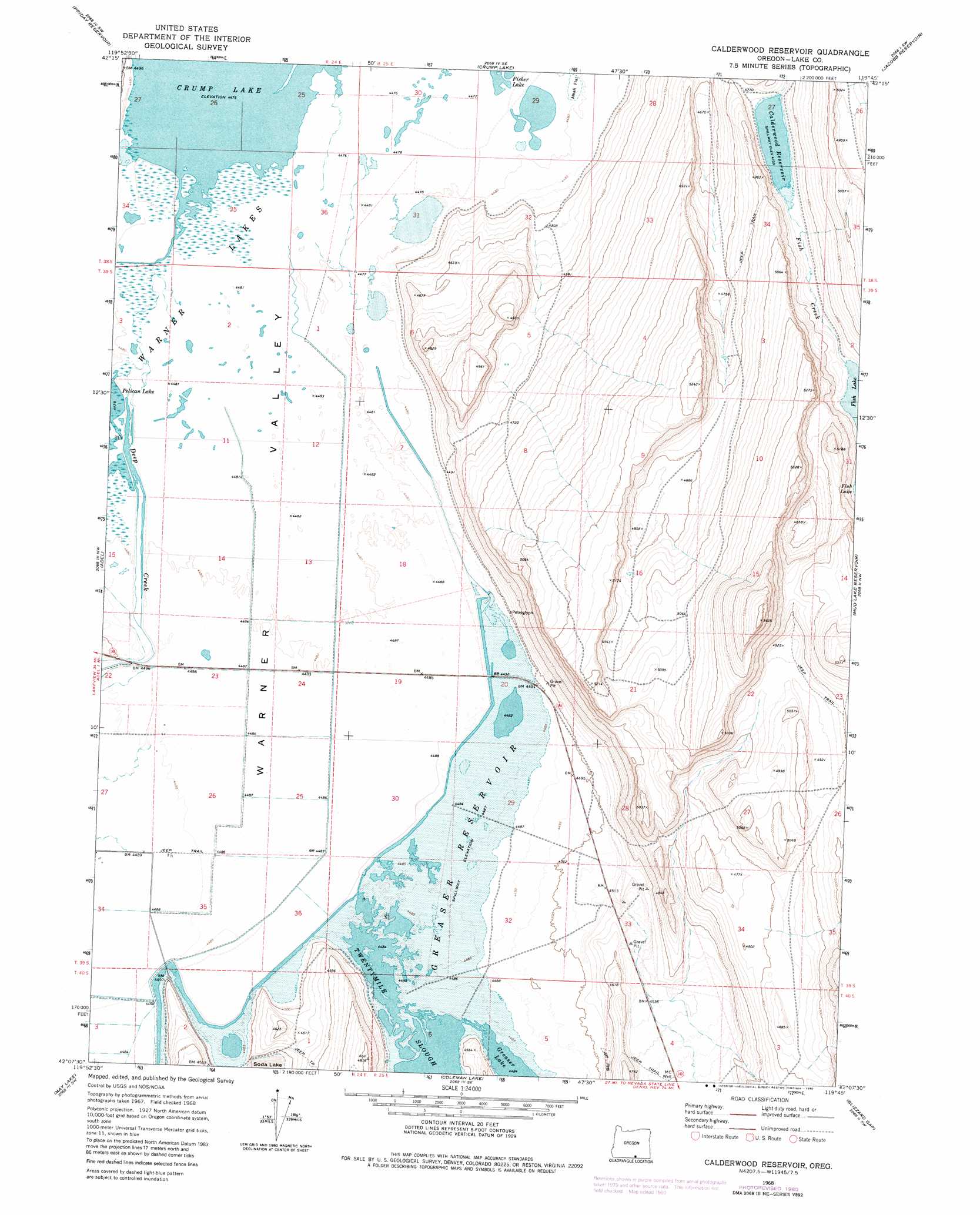
USGS Topo Quad 42119b7 - 1:24,000 scale
| Topo Map Name: | Calderwood Reservoir |
| USGS Topo Quad ID: | 42119b7 |
| Print Size: | ca. 21 1/4" wide x 27" high |
| Southeast Coordinates: | 42.125° N latitude / 119.75° W longitude |
| Map Center Coordinates: | 42.1875° N latitude / 119.8125° W longitude |
| U.S. State: | OR |
| Filename: | o42119b7.jpg |
| Download Map JPG Image: | Calderwood Reservoir topo map 1:24,000 scale |
| Map Type: | Topographic |
| Topo Series: | 7.5´ |
| Map Scale: | 1:24,000 |
| Source of Map Images: | United States Geological Survey (USGS) |
| Alternate Map Versions: |
Calderwood Reservoir OR 1968, updated 1972 Download PDF Buy paper map Calderwood Reservoir OR 1968, updated 1980 Download PDF Buy paper map Calderwood Reservoir OR 2011 Download PDF Buy paper map Calderwood Reservoir OR 2014 Download PDF Buy paper map |
1:24,000 Topo Quads surrounding Calderwood Reservoir
Drake Peak Ne |
Plush |
Hart Lake |
Warner Peak |
Swede Knoll |
Drake Peak |
Priday Reservoir |
Crump Lake |
Jacobs Reservoir |
Alger Lake |
Sage Hen Butte |
Adel |
Calderwood Reservoir |
Mud Lake Reservoir |
Guano Lake |
Collins Rim |
May Lake |
Coleman Lake |
Blizzard Gap |
Piute Reservoir |
Lake Annie |
Barrel Springs |
Little Coleman Canyon |
Coleman Canyon |
Rye Creek |
> Back to 42119a1 at 1:100,000 scale
> Back to 42118a1 at 1:250,000 scale
> Back to U.S. Topo Maps home
Calderwood Reservoir topo map: Gazetteer
Calderwood Reservoir: Dams
Calderwood Dam elevation 1443m 4734′Greaser Lake Dam elevation 1370m 4494′
Calderwood Reservoir: Lakes
Fish Lake elevation 1450m 4757′Twentymile Slough elevation 1368m 4488′
Calderwood Reservoir: Reservoirs
Calderwood Reservoir elevation 1443m 4734′Greaser Reservoir elevation 1370m 4494′
Calderwood Reservoir: Streams
Deep Creek elevation 1364m 4475′Calderwood Reservoir: Wells
MC Well elevation 1388m 4553′Calderwood Reservoir digital topo map on disk
Buy this Calderwood Reservoir topo map showing relief, roads, GPS coordinates and other geographical features, as a high-resolution digital map file on DVD: