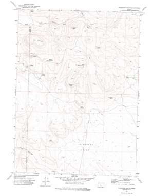
Mahogany Butte Topo Map Oregon
To zoom in, hover over the map of Mahogany Butte
USGS Topo Quad 42119c3 - 1:24,000 scale
| Topo Map Name: | Mahogany Butte |
| USGS Topo Quad ID: | 42119c3 |
| Print Size: | ca. 21 1/4" wide x 27" high |
| Southeast Coordinates: | 42.25° N latitude / 119.25° W longitude |
| Map Center Coordinates: | 42.3125° N latitude / 119.3125° W longitude |
| U.S. State: | OR |
| Filename: | o42119c3.jpg |
| Download Map JPG Image: | Mahogany Butte topo map 1:24,000 scale |
| Map Type: | Topographic |
| Topo Series: | 7.5´ |
| Map Scale: | 1:24,000 |
| Source of Map Images: | United States Geological Survey (USGS) |
| Alternate Map Versions: |
Mahogany Butte OR 1971, updated 1974 Download PDF Buy paper map Mahogany Butte OR 2011 Download PDF Buy paper map Mahogany Butte OR 2014 Download PDF Buy paper map |
1:24,000 Topo Quads surrounding Mahogany Butte
> Back to 42119a1 at 1:100,000 scale
> Back to 42118a1 at 1:250,000 scale
> Back to U.S. Topo Maps home
Mahogany Butte topo map: Gazetteer
Mahogany Butte: Basins
Ryegrass Valley elevation 1673m 5488′Mahogany Butte: Gaps
Buckaroo Pass elevation 1787m 5862′Mahogany Butte: Reservoirs
Dropoff Waterhole elevation 1900m 6233′Mahogany Butte: Springs
Buckaroo Spring elevation 1862m 6108′East Corral Spring elevation 1952m 6404′
Highland Spring elevation 1926m 6318′
Lick Spring elevation 1781m 5843′
Mahogany Spring elevation 1826m 5990′
Mudhole Spring elevation 1863m 6112′
North Highland Spring elevation 1992m 6535′
Reed Spring elevation 1792m 5879′
Rose Brier Spring elevation 1746m 5728′
Sunrise Spring elevation 1999m 6558′
Wilson Spring elevation 1732m 5682′
Mahogany Butte: Summits
Mahogany Butte elevation 2174m 7132′Mahogany Mountain elevation 2079m 6820′
Shirks Lookout elevation 2066m 6778′
Mahogany Butte digital topo map on disk
Buy this Mahogany Butte topo map showing relief, roads, GPS coordinates and other geographical features, as a high-resolution digital map file on DVD:


