Flagstaff Lake Topo Map Oregon
To zoom in, hover over the map of Flagstaff Lake
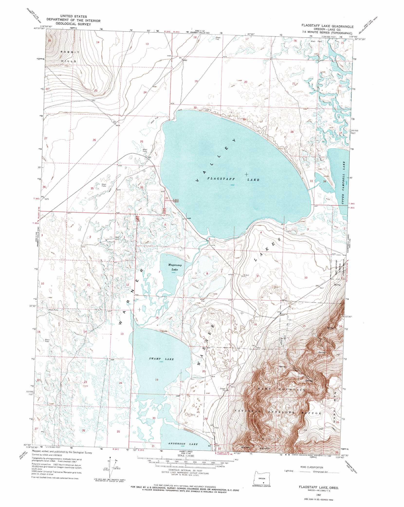
USGS Topo Quad 42119e7 - 1:24,000 scale
| Topo Map Name: | Flagstaff Lake |
| USGS Topo Quad ID: | 42119e7 |
| Print Size: | ca. 21 1/4" wide x 27" high |
| Southeast Coordinates: | 42.5° N latitude / 119.75° W longitude |
| Map Center Coordinates: | 42.5625° N latitude / 119.8125° W longitude |
| U.S. State: | OR |
| Filename: | o42119e7.jpg |
| Download Map JPG Image: | Flagstaff Lake topo map 1:24,000 scale |
| Map Type: | Topographic |
| Topo Series: | 7.5´ |
| Map Scale: | 1:24,000 |
| Source of Map Images: | United States Geological Survey (USGS) |
| Alternate Map Versions: |
Flagstaff Lake OR 1967, updated 1969 Download PDF Buy paper map Flagstaff Lake OR 1967, updated 1969 Download PDF Buy paper map Flagstaff Lake OR 2011 Download PDF Buy paper map Flagstaff Lake OR 2014 Download PDF Buy paper map |
1:24,000 Topo Quads surrounding Flagstaff Lake
Coleman Hills |
Sagebrush Knoll |
Corn Lake |
Corporation Rim |
Steamboat Point |
Commodore Ridge |
Rabbit Hills Nw |
Rabbit Hills Ne |
Bluejoint Lake West |
Bluejoint Lake East |
Cooper Draw |
Rabbit Hills Sw |
Flagstaff Lake |
Campbell Lake |
Flook Lake |
Drake Peak Ne |
Plush |
Hart Lake |
Warner Peak |
Swede Knoll |
Drake Peak |
Priday Reservoir |
Crump Lake |
Jacobs Reservoir |
Alger Lake |
> Back to 42119e1 at 1:100,000 scale
> Back to 42118a1 at 1:250,000 scale
> Back to U.S. Topo Maps home
Flagstaff Lake topo map: Gazetteer
Flagstaff Lake: Lakes
Anderson Lake elevation 1362m 4468′Flagstaff Lake elevation 1361m 4465′
Mugwump Lake elevation 1361m 4465′
Swamp Lake elevation 1362m 4468′
Flagstaff Lake: Streams
Juniper Creek elevation 1407m 4616′Flagstaff Lake: Valleys
Mulkey Canyon elevation 1439m 4721′Flagstaff Lake digital topo map on disk
Buy this Flagstaff Lake topo map showing relief, roads, GPS coordinates and other geographical features, as a high-resolution digital map file on DVD: