Murphy Waterholes Ne Topo Map Oregon
To zoom in, hover over the map of Murphy Waterholes Ne
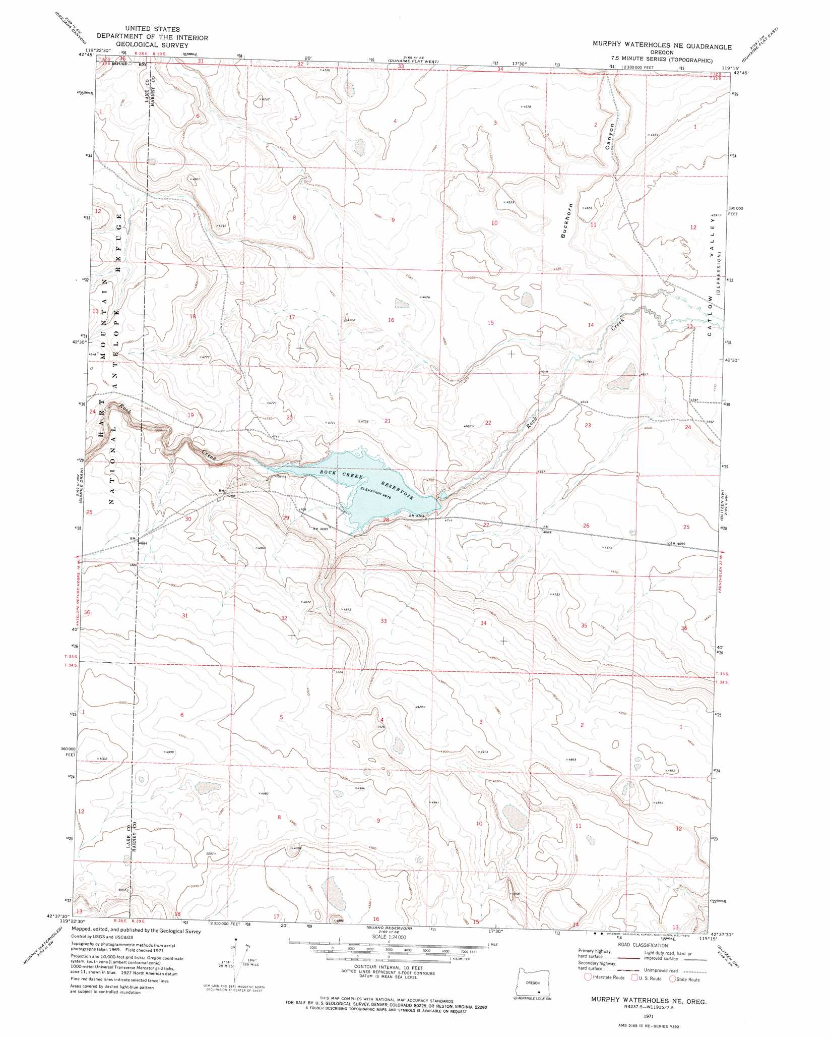
USGS Topo Quad 42119f3 - 1:24,000 scale
| Topo Map Name: | Murphy Waterholes Ne |
| USGS Topo Quad ID: | 42119f3 |
| Print Size: | ca. 21 1/4" wide x 27" high |
| Southeast Coordinates: | 42.625° N latitude / 119.25° W longitude |
| Map Center Coordinates: | 42.6875° N latitude / 119.3125° W longitude |
| U.S. State: | OR |
| Filename: | o42119f3.jpg |
| Download Map JPG Image: | Murphy Waterholes Ne topo map 1:24,000 scale |
| Map Type: | Topographic |
| Topo Series: | 7.5´ |
| Map Scale: | 1:24,000 |
| Source of Map Images: | United States Geological Survey (USGS) |
| Alternate Map Versions: |
Murphy Waterholes NE OR 1971, updated 1974 Download PDF Buy paper map Murphy Waterholes NE OR 2011 Download PDF Buy paper map Murphy Waterholes NE OR 2014 Download PDF Buy paper map |
1:24,000 Topo Quads surrounding Murphy Waterholes Ne
Rock Camp Draw |
Balls Lake |
Clover Swale |
Keg Sprs Valley West |
Keg Sprs Valley East |
Steamboat Point |
Orejana Canyon |
Duhaime Flat West |
Duhaime Flat East |
Walls Lake |
Bluejoint Lake East |
Sixmile Draw |
Murphy Waterholes Ne |
Blitzen Nw |
Butler Hill |
Flook Lake |
Murphy Waterholes |
Guano Reservoir |
Blitzen Sw |
Blitzen |
Swede Knoll |
Beatys Butte Nw |
Beatys Butte |
Fish Fin Rim |
Coyote Gap |
> Back to 42119e1 at 1:100,000 scale
> Back to 42118a1 at 1:250,000 scale
> Back to U.S. Topo Maps home
Murphy Waterholes Ne topo map: Gazetteer
Murphy Waterholes Ne: Reservoirs
Oreana Waterhole elevation 1424m 4671′Rock Creek Reservoir elevation 1428m 4685′
Murphy Waterholes Ne: Valleys
Buckhorn Canyon elevation 1406m 4612′Murphy Waterholes Ne digital topo map on disk
Buy this Murphy Waterholes Ne topo map showing relief, roads, GPS coordinates and other geographical features, as a high-resolution digital map file on DVD: