Rabbit Hills Ne Topo Map Oregon
To zoom in, hover over the map of Rabbit Hills Ne
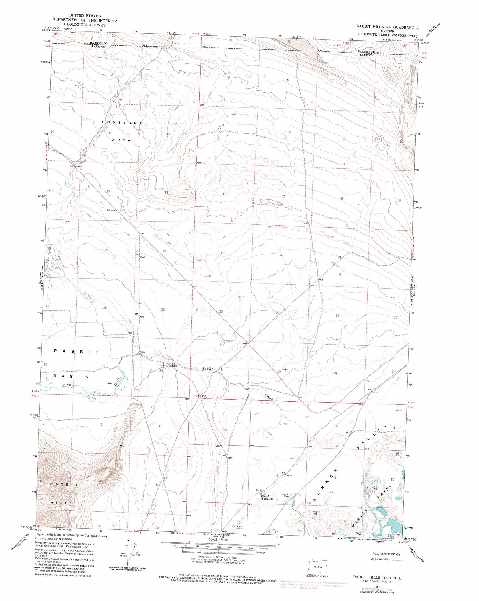
USGS Topo Quad 42119f7 - 1:24,000 scale
| Topo Map Name: | Rabbit Hills Ne |
| USGS Topo Quad ID: | 42119f7 |
| Print Size: | ca. 21 1/4" wide x 27" high |
| Southeast Coordinates: | 42.625° N latitude / 119.75° W longitude |
| Map Center Coordinates: | 42.6875° N latitude / 119.8125° W longitude |
| U.S. State: | OR |
| Filename: | o42119f7.jpg |
| Download Map JPG Image: | Rabbit Hills Ne topo map 1:24,000 scale |
| Map Type: | Topographic |
| Topo Series: | 7.5´ |
| Map Scale: | 1:24,000 |
| Source of Map Images: | United States Geological Survey (USGS) |
| Alternate Map Versions: |
Rabbit Hills NE OR 1966, updated 1969 Download PDF Buy paper map Rabbit Hills NE OR 1966, updated 1980 Download PDF Buy paper map Rabbit Hills NE OR 2011 Download PDF Buy paper map Rabbit Hills NE OR 2014 Download PDF Buy paper map |
1:24,000 Topo Quads surrounding Rabbit Hills Ne
Alkali Lake |
Juniper Mountain |
Turpin Knoll |
Red Bank Lakes |
Rock Camp Draw |
Coleman Hills |
Sagebrush Knoll |
Corn Lake |
Corporation Rim |
Steamboat Point |
Commodore Ridge |
Rabbit Hills Nw |
Rabbit Hills Ne |
Bluejoint Lake West |
Bluejoint Lake East |
Cooper Draw |
Rabbit Hills Sw |
Flagstaff Lake |
Campbell Lake |
Flook Lake |
Drake Peak Ne |
Plush |
Hart Lake |
Warner Peak |
Swede Knoll |
> Back to 42119e1 at 1:100,000 scale
> Back to 42118a1 at 1:250,000 scale
> Back to U.S. Topo Maps home
Rabbit Hills Ne topo map: Gazetteer
Rabbit Hills Ne: Areas
Sunstone Area elevation 1415m 4642′Rabbit Hills Ne: Dams
Carty West Dam elevation 1397m 4583′Rabbit Hills Ne: Mines
Sunstone Mine elevation 1404m 4606′Rabbit Hills Ne: Reservoirs
Canterbury Reservoir elevation 1364m 4475′Carty Reservoir elevation 1397m 4583′
Corral Waterhole elevation 1365m 4478′
Rabbit Hills Ne: Ridges
Dudeck Ridge elevation 1426m 4678′Rabbit Hills Ne: Streams
Rabbit Creek elevation 1365m 4478′Rabbit Hills Ne digital topo map on disk
Buy this Rabbit Hills Ne topo map showing relief, roads, GPS coordinates and other geographical features, as a high-resolution digital map file on DVD: