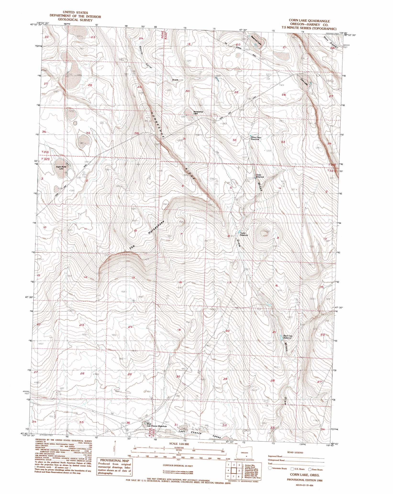
Corn Lake Topo Map Oregon
To zoom in, hover over the map of Corn Lake
USGS Topo Quad 42119g7 - 1:24,000 scale
| Topo Map Name: | Corn Lake |
| USGS Topo Quad ID: | 42119g7 |
| Print Size: | ca. 21 1/4" wide x 27" high |
| Southeast Coordinates: | 42.75° N latitude / 119.75° W longitude |
| Map Center Coordinates: | 42.8125° N latitude / 119.8125° W longitude |
| U.S. State: | OR |
| Filename: | o42119g7.jpg |
| Download Map JPG Image: | Corn Lake topo map 1:24,000 scale |
| Map Type: | Topographic |
| Topo Series: | 7.5´ |
| Map Scale: | 1:24,000 |
| Source of Map Images: | United States Geological Survey (USGS) |
| Alternate Map Versions: |
Corn Lake OR 1984, updated 1984 Download PDF Buy paper map Corn Lake OR 2011 Download PDF Buy paper map Corn Lake OR 2014 Download PDF Buy paper map |
1:24,000 Topo Quads surrounding Corn Lake
Alkali Buttes |
Venator Canyon |
Cox Canyon |
Dry Valley Rim |
Rawhide Canyon |
Alkali Lake |
Juniper Mountain |
Turpin Knoll |
Red Bank Lakes |
Rock Camp Draw |
Coleman Hills |
Sagebrush Knoll |
Corn Lake |
Corporation Rim |
Steamboat Point |
Commodore Ridge |
Rabbit Hills Nw |
Rabbit Hills Ne |
Bluejoint Lake West |
Bluejoint Lake East |
Cooper Draw |
Rabbit Hills Sw |
Flagstaff Lake |
Campbell Lake |
Flook Lake |
> Back to 42119e1 at 1:100,000 scale
> Back to 42118a1 at 1:250,000 scale
> Back to U.S. Topo Maps home
Corn Lake digital topo map on disk
Buy this Corn Lake topo map showing relief, roads, GPS coordinates and other geographical features, as a high-resolution digital map file on DVD: