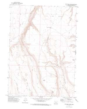
Red Bank Lakes Topo Map Oregon
To zoom in, hover over the map of Red Bank Lakes
USGS Topo Quad 42119h6 - 1:24,000 scale
| Topo Map Name: | Red Bank Lakes |
| USGS Topo Quad ID: | 42119h6 |
| Print Size: | ca. 21 1/4" wide x 27" high |
| Southeast Coordinates: | 42.875° N latitude / 119.625° W longitude |
| Map Center Coordinates: | 42.9375° N latitude / 119.6875° W longitude |
| U.S. State: | OR |
| Filename: | o42119h6.jpg |
| Download Map JPG Image: | Red Bank Lakes topo map 1:24,000 scale |
| Map Type: | Topographic |
| Topo Series: | 7.5´ |
| Map Scale: | 1:24,000 |
| Source of Map Images: | United States Geological Survey (USGS) |
| Alternate Map Versions: |
Red Bank Lakes OR 1971, updated 1974 Download PDF Buy paper map Red Bank Lakes OR 2011 Download PDF Buy paper map Red Bank Lakes OR 2014 Download PDF Buy paper map |
1:24,000 Topo Quads surrounding Red Bank Lakes
> Back to 42119e1 at 1:100,000 scale
> Back to 42118a1 at 1:250,000 scale
> Back to U.S. Topo Maps home
Red Bank Lakes topo map: Gazetteer
Red Bank Lakes: Basins
Hole in the Ground elevation 1647m 5403′Red Bank Lakes: Flats
Brushy Lake elevation 1648m 5406′Old Jims Open elevation 1673m 5488′
Red Bank Lakes elevation 1595m 5232′
Red Bank Lakes: Lakes
Hole in the Ground Lake elevation 1675m 5495′Red Bank Lakes: Reservoirs
Bacon Camp Lake Waterhole elevation 1606m 5269′Common Bedground Waterhole elevation 1677m 5501′
Egan Cabin Waterhole elevation 1541m 5055′
Hidden Reservoir elevation 1639m 5377′
Kit Canyon Waterhole elevation 1667m 5469′
Lakehole in the Ground Waterhole elevation 1677m 5501′
Lower Bedground Waterhole elevation 1542m 5059′
Lynch Gulch Waterhole elevation 1547m 5075′
Peters Waterhole elevation 1676m 5498′
State Game Reservoir Number Eleven elevation 1539m 5049′
West Bacon Waterhole elevation 1604m 5262′
West Draw Waterhole elevation 1594m 5229′
Red Bank Lakes: Springs
Mule Spring Road Waterhole elevation 1640m 5380′Sunrise Waterhole elevation 1694m 5557′
Red Bank Lakes: Valleys
Lynch Gulch elevation 1401m 4596′Red Bank Lakes digital topo map on disk
Buy this Red Bank Lakes topo map showing relief, roads, GPS coordinates and other geographical features, as a high-resolution digital map file on DVD:


