Collins Rim Topo Map Oregon
To zoom in, hover over the map of Collins Rim
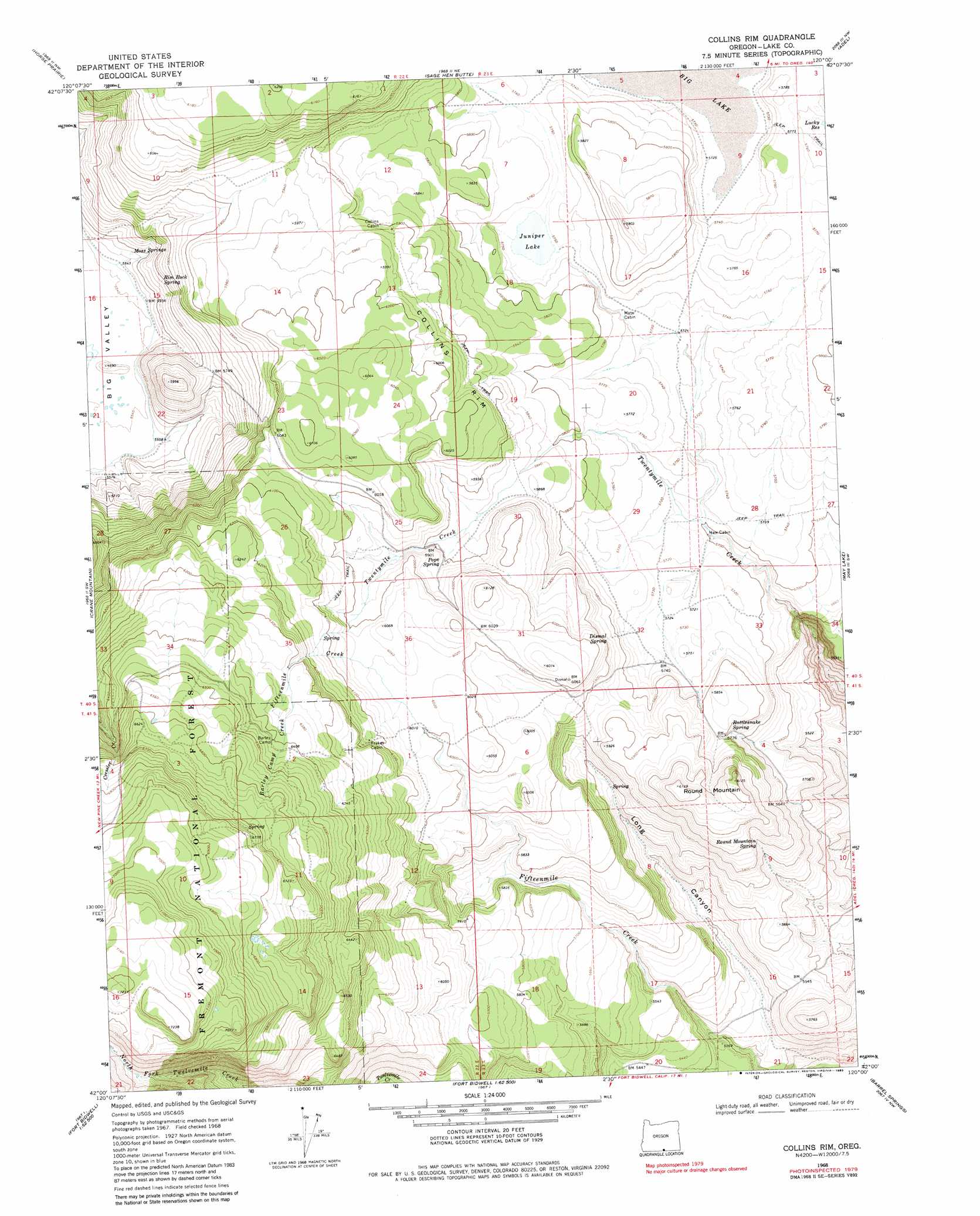
USGS Topo Quad 42120a1 - 1:24,000 scale
| Topo Map Name: | Collins Rim |
| USGS Topo Quad ID: | 42120a1 |
| Print Size: | ca. 21 1/4" wide x 27" high |
| Southeast Coordinates: | 42° N latitude / 120° W longitude |
| Map Center Coordinates: | 42.0625° N latitude / 120.0625° W longitude |
| U.S. State: | OR |
| Filename: | o42120a1.jpg |
| Download Map JPG Image: | Collins Rim topo map 1:24,000 scale |
| Map Type: | Topographic |
| Topo Series: | 7.5´ |
| Map Scale: | 1:24,000 |
| Source of Map Images: | United States Geological Survey (USGS) |
| Alternate Map Versions: |
Collins Rim OR 1968, updated 1972 Download PDF Buy paper map Collins Rim OR 1968, updated 1983 Download PDF Buy paper map Collins Rim OR 2004, updated 2007 Download PDF Buy paper map Collins Rim OR 2011 Download PDF Buy paper map Collins Rim OR 2014 Download PDF Buy paper map |
| FStopo: | US Forest Service topo Collins Rim is available: Download FStopo PDF Download FStopo TIF |
1:24,000 Topo Quads surrounding Collins Rim
Crooked Creek Valley |
Crook Peak |
Drake Peak |
Priday Reservoir |
Crump Lake |
Lakeview |
Horse Prairie |
Sage Hen Butte |
Adel |
Calderwood Reservoir |
Crane Creek |
Crane Mountain |
Collins Rim |
May Lake |
Coleman Lake |
Willow Ranch |
Mount Bidwell |
Lake Annie |
Barrel Springs |
Little Coleman Canyon |
Sugar Hill |
Fort Bidwell |
Larkspur Hills |
Crooks Meadow |
Mosquito Valley |
> Back to 42120a1 at 1:100,000 scale
> Back to 42120a1 at 1:250,000 scale
> Back to U.S. Topo Maps home
Collins Rim topo map: Gazetteer
Collins Rim: Cliffs
Collins Rim elevation 1827m 5994′Collins Rim: Lakes
Juniper Lake elevation 1754m 5754′Collins Rim: Reservoirs
Lane Reservoir Number Four elevation 1815m 5954′Lane Waterhole Number Eleven elevation 1830m 6003′
Lane Waterhole Number Twelve elevation 1705m 5593′
O'Keefe Reservoir elevation 1746m 5728′
O'Keefe Reservoir Number Four elevation 1750m 5741′
O'Keefe Reservoir Number Six elevation 1756m 5761′
Collins Rim: Springs
Dismal Spring elevation 1782m 5846′Moss Springs elevation 1700m 5577′
Pope Spring elevation 1802m 5912′
Rattlesnake Spring elevation 1750m 5741′
Rim Rock Spring elevation 1732m 5682′
Round Mountain Spring elevation 1763m 5784′
Collins Rim: Streams
Barley Camp Creek elevation 1928m 6325′Collins Rim: Summits
Round Mountain elevation 1869m 6131′Collins Rim: Valleys
Long Canyon elevation 1616m 5301′Collins Rim digital topo map on disk
Buy this Collins Rim topo map showing relief, roads, GPS coordinates and other geographical features, as a high-resolution digital map file on DVD: