Sage Hen Butte Topo Map Oregon
To zoom in, hover over the map of Sage Hen Butte
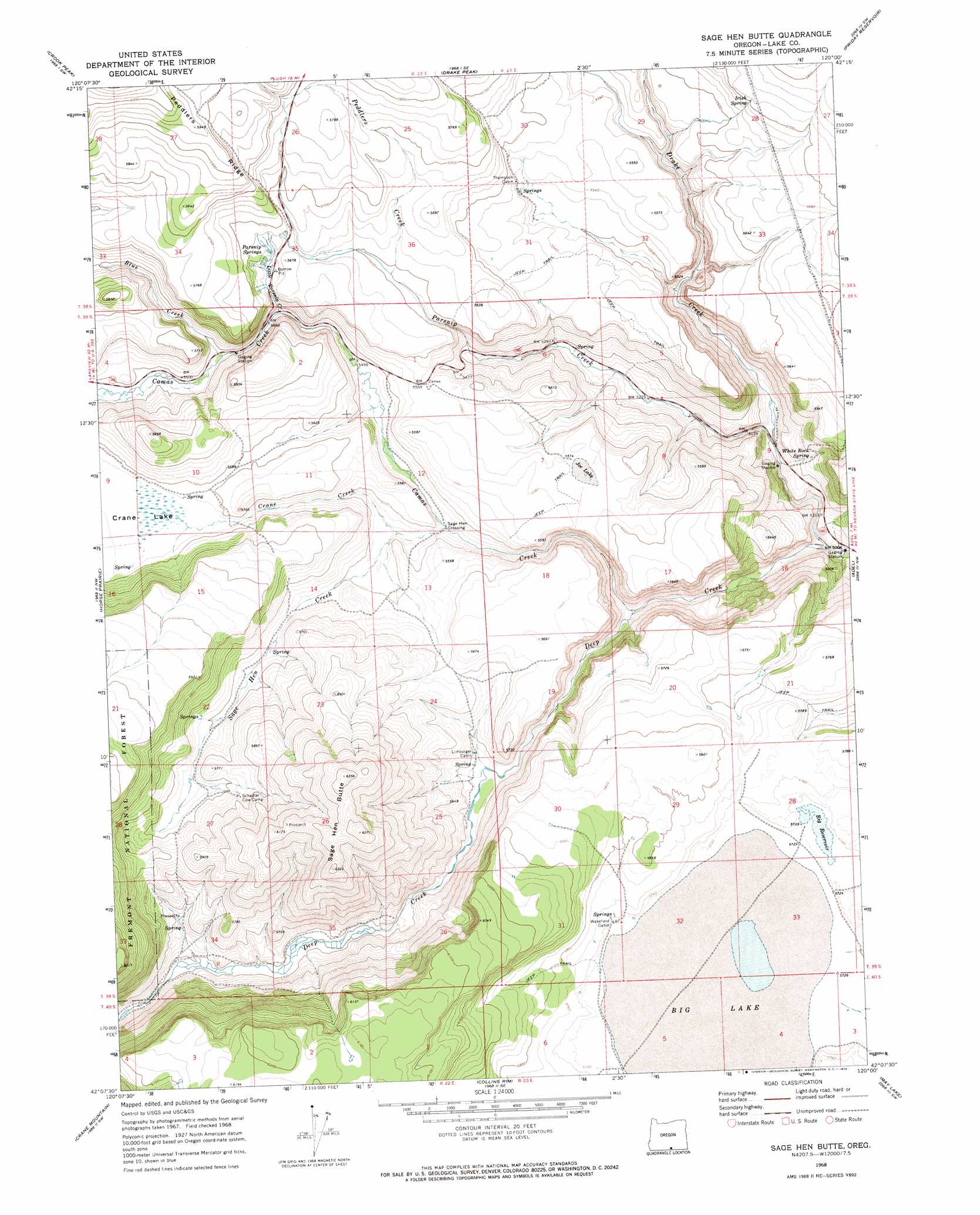
USGS Topo Quad 42120b1 - 1:24,000 scale
| Topo Map Name: | Sage Hen Butte |
| USGS Topo Quad ID: | 42120b1 |
| Print Size: | ca. 21 1/4" wide x 27" high |
| Southeast Coordinates: | 42.125° N latitude / 120° W longitude |
| Map Center Coordinates: | 42.1875° N latitude / 120.0625° W longitude |
| U.S. State: | OR |
| Filename: | o42120b1.jpg |
| Download Map JPG Image: | Sage Hen Butte topo map 1:24,000 scale |
| Map Type: | Topographic |
| Topo Series: | 7.5´ |
| Map Scale: | 1:24,000 |
| Source of Map Images: | United States Geological Survey (USGS) |
| Alternate Map Versions: |
Sage Hen Butte OR 1968, updated 1972 Download PDF Buy paper map Sage Hen Butte OR 2004, updated 2007 Download PDF Buy paper map Sage Hen Butte OR 2011 Download PDF Buy paper map Sage Hen Butte OR 2014 Download PDF Buy paper map |
| FStopo: | US Forest Service topo Sage Hen Butte is available: Download FStopo PDF Download FStopo TIF |
1:24,000 Topo Quads surrounding Sage Hen Butte
Valley Falls |
Little Honey Creek |
Drake Peak Ne |
Plush |
Hart Lake |
Crooked Creek Valley |
Crook Peak |
Drake Peak |
Priday Reservoir |
Crump Lake |
Lakeview |
Horse Prairie |
Sage Hen Butte |
Adel |
Calderwood Reservoir |
Crane Creek |
Crane Mountain |
Collins Rim |
May Lake |
Coleman Lake |
Willow Ranch |
Mount Bidwell |
Lake Annie |
Barrel Springs |
Little Coleman Canyon |
> Back to 42120a1 at 1:100,000 scale
> Back to 42120a1 at 1:250,000 scale
> Back to U.S. Topo Maps home
Sage Hen Butte topo map: Gazetteer
Sage Hen Butte: Flats
Big Lake elevation 1746m 5728′Joe Lake elevation 1699m 5574′
Sage Hen Butte: Reservoirs
Big Reservoir elevation 1749m 5738′Crump Reservoir elevation 1734m 5688′
Hickey Waterhole elevation 1700m 5577′
Lane Reservoir Number One elevation 1882m 6174′
Wakefield Reservoir elevation 1768m 5800′
Sage Hen Butte: Springs
Irish Spring elevation 1740m 5708′Parsnip Springs elevation 1721m 5646′
White Rock Spring elevation 1597m 5239′
Sage Hen Butte: Streams
Blue Creek elevation 1669m 5475′Camas Creek elevation 1585m 5200′
Crane Creek elevation 1664m 5459′
Drake Creek elevation 1523m 4996′
Little Parsnip Creek elevation 1667m 5469′
Parsnip Creek elevation 1552m 5091′
Peddlers Creek elevation 1703m 5587′
Sage Hen Creek elevation 1658m 5439′
Sage Hen Butte: Summits
Sage Hen Butte elevation 1942m 6371′Sage Hen Butte: Swamps
Tule Swamp elevation 1699m 5574′Sage Hen Butte digital topo map on disk
Buy this Sage Hen Butte topo map showing relief, roads, GPS coordinates and other geographical features, as a high-resolution digital map file on DVD: