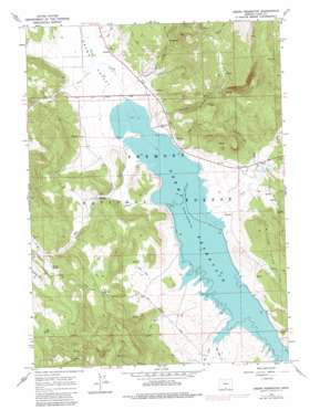
Drews Reservoir Topo Map Oregon
To zoom in, hover over the map of Drews Reservoir
USGS Topo Quad 42120b6 - 1:24,000 scale
| Topo Map Name: | Drews Reservoir |
| USGS Topo Quad ID: | 42120b6 |
| Print Size: | ca. 21 1/4" wide x 27" high |
| Southeast Coordinates: | 42.125° N latitude / 120.625° W longitude |
| Map Center Coordinates: | 42.1875° N latitude / 120.6875° W longitude |
| U.S. State: | OR |
| Filename: | o42120b6.jpg |
| Download Map JPG Image: | Drews Reservoir topo map 1:24,000 scale |
| Map Type: | Topographic |
| Topo Series: | 7.5´ |
| Map Scale: | 1:24,000 |
| Source of Map Images: | United States Geological Survey (USGS) |
| Alternate Map Versions: |
Drews Reservoir OR 1964, updated 1965 Download PDF Buy paper map Drews Reservoir OR 1964, updated 1983 Download PDF Buy paper map Drews Reservoir OR 2004, updated 2007 Download PDF Buy paper map Drews Reservoir OR 2011 Download PDF Buy paper map Drews Reservoir OR 2014 Download PDF Buy paper map |
| FStopo: | US Forest Service topo Drews Reservoir is available: Download FStopo PDF Download FStopo TIF |
1:24,000 Topo Quads surrounding Drews Reservoir
> Back to 42120a1 at 1:100,000 scale
> Back to 42120a1 at 1:250,000 scale
> Back to U.S. Topo Maps home
Drews Reservoir topo map: Gazetteer
Drews Reservoir: Populated Places
Drews Valley (historical) elevation 1514m 4967′Vistillas (historical) elevation 1525m 5003′
Drews Reservoir: Post Offices
Drews Valley Post Office (historical) elevation 1514m 4967′Vistillas Post Office (historical) elevation 1525m 5003′
Drews Reservoir: Springs
Dip Spring elevation 1596m 5236′Kerman Spring elevation 1535m 5036′
Salt Spring elevation 1583m 5193′
Drews Reservoir: Streams
Chandler Creek elevation 1500m 4921′Dent Creek elevation 1501m 4924′
Dog Creek elevation 1500m 4921′
Fish Creek elevation 1503m 4931′
Hay Creek elevation 1500m 4921′
La Sere Creek elevation 1500m 4921′
Sagehen Creek elevation 1501m 4924′
Seventy Creek elevation 1499m 4917′
Stevenson Creek elevation 1502m 4927′
Upset Creek elevation 1519m 4983′
Drews Reservoir: Summits
La Sere Point elevation 1831m 6007′Drews Reservoir: Valleys
Drews Valley elevation 1500m 4921′Drews Reservoir digital topo map on disk
Buy this Drews Reservoir topo map showing relief, roads, GPS coordinates and other geographical features, as a high-resolution digital map file on DVD:


