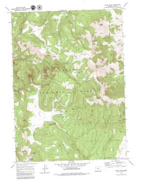
Crook Peak Topo Map Oregon
To zoom in, hover over the map of Crook Peak
USGS Topo Quad 42120c2 - 1:24,000 scale
| Topo Map Name: | Crook Peak |
| USGS Topo Quad ID: | 42120c2 |
| Print Size: | ca. 21 1/4" wide x 27" high |
| Southeast Coordinates: | 42.25° N latitude / 120.125° W longitude |
| Map Center Coordinates: | 42.3125° N latitude / 120.1875° W longitude |
| U.S. State: | OR |
| Filename: | o42120c2.jpg |
| Download Map JPG Image: | Crook Peak topo map 1:24,000 scale |
| Map Type: | Topographic |
| Topo Series: | 7.5´ |
| Map Scale: | 1:24,000 |
| Source of Map Images: | United States Geological Survey (USGS) |
| Alternate Map Versions: |
Crook Peak OR 1968, updated 1972 Download PDF Buy paper map Crook Peak OR 1968, updated 1980 Download PDF Buy paper map Crook Peak OR 2004, updated 2007 Download PDF Buy paper map Crook Peak OR 2011 Download PDF Buy paper map Crook Peak OR 2014 Download PDF Buy paper map |
| FStopo: | US Forest Service topo Crook Peak is available: Download FStopo PDF Download FStopo TIF |
1:24,000 Topo Quads surrounding Crook Peak
> Back to 42120a1 at 1:100,000 scale
> Back to 42120a1 at 1:250,000 scale
> Back to U.S. Topo Maps home
Crook Peak topo map: Gazetteer
Crook Peak: Basins
Sherman Valley elevation 2019m 6624′Crook Peak: Flats
Bull Prairie elevation 1973m 6473′Sage Flat elevation 2065m 6774′
Crook Peak: Springs
Drake Spring elevation 2085m 6840′Emery Spring elevation 2019m 6624′
Military Spring elevation 2042m 6699′
Mud Creek Spring elevation 1974m 6476′
Stairstep Spring elevation 2000m 6561′
Woodchopper Spring elevation 1933m 6341′
Crook Peak: Streams
Big Cove Creek elevation 1724m 5656′Long John Creek elevation 1898m 6227′
Middle Fork Crooked Creek elevation 2080m 6824′
North Fork Crooked Creek elevation 1971m 6466′
Porcupine Creek elevation 1971m 6466′
Sage Creek elevation 1897m 6223′
South Fork Crooked Creek elevation 1971m 6466′
Crook Peak: Summits
Crook Peak elevation 2379m 7805′Light Peak elevation 2539m 8330′
McDowell Peak elevation 2322m 7618′
North Warner Viewpoint elevation 2100m 6889′
Squaw Butte elevation 2209m 7247′
Twelvemile Peak elevation 2465m 8087′
Crook Peak digital topo map on disk
Buy this Crook Peak topo map showing relief, roads, GPS coordinates and other geographical features, as a high-resolution digital map file on DVD:


