Paradise Mountain Topo Map Oregon
To zoom in, hover over the map of Paradise Mountain
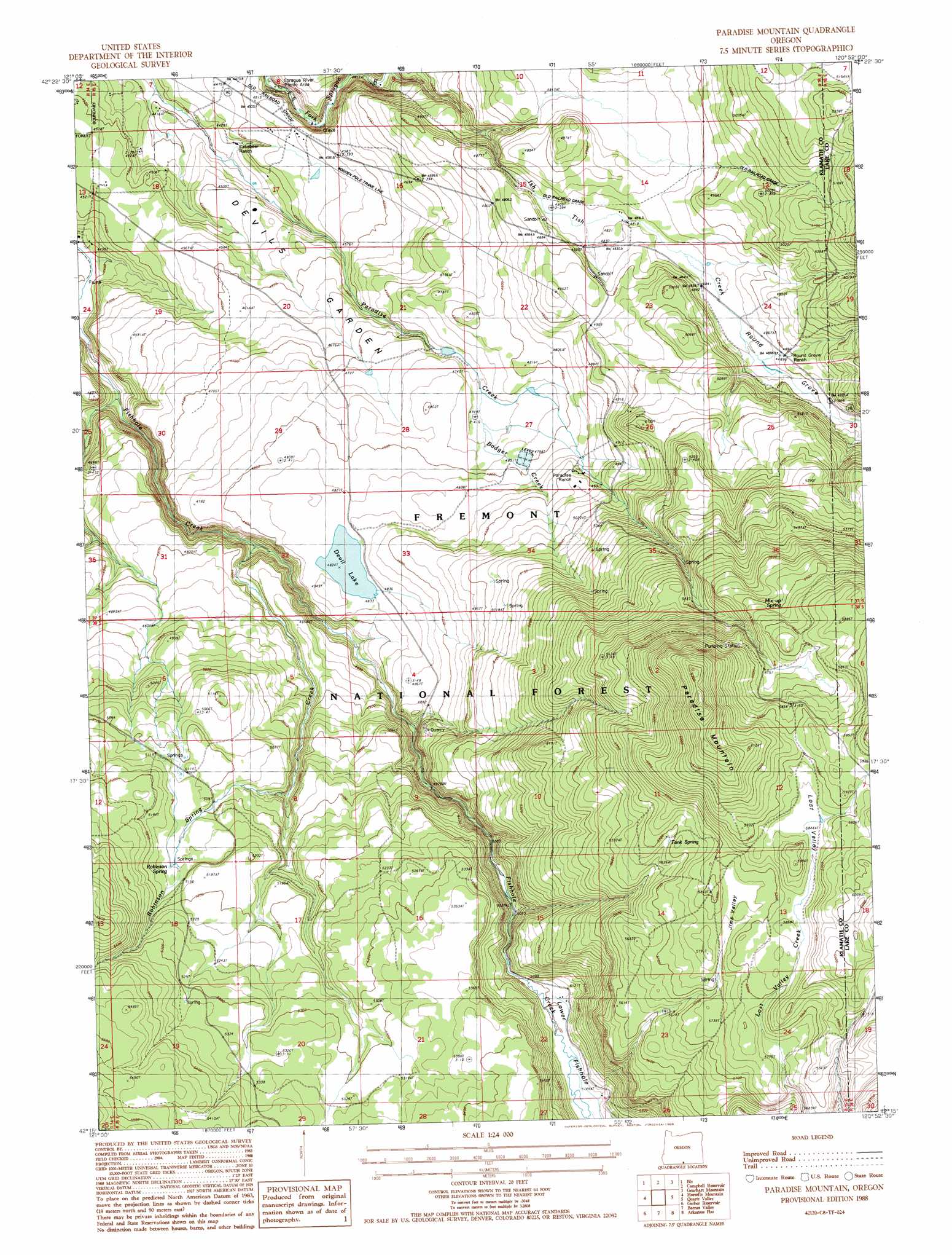
USGS Topo Quad 42120c8 - 1:24,000 scale
| Topo Map Name: | Paradise Mountain |
| USGS Topo Quad ID: | 42120c8 |
| Print Size: | ca. 21 1/4" wide x 27" high |
| Southeast Coordinates: | 42.25° N latitude / 120.875° W longitude |
| Map Center Coordinates: | 42.3125° N latitude / 120.9375° W longitude |
| U.S. State: | OR |
| Filename: | o42120c8.jpg |
| Download Map JPG Image: | Paradise Mountain topo map 1:24,000 scale |
| Map Type: | Topographic |
| Topo Series: | 7.5´ |
| Map Scale: | 1:24,000 |
| Source of Map Images: | United States Geological Survey (USGS) |
| Alternate Map Versions: |
Paradise Mountain OR 1988, updated 1988 Download PDF Buy paper map Paradise Mountain OR 2011 Download PDF Buy paper map Paradise Mountain OR 2014 Download PDF Buy paper map |
| FStopo: | US Forest Service topo Paradise Mountain is available: Download FStopo PDF Download FStopo TIF |
1:24,000 Topo Quads surrounding Paradise Mountain
Ponina Butte |
Rodeo Butte |
Sandhill Crossing |
Lee Thomas Crossing |
Coffeepot Creek |
Ferguson Mountain |
Bly |
Campbell Reservoir |
Gearhart Mountain |
Coleman Point |
Dry Prairie |
Horsefly Mountain |
Paradise Mountain |
Quartz Valley |
Cougar Peak |
Goodlow Mountain |
Gerber Reservoir |
Barnes Valley |
Arkansas Flat |
Drews Reservoir |
Langell Valley |
Brady Butte |
Antler Point |
Strawberry Butte |
Dog Lake |
> Back to 42120a1 at 1:100,000 scale
> Back to 42120a1 at 1:250,000 scale
> Back to U.S. Topo Maps home
Paradise Mountain topo map: Gazetteer
Paradise Mountain: Areas
Devils Garden elevation 1445m 4740′Paradise Mountain: Reservoirs
Devil Lake elevation 1472m 4829′Little Reservoir Number Five elevation 1439m 4721′
Little Reservoir Number One elevation 1346m 4416′
Little Reservoir Number Six elevation 1442m 4730′
Little Reservoir Number Three elevation 1386m 4547′
Paradise Mountain: Springs
Mixup Spring elevation 1762m 5780′Robinson Spring elevation 1572m 5157′
Shone Spring elevation 1747m 5731′
Tank Spring elevation 1737m 5698′
Paradise Mountain: Streams
Badger Creek elevation 1445m 4740′Ish Tish Creek elevation 1356m 4448′
Robinson Spring Creek elevation 1415m 4642′
Paradise Mountain: Summits
Paradise Mountain elevation 1916m 6286′Paradise Mountain: Swamps
Round Grove elevation 1482m 4862′Paradise Mountain: Valleys
Jims Valley elevation 1750m 5741′Lost Valley elevation 1779m 5836′
Paradise Mountain digital topo map on disk
Buy this Paradise Mountain topo map showing relief, roads, GPS coordinates and other geographical features, as a high-resolution digital map file on DVD: