Clover Flat Topo Map Oregon
To zoom in, hover over the map of Clover Flat
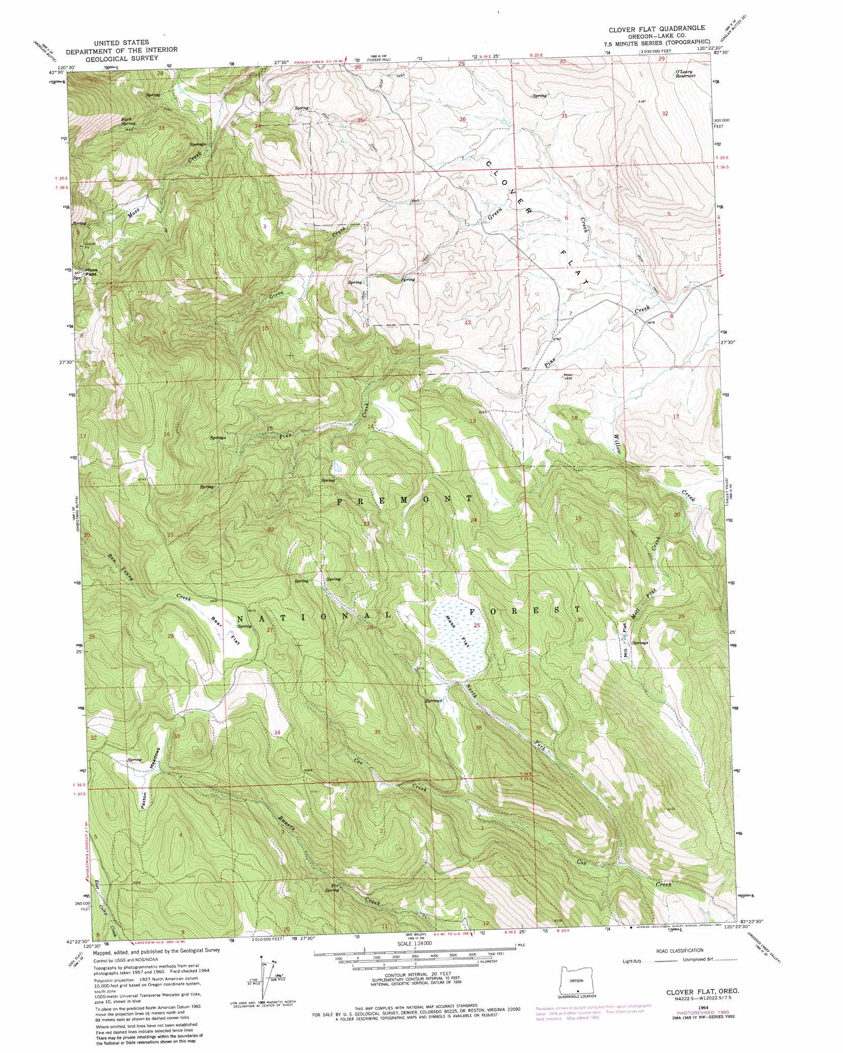
USGS Topo Quad 42120d4 - 1:24,000 scale
| Topo Map Name: | Clover Flat |
| USGS Topo Quad ID: | 42120d4 |
| Print Size: | ca. 21 1/4" wide x 27" high |
| Southeast Coordinates: | 42.375° N latitude / 120.375° W longitude |
| Map Center Coordinates: | 42.4375° N latitude / 120.4375° W longitude |
| U.S. State: | OR |
| Filename: | o42120d4.jpg |
| Download Map JPG Image: | Clover Flat topo map 1:24,000 scale |
| Map Type: | Topographic |
| Topo Series: | 7.5´ |
| Map Scale: | 1:24,000 |
| Source of Map Images: | United States Geological Survey (USGS) |
| Alternate Map Versions: |
Clover Flat OR 1964, updated 1966 Download PDF Buy paper map Clover Flat OR 1980, updated 1980 Download PDF Buy paper map Clover Flat OR 2004, updated 2007 Download PDF Buy paper map Clover Flat OR 2011 Download PDF Buy paper map Clover Flat OR 2014 Download PDF Buy paper map |
| FStopo: | US Forest Service topo Clover Flat is available: Download FStopo PDF Download FStopo TIF |
1:24,000 Topo Quads surrounding Clover Flat
Slide Mountain |
Paisley |
Coglan Buttes |
Coglan Buttes Ne |
Lake Abert North |
Coffeepot Creek |
Morgan Butte |
Tucker Hill |
Coglan Buttes Se |
Lake Abert South |
Coleman Point |
Shoestring Butte |
Clover Flat |
Valley Falls |
Little Honey Creek |
Cougar Peak |
Cox Flat |
Big Baldy |
Crooked Creek Valley |
Crook Peak |
Drews Reservoir |
Drews Gap |
Lakeview Airport |
Lakeview |
Horse Prairie |
> Back to 42120a1 at 1:100,000 scale
> Back to 42120a1 at 1:250,000 scale
> Back to U.S. Topo Maps home
Clover Flat topo map: Gazetteer
Clover Flat: Flats
Bear Flat elevation 2003m 6571′Clover Flat elevation 1471m 4826′
Mill Flat elevation 1586m 5203′
Paxton Meadows elevation 1993m 6538′
Clover Flat: Gaps
Moss Pass elevation 1943m 6374′Clover Flat: Post Offices
Clover Flat Post Office (historical) elevation 1469m 4819′Clover Flat: Reservoirs
O'Leary Reservoir elevation 1505m 4937′Red Knoll Reservoir elevation 1475m 4839′
Clover Flat: Springs
Buck Spring elevation 1842m 6043′Fir Spring elevation 1767m 5797′
Moss Flat Spring elevation 1728m 5669′
Clover Flat: Streams
Green Creek elevation 1410m 4625′Mill Flat Creek elevation 1444m 4737′
North Fork Cox Creek elevation 1609m 5278′
Clover Flat: Swamps
Moss Flat elevation 1722m 5649′Clover Flat digital topo map on disk
Buy this Clover Flat topo map showing relief, roads, GPS coordinates and other geographical features, as a high-resolution digital map file on DVD: