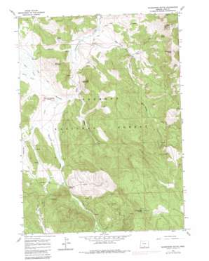
Shoestring Butte Topo Map Oregon
To zoom in, hover over the map of Shoestring Butte
USGS Topo Quad 42120d5 - 1:24,000 scale
| Topo Map Name: | Shoestring Butte |
| USGS Topo Quad ID: | 42120d5 |
| Print Size: | ca. 21 1/4" wide x 27" high |
| Southeast Coordinates: | 42.375° N latitude / 120.5° W longitude |
| Map Center Coordinates: | 42.4375° N latitude / 120.5625° W longitude |
| U.S. State: | OR |
| Filename: | o42120d5.jpg |
| Download Map JPG Image: | Shoestring Butte topo map 1:24,000 scale |
| Map Type: | Topographic |
| Topo Series: | 7.5´ |
| Map Scale: | 1:24,000 |
| Source of Map Images: | United States Geological Survey (USGS) |
| Alternate Map Versions: |
Shoestring Butte OR 1964, updated 1966 Download PDF Buy paper map Shoestring Butte OR 1964, updated 1980 Download PDF Buy paper map Shoestring Butte OR 2004, updated 2007 Download PDF Buy paper map Shoestring Butte OR 2011 Download PDF Buy paper map Shoestring Butte OR 2014 Download PDF Buy paper map |
| FStopo: | US Forest Service topo Shoestring Butte is available: Download FStopo PDF Download FStopo TIF |
1:24,000 Topo Quads surrounding Shoestring Butte
> Back to 42120a1 at 1:100,000 scale
> Back to 42120a1 at 1:250,000 scale
> Back to U.S. Topo Maps home
Shoestring Butte topo map: Gazetteer
Shoestring Butte: Gaps
Round Pass elevation 2077m 6814′Shoestring Butte: Lakes
Dicks Pond elevation 1621m 5318′Shoestring Butte: Springs
Cannon Spring elevation 1864m 6115′Clem Spring elevation 1972m 6469′
Lucky Six Spring elevation 1683m 5521′
Moss Spring elevation 1915m 6282′
Paddy Spring elevation 1603m 5259′
Schuster Spring elevation 1591m 5219′
Shoestring Spring elevation 1622m 5321′
Shoestring Butte: Streams
Ben Young Creek elevation 1528m 5013′Dairy Creek elevation 1571m 5154′
Elder Creek elevation 1571m 5154′
Farrow Creek elevation 1569m 5147′
Shoestring Creek elevation 1573m 5160′
South Creek elevation 1565m 5134′
Swamp Creek elevation 1566m 5137′
West Fork Shoestring Creek elevation 1608m 5275′
Shoestring Butte: Summits
Buck Mountain elevation 1848m 6062′Doe Mountain elevation 1858m 6095′
Jack and Jenny Buttes elevation 1575m 5167′
Moss Pass Butte elevation 2223m 7293′
Round Mountain elevation 2278m 7473′
Shoestring Butte elevation 2216m 7270′
Shoestring Butte digital topo map on disk
Buy this Shoestring Butte topo map showing relief, roads, GPS coordinates and other geographical features, as a high-resolution digital map file on DVD:


