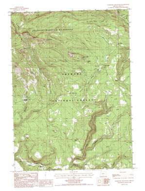
Gearhart Mountain Topo Map Oregon
To zoom in, hover over the map of Gearhart Mountain
USGS Topo Quad 42120d7 - 1:24,000 scale
| Topo Map Name: | Gearhart Mountain |
| USGS Topo Quad ID: | 42120d7 |
| Print Size: | ca. 21 1/4" wide x 27" high |
| Southeast Coordinates: | 42.375° N latitude / 120.75° W longitude |
| Map Center Coordinates: | 42.4375° N latitude / 120.8125° W longitude |
| U.S. State: | OR |
| Filename: | o42120d7.jpg |
| Download Map JPG Image: | Gearhart Mountain topo map 1:24,000 scale |
| Map Type: | Topographic |
| Topo Series: | 7.5´ |
| Map Scale: | 1:24,000 |
| Source of Map Images: | United States Geological Survey (USGS) |
| Alternate Map Versions: |
Gearhart Mountain OR 1988, updated 1988 Download PDF Buy paper map Gearhart Mountain OR 2004, updated 2007 Download PDF Buy paper map Gearhart Mountain OR 2011 Download PDF Buy paper map Gearhart Mountain OR 2014 Download PDF Buy paper map |
| FStopo: | US Forest Service topo Gearhart Mountain is available: Download FStopo PDF Download FStopo TIF |
1:24,000 Topo Quads surrounding Gearhart Mountain
> Back to 42120a1 at 1:100,000 scale
> Back to 42120a1 at 1:250,000 scale
> Back to U.S. Topo Maps home
Gearhart Mountain topo map: Gazetteer
Gearhart Mountain: Flats
Bare Flat elevation 1838m 6030′Grouse Prairie elevation 1832m 6010′
Jack Flat elevation 1819m 5967′
Gearhart Mountain: Parks
Mitchell Monument elevation 1655m 5429′Mitchell Recreation Area elevation 1654m 5426′
Gearhart Mountain: Pillars
Lookout Rock elevation 1971m 6466′Gearhart Mountain: Populated Places
Blaisdell elevation 1470m 4822′Gearhart Mountain: Springs
Box Spring elevation 1859m 6099′Cottonwood Spring elevation 1639m 5377′
Edler Spring elevation 1776m 5826′
Lookout Spring elevation 1854m 6082′
Mitten Spring elevation 1836m 6023′
Salt Spring elevation 1655m 5429′
Watson Spring elevation 1825m 5987′
Gearhart Mountain: Streams
Alder Creek elevation 1514m 4967′Buckboard Creek elevation 1558m 5111′
Camp Creek elevation 1789m 5869′
Corral Creek elevation 1810m 5938′
Cougar Creek elevation 1813m 5948′
Hammond Creek elevation 1565m 5134′
Jack Creek elevation 1730m 5675′
Jade Creek elevation 1714m 5623′
Leonard Creek elevation 1625m 5331′
Little Cougar Creek elevation 1823m 5980′
Pothole Creek elevation 1500m 4921′
Trapper Creek elevation 1805m 5921′
Wildcat Creek elevation 1781m 5843′
Gearhart Mountain: Summits
Haystack Rock elevation 2231m 7319′Palisade Rocks elevation 1991m 6532′
The Dome elevation 2182m 7158′
Gearhart Mountain digital topo map on disk
Buy this Gearhart Mountain topo map showing relief, roads, GPS coordinates and other geographical features, as a high-resolution digital map file on DVD:


