Coleman Hills Topo Map Oregon
To zoom in, hover over the map of Coleman Hills
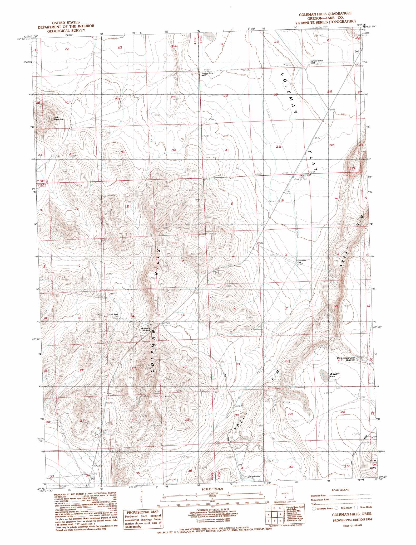
USGS Topo Quad 42120g1 - 1:24,000 scale
| Topo Map Name: | Coleman Hills |
| USGS Topo Quad ID: | 42120g1 |
| Print Size: | ca. 21 1/4" wide x 27" high |
| Southeast Coordinates: | 42.75° N latitude / 120° W longitude |
| Map Center Coordinates: | 42.8125° N latitude / 120.0625° W longitude |
| U.S. State: | OR |
| Filename: | o42120g1.jpg |
| Download Map JPG Image: | Coleman Hills topo map 1:24,000 scale |
| Map Type: | Topographic |
| Topo Series: | 7.5´ |
| Map Scale: | 1:24,000 |
| Source of Map Images: | United States Geological Survey (USGS) |
| Alternate Map Versions: |
Coleman Hills OR 1984, updated 1984 Download PDF Buy paper map Coleman Hills OR 2011 Download PDF Buy paper map Coleman Hills OR 2014 Download PDF Buy paper map |
1:24,000 Topo Quads surrounding Coleman Hills
Fire Lake |
Poverty Basin North |
Alkali Buttes |
Venator Canyon |
Cox Canyon |
Diatomite Reservoir |
Poverty Basin South |
Alkali Lake |
Juniper Mountain |
Turpin Knoll |
Biscuit Point |
Sawed Horn |
Coleman Hills |
Sagebrush Knoll |
Corn Lake |
Coglan Buttes Ne |
Lake Abert North |
Commodore Ridge |
Rabbit Hills Nw |
Rabbit Hills Ne |
Coglan Buttes Se |
Lake Abert South |
Cooper Draw |
Rabbit Hills Sw |
Flagstaff Lake |
> Back to 42120e1 at 1:100,000 scale
> Back to 42120a1 at 1:250,000 scale
> Back to U.S. Topo Maps home
Coleman Hills topo map: Gazetteer
Coleman Hills: Canals
Luce Ditch elevation 1415m 4642′Coleman Hills: Flats
Coleman Flat elevation 1380m 4527′Coleman Hills: Gaps
Hogback Summit elevation 1524m 5000′Coleman Hills: Ranges
Coleman Hills elevation 1555m 5101′Coleman Hills: Reservoirs
Rock Spring Gulch Reservoir elevation 1629m 5344′Coleman Hills: Summits
Jug Mountain elevation 1588m 5209′Coleman Hills: Wells
Euchre Butte Well elevation 1372m 4501′Highway Well elevation 1383m 4537′
Leehmann Well elevation 1411m 4629′
State Block Well elevation 1411m 4629′
Coleman Hills digital topo map on disk
Buy this Coleman Hills topo map showing relief, roads, GPS coordinates and other geographical features, as a high-resolution digital map file on DVD: