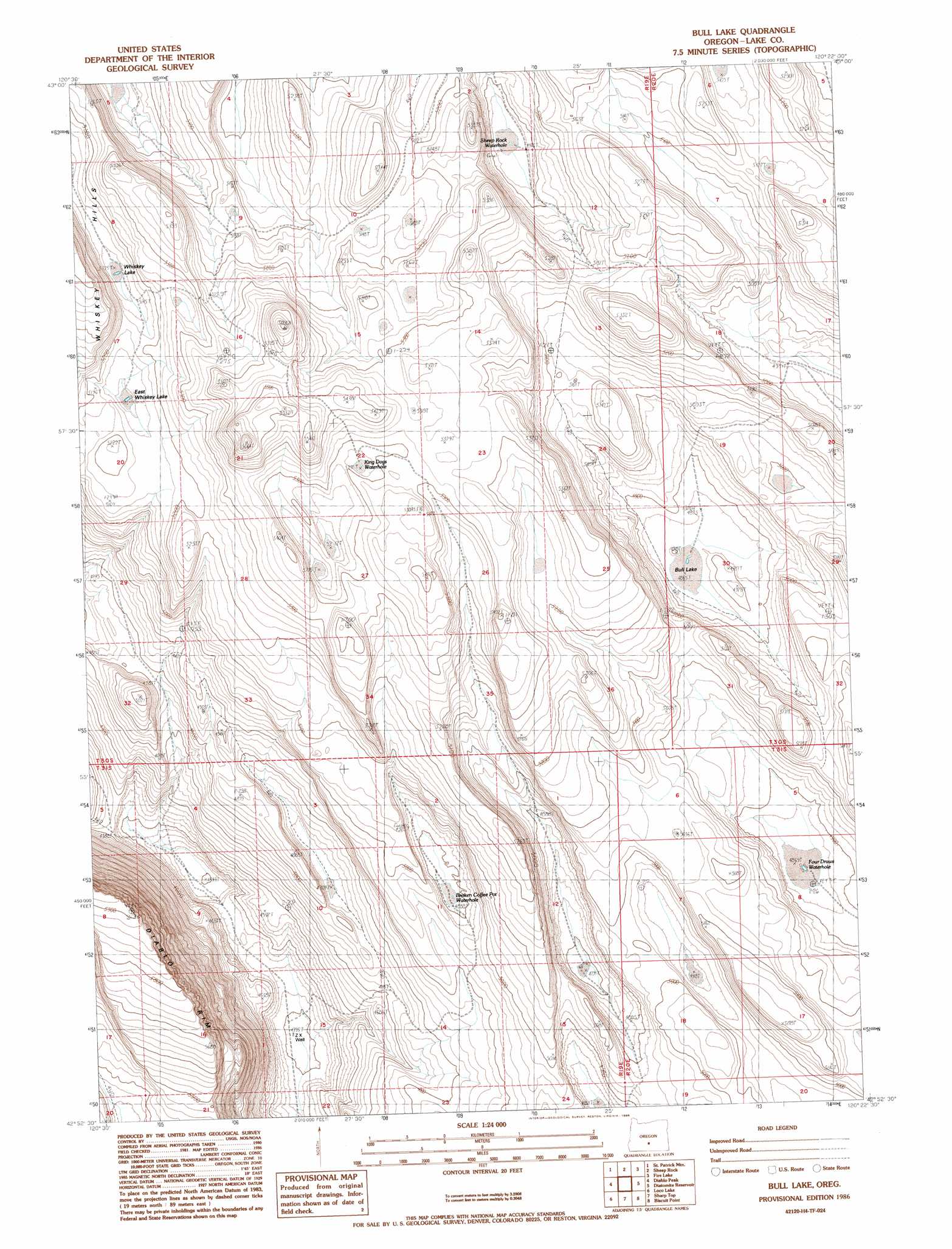
Bull Lake Topo Map Oregon
To zoom in, hover over the map of Bull Lake
USGS Topo Quad 42120h4 - 1:24,000 scale
| Topo Map Name: | Bull Lake |
| USGS Topo Quad ID: | 42120h4 |
| Print Size: | ca. 21 1/4" wide x 27" high |
| Southeast Coordinates: | 42.875° N latitude / 120.375° W longitude |
| Map Center Coordinates: | 42.9375° N latitude / 120.4375° W longitude |
| U.S. State: | OR |
| Filename: | o42120h4.jpg |
| Download Map JPG Image: | Bull Lake topo map 1:24,000 scale |
| Map Type: | Topographic |
| Topo Series: | 7.5´ |
| Map Scale: | 1:24,000 |
| Source of Map Images: | United States Geological Survey (USGS) |
| Alternate Map Versions: |
Bull Lake OR 1986, updated 1986 Download PDF Buy paper map Bull Lake OR 2011 Download PDF Buy paper map Bull Lake OR 2014 Download PDF Buy paper map |
1:24,000 Topo Quads surrounding Bull Lake
Christmas Valley |
Fandango Canyon |
Vaughn Well |
Buffalo Well |
Horse Mountain |
Sheeplick Draw |
Saint Patrick Mountain |
Sheep Rock |
Fire Lake |
Poverty Basin North |
Ana River |
Diablo Peak |
Bull Lake |
Diatomite Reservoir |
Poverty Basin South |
South Of Ana River |
Loco Lake |
Sharp Top |
Biscuit Point |
Sawed Horn |
Slide Mountain |
Paisley |
Coglan Buttes |
Coglan Buttes Ne |
Lake Abert North |
> Back to 42120e1 at 1:100,000 scale
> Back to 42120a1 at 1:250,000 scale
> Back to U.S. Topo Maps home
Bull Lake topo map: Gazetteer
Bull Lake: Flats
Bull Lake elevation 1484m 4868′East Whiskey Lake elevation 1567m 5141′
Whiskey Lake elevation 1566m 5137′
Bull Lake: Reservoirs
Broken Coffee Pot Waterhole elevation 1493m 4898′Four Draws Waterhole elevation 1489m 4885′
King Dogs Waterhole elevation 1608m 5275′
Sheep Rock Waterhole elevation 1516m 4973′
Bull Lake: Wells
ZX Well elevation 1339m 4393′Bull Lake digital topo map on disk
Buy this Bull Lake topo map showing relief, roads, GPS coordinates and other geographical features, as a high-resolution digital map file on DVD: