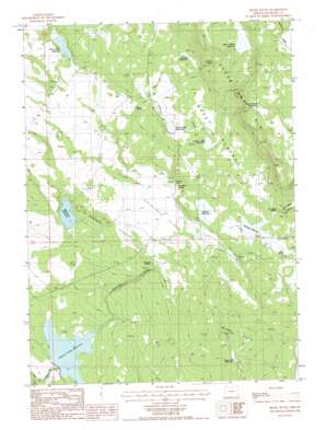
Brady Butte Topo Map Oregon
To zoom in, hover over the map of Brady Butte
USGS Topo Quad 42121a1 - 1:24,000 scale
| Topo Map Name: | Brady Butte |
| USGS Topo Quad ID: | 42121a1 |
| Print Size: | ca. 21 1/4" wide x 27" high |
| Southeast Coordinates: | 42° N latitude / 121° W longitude |
| Map Center Coordinates: | 42.0625° N latitude / 121.0625° W longitude |
| U.S. State: | OR |
| Filename: | o42121a1.jpg |
| Download Map JPG Image: | Brady Butte topo map 1:24,000 scale |
| Map Type: | Topographic |
| Topo Series: | 7.5´ |
| Map Scale: | 1:24,000 |
| Source of Map Images: | United States Geological Survey (USGS) |
| Alternate Map Versions: |
Brady Butte OR 1988, updated 1988 Download PDF Buy paper map Brady Butte OR 2011 Download PDF Buy paper map Brady Butte OR 2014 Download PDF Buy paper map |
1:24,000 Topo Quads surrounding Brady Butte
> Back to 42121a1 at 1:100,000 scale
> Back to 42120a1 at 1:250,000 scale
> Back to U.S. Topo Maps home
Brady Butte topo map: Gazetteer
Brady Butte: Cliffs
Horse Camp Rim elevation 1606m 5269′Brady Butte: Dams
Antelope Dam elevation 1476m 4842′Bumphead Dam elevation 1449m 4753′
Dog Hollow Dam elevation 1488m 4881′
Kilgore Dam elevation 1465m 4806′
Upper Midway Dam elevation 1518m 4980′
Willow Valley Dam elevation 1378m 4520′
Brady Butte: Flats
Antelope Flat elevation 1451m 4760′Brady Butte: Parks
Antelope Reservoir Day-Use Area elevation 1476m 4842′Brady Butte: Plains
Rocky Plateau elevation 1512m 4960′Brady Butte: Reservoirs
Antelope Reservoir elevation 1472m 4829′Bumphead Reservoir elevation 1449m 4753′
Dog Hollow Reservoir elevation 1489m 4885′
Gerber Lower Division Reservoir elevation 1512m 4960′
Horse Camp Reservoir elevation 1624m 5328′
Jake Spring Reservoir elevation 1491m 4891′
Junction Waterhole elevation 1506m 4940′
Kilgore Reservoir elevation 1465m 4806′
Logger Waterhole elevation 1586m 5203′
Midway Reservoir elevation 1507m 4944′
Spreader Reservoir elevation 1476m 4842′
Timber Hill Reservoir elevation 1530m 5019′
Twenty One Reservoir elevation 1494m 4901′
Upper Midway Reservoir elevation 1580m 5183′
Willow Valley Reservoir elevation 1381m 4530′
Brady Butte: Springs
Alkali Spring elevation 1480m 4855′Antelope Spring elevation 1456m 4776′
Cold Spring elevation 1410m 4625′
Duncan Spring elevation 1441m 4727′
Jennette Spring elevation 1546m 5072′
Lost River Spring elevation 1483m 4865′
North Spring elevation 1483m 4865′
Rimrock Spring elevation 1536m 5039′
Brady Butte: Streams
Antelope Creek elevation 1384m 4540′Brady Butte: Summits
Brady Butte elevation 1563m 5127′The Bumpheads elevation 1474m 4835′
Brady Butte: Valleys
Bear Valley Canyon elevation 1476m 4842′Brady Butte digital topo map on disk
Buy this Brady Butte topo map showing relief, roads, GPS coordinates and other geographical features, as a high-resolution digital map file on DVD:


