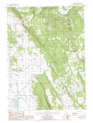
Yonna Topo Map Oregon
To zoom in, hover over the map of Yonna
USGS Topo Quad 42121c4 - 1:24,000 scale
| Topo Map Name: | Yonna |
| USGS Topo Quad ID: | 42121c4 |
| Print Size: | ca. 21 1/4" wide x 27" high |
| Southeast Coordinates: | 42.25° N latitude / 121.375° W longitude |
| Map Center Coordinates: | 42.3125° N latitude / 121.4375° W longitude |
| U.S. State: | OR |
| Filename: | o42121c4.jpg |
| Download Map JPG Image: | Yonna topo map 1:24,000 scale |
| Map Type: | Topographic |
| Topo Series: | 7.5´ |
| Map Scale: | 1:24,000 |
| Source of Map Images: | United States Geological Survey (USGS) |
| Alternate Map Versions: |
Yonna OR 1988, updated 1988 Download PDF Buy paper map Yonna OR 1998, updated 2000 Download PDF Buy paper map Yonna OR 2011 Download PDF Buy paper map Yonna OR 2014 Download PDF Buy paper map |
| FStopo: | US Forest Service topo Yonna is available: Download FStopo PDF Download FStopo TIF |
1:24,000 Topo Quads surrounding Yonna
> Back to 42121a1 at 1:100,000 scale
> Back to 42120a1 at 1:250,000 scale
> Back to U.S. Topo Maps home
Yonna topo map: Gazetteer
Yonna: Flats
Maynard Flat elevation 1549m 5082′Yonna: Gaps
Bly Mountain Pass elevation 1547m 5075′Yonna: Lakes
Johnny Lake elevation 1264m 4146′Log Lake elevation 1344m 4409′
Yonna: Mines
Schonchin Cinder Pit elevation 1603m 5259′Yonna: Parks
Klamath Falls-Lakeview Forest State Park elevation 1432m 4698′Yonna: Populated Places
Hildebrand elevation 1278m 4192′Yonna elevation 1263m 4143′
Yonna: Post Offices
Hildebrand Post Office (historical) elevation 1278m 4192′Yonna Post Office (historical) elevation 1263m 4143′
Yonna: Reservoirs
Cox Reservoir elevation 1391m 4563′Kodiak Pond (historical) elevation 1561m 5121′
Ritter Reservoir elevation 1322m 4337′
Ritter Reservoir elevation 1305m 4281′
Yonna: Springs
Boundary Spring elevation 1536m 5039′Calohan Spring elevation 1538m 5045′
Indian Spring elevation 1454m 4770′
Wildhorse Spring elevation 1525m 5003′
Yonna: Streams
Fisher Creek elevation 1294m 4245′Wildhorse Creek elevation 1266m 4153′
Yonna: Valleys
Wildhorse Canyon elevation 1375m 4511′Yonna digital topo map on disk
Buy this Yonna topo map showing relief, roads, GPS coordinates and other geographical features, as a high-resolution digital map file on DVD:


