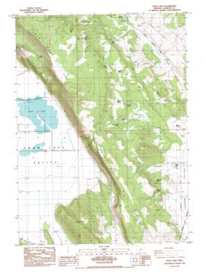
Swan Lake Topo Map Oregon
To zoom in, hover over the map of Swan Lake
USGS Topo Quad 42121c5 - 1:24,000 scale
| Topo Map Name: | Swan Lake |
| USGS Topo Quad ID: | 42121c5 |
| Print Size: | ca. 21 1/4" wide x 27" high |
| Southeast Coordinates: | 42.25° N latitude / 121.5° W longitude |
| Map Center Coordinates: | 42.3125° N latitude / 121.5625° W longitude |
| U.S. State: | OR |
| Filename: | o42121c5.jpg |
| Download Map JPG Image: | Swan Lake topo map 1:24,000 scale |
| Map Type: | Topographic |
| Topo Series: | 7.5´ |
| Map Scale: | 1:24,000 |
| Source of Map Images: | United States Geological Survey (USGS) |
| Alternate Map Versions: |
Swan Lake OR 1985, updated 1985 Download PDF Buy paper map Swan Lake OR 2011 Download PDF Buy paper map Swan Lake OR 2014 Download PDF Buy paper map |
1:24,000 Topo Quads surrounding Swan Lake
> Back to 42121a1 at 1:100,000 scale
> Back to 42120a1 at 1:250,000 scale
> Back to U.S. Topo Maps home
Swan Lake topo map: Gazetteer
Swan Lake: Dams
Horton Dam elevation 1331m 4366′Swan Lake: Lakes
Swan Lake elevation 1275m 4183′Swan Lake: Post Offices
McCurdy Post Office (historical) elevation 1269m 4163′Swan Lake: Reservoirs
C C Porter Reservoir elevation 1331m 4366′Chapman Reservoir elevation 1323m 4340′
Parker Reservoir elevation 1350m 4429′
Swan Lake: Springs
Applegate Spring elevation 1326m 4350′Big Springs elevation 1390m 4560′
Bodnar Springs elevation 1376m 4514′
Buckhorn Spring elevation 1419m 4655′
Egert Spring elevation 1397m 4583′
First Sheep Camp Spring elevation 1481m 4858′
Fourmile Spring elevation 1306m 4284′
Jack Frost Spring elevation 1440m 4724′
Rattlesnake Spring elevation 1365m 4478′
Second Sheep Camp Spring elevation 1492m 4895′
Stiles Spring elevation 1482m 4862′
Tunnel Spring elevation 1289m 4229′
Welsh Spring elevation 1508m 4947′
Swan Lake: Streams
Buck Creek elevation 1280m 4199′Rattlesnake Creek elevation 1268m 4160′
Swan Lake: Summits
Hopper Hill elevation 1558m 5111′Swan Lake: Valleys
Swan Lake Valley elevation 1277m 4189′Welsh Gulch elevation 1287m 4222′
Swan Lake digital topo map on disk
Buy this Swan Lake topo map showing relief, roads, GPS coordinates and other geographical features, as a high-resolution digital map file on DVD:


