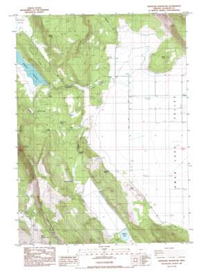
Whiteline Reservoir Topo Map Oregon
To zoom in, hover over the map of Whiteline Reservoir
USGS Topo Quad 42121c6 - 1:24,000 scale
| Topo Map Name: | Whiteline Reservoir |
| USGS Topo Quad ID: | 42121c6 |
| Print Size: | ca. 21 1/4" wide x 27" high |
| Southeast Coordinates: | 42.25° N latitude / 121.625° W longitude |
| Map Center Coordinates: | 42.3125° N latitude / 121.6875° W longitude |
| U.S. State: | OR |
| Filename: | o42121c6.jpg |
| Download Map JPG Image: | Whiteline Reservoir topo map 1:24,000 scale |
| Map Type: | Topographic |
| Topo Series: | 7.5´ |
| Map Scale: | 1:24,000 |
| Source of Map Images: | United States Geological Survey (USGS) |
| Alternate Map Versions: |
Whiteline Reservoir OR 1985, updated 1985 Download PDF Buy paper map Whiteline Reservoir OR 2011 Download PDF Buy paper map Whiteline Reservoir OR 2014 Download PDF Buy paper map |
1:24,000 Topo Quads surrounding Whiteline Reservoir
> Back to 42121a1 at 1:100,000 scale
> Back to 42120a1 at 1:250,000 scale
> Back to U.S. Topo Maps home
Whiteline Reservoir topo map: Gazetteer
Whiteline Reservoir: Basins
Twomile Valley elevation 1339m 4393′Whiteline Reservoir: Canals
Whiteline Ditch elevation 1349m 4425′Whiteline Reservoir: Dams
Meadow Lake Dam elevation 1391m 4563′Whiteline Dam elevation 1343m 4406′
Whiteline Reservoir: Flats
Meadow Lake Valley elevation 1390m 4560′Swan Lake Meadow elevation 1275m 4183′
Whiteline Reservoir: Post Offices
Oretech Post Office elevation 1464m 4803′Swan Post Office (historical) elevation 1291m 4235′
Whiteline Reservoir: Reservoirs
Meadow Lake elevation 1391m 4563′Oberman Reservoir elevation 1300m 4265′
Whiteline Reservoir elevation 1342m 4402′
Whiteline Reservoir: Ridges
Twomile Ridge elevation 1446m 4744′Whiteline Reservoir: Springs
Brookside Spring elevation 1382m 4534′Cabin Creek Spring elevation 1379m 4524′
Chitwood Spring elevation 1336m 4383′
Cold Spring elevation 1381m 4530′
Deer Spring elevation 1412m 4632′
Holcomb Spring elevation 1414m 4639′
Janssen Spring elevation 1543m 5062′
Surveyors Spring elevation 1397m 4583′
Whiteline Reservoir: Streams
Anderson Creek elevation 1277m 4189′Brookside Creek elevation 1286m 4219′
Cabin Creek elevation 1281m 4202′
Edgewood Creek elevation 1278m 4192′
Janssen Spring Creek elevation 1365m 4478′
Whiteline Reservoir: Summits
Grizzly Butte elevation 1364m 4475′Whiteline Reservoir: Valleys
Antelope Valley elevation 1368m 4488′Whiteline Reservoir digital topo map on disk
Buy this Whiteline Reservoir topo map showing relief, roads, GPS coordinates and other geographical features, as a high-resolution digital map file on DVD:


