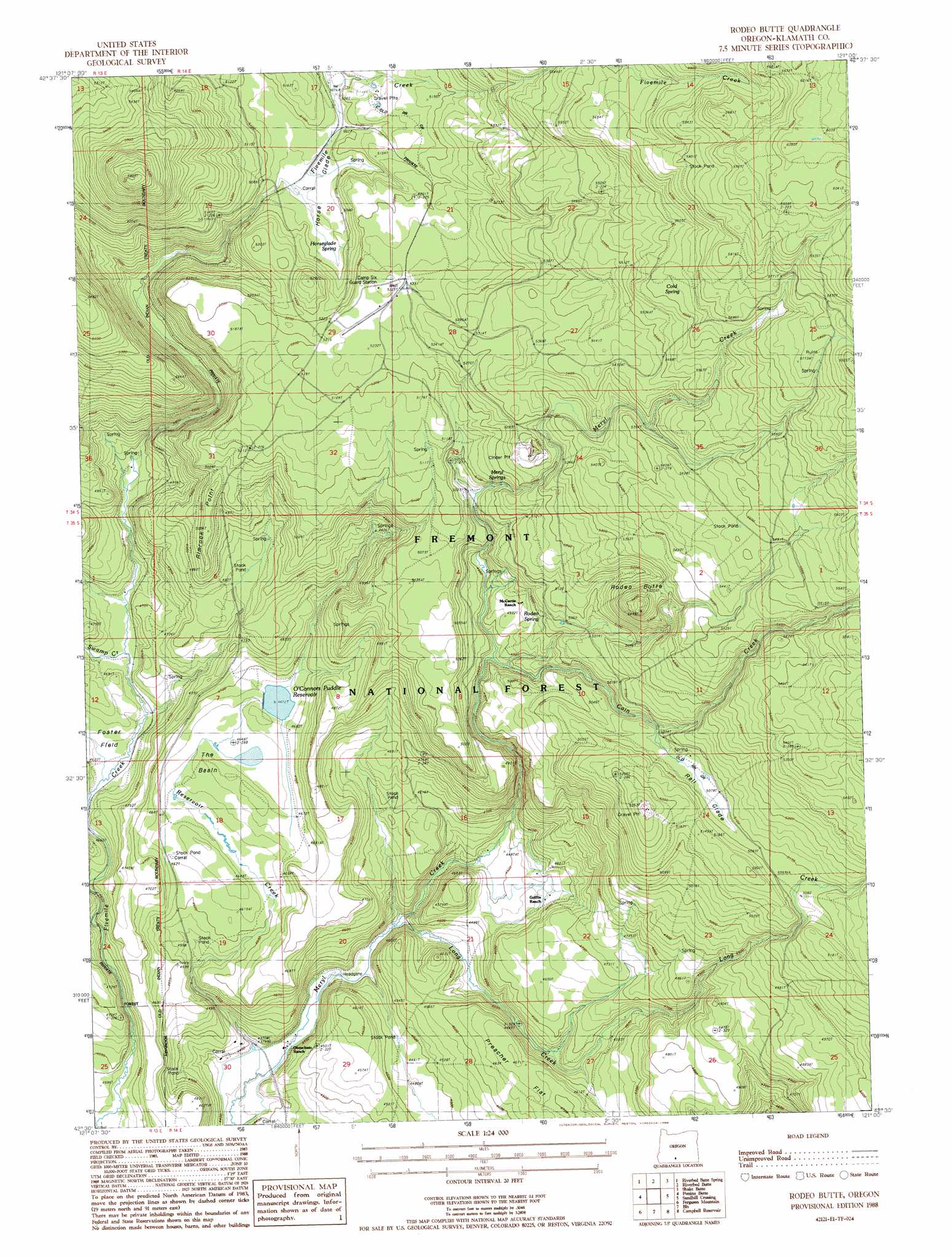
Rodeo Butte Topo Map Oregon
To zoom in, hover over the map of Rodeo Butte
USGS Topo Quad 42121e1 - 1:24,000 scale
| Topo Map Name: | Rodeo Butte |
| USGS Topo Quad ID: | 42121e1 |
| Print Size: | ca. 21 1/4" wide x 27" high |
| Southeast Coordinates: | 42.5° N latitude / 121° W longitude |
| Map Center Coordinates: | 42.5625° N latitude / 121.0625° W longitude |
| U.S. State: | OR |
| Filename: | o42121e1.jpg |
| Download Map JPG Image: | Rodeo Butte topo map 1:24,000 scale |
| Map Type: | Topographic |
| Topo Series: | 7.5´ |
| Map Scale: | 1:24,000 |
| Source of Map Images: | United States Geological Survey (USGS) |
| Alternate Map Versions: |
Rodeo Butte OR 1988, updated 1988 Download PDF Buy paper map Rodeo Butte OR 2011 Download PDF Buy paper map Rodeo Butte OR 2014 Download PDF Buy paper map |
| FStopo: | US Forest Service topo Rodeo Butte is available: Download FStopo PDF Download FStopo TIF |
1:24,000 Topo Quads surrounding Rodeo Butte
Hamelton Butte |
Sycan Marsh West |
Sycan Marsh East |
Pole Butte |
Fremont Point |
Silver Dollar Flat |
Riverbed Butte Spring |
Riverbed Butte |
Shake Butte |
Harvey Creek |
Spodue Mountain |
Ponina Butte |
Rodeo Butte |
Sandhill Crossing |
Lee Thomas Crossing |
Beatty |
Ferguson Mountain |
Bly |
Campbell Reservoir |
Gearhart Mountain |
Yainax Butte |
Dry Prairie |
Horsefly Mountain |
Paradise Mountain |
Quartz Valley |
> Back to 42121e1 at 1:100,000 scale
> Back to 42120a1 at 1:250,000 scale
> Back to U.S. Topo Maps home
Rodeo Butte topo map: Gazetteer
Rodeo Butte: Basins
The Basin elevation 1418m 4652′Rodeo Butte: Dams
O'Connors Puddle Dam elevation 1424m 4671′Rodeo Butte: Flats
Horse Glade elevation 1552m 5091′Preacher Flat elevation 1422m 4665′
Rail Glade elevation 1548m 5078′
Rodeo Butte: Parks
Foster Field elevation 1410m 4625′Rodeo Butte: Reservoirs
O'Connors Puddle Reservoir elevation 1424m 4671′Rodeo Butte: Ridges
Rimrock Point elevation 1536m 5039′Rodeo Butte: Springs
Cold Spring elevation 1713m 5620′Horseglade Spring elevation 1552m 5091′
Meryl Springs elevation 1565m 5134′
Rodeo Spring elevation 1521m 4990′
Rodeo Butte: Streams
Cain Creek elevation 1481m 4858′Long Creek elevation 1342m 4402′
Reservoir Creek elevation 1330m 4363′
Swamp Creek elevation 1410m 4625′
Rodeo Butte: Summits
Rodeo Butte elevation 1667m 5469′Rodeo Butte digital topo map on disk
Buy this Rodeo Butte topo map showing relief, roads, GPS coordinates and other geographical features, as a high-resolution digital map file on DVD: