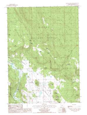
Buttes Of The Gods Topo Map Oregon
To zoom in, hover over the map of Buttes Of The Gods
USGS Topo Quad 42121e5 - 1:24,000 scale
| Topo Map Name: | Buttes Of The Gods |
| USGS Topo Quad ID: | 42121e5 |
| Print Size: | ca. 21 1/4" wide x 27" high |
| Southeast Coordinates: | 42.5° N latitude / 121.5° W longitude |
| Map Center Coordinates: | 42.5625° N latitude / 121.5625° W longitude |
| U.S. State: | OR |
| Filename: | o42121e5.jpg |
| Download Map JPG Image: | Buttes Of The Gods topo map 1:24,000 scale |
| Map Type: | Topographic |
| Topo Series: | 7.5´ |
| Map Scale: | 1:24,000 |
| Source of Map Images: | United States Geological Survey (USGS) |
| Alternate Map Versions: |
Buttes of The Gods OR 1988, updated 1988 Download PDF Buy paper map Buttes of The Gods OR 1998, updated 2000 Download PDF Buy paper map Buttes of the Gods OR 2011 Download PDF Buy paper map Buttes of the Gods OR 2014 Download PDF Buy paper map |
| FStopo: | US Forest Service topo Buttes of the Gods is available: Download FStopo PDF Download FStopo TIF |
1:24,000 Topo Quads surrounding Buttes Of The Gods
> Back to 42121e1 at 1:100,000 scale
> Back to 42120a1 at 1:250,000 scale
> Back to U.S. Topo Maps home
Buttes Of The Gods topo map: Gazetteer
Buttes Of The Gods: Reservoirs
Grade Reservoir elevation 1487m 4878′John Smith Reservoir elevation 1436m 4711′
Junction Reservoir elevation 1427m 4681′
Long Reservoir elevation 1471m 4826′
Pothole Reservoir elevation 1429m 4688′
Prairie Reservoir elevation 1427m 4681′
South Grade Reservoir elevation 1494m 4901′
Wigwam Reservoir elevation 1430m 4691′
Buttes Of The Gods: Summits
Antone Butte elevation 1435m 4708′Buttes of the Gods elevation 1312m 4304′
Coyote Butte elevation 1386m 4547′
Magpie Butte elevation 1361m 4465′
Mousehawk Butte elevation 1379m 4524′
Rat Butte elevation 1391m 4563′
Skunk Butte elevation 1372m 4501′
Wolf Butte elevation 1375m 4511′
Buttes Of The Gods: Valleys
Cooks Canyon elevation 1335m 4379′Sprague River Valley elevation 1306m 4284′
Buttes Of The Gods digital topo map on disk
Buy this Buttes Of The Gods topo map showing relief, roads, GPS coordinates and other geographical features, as a high-resolution digital map file on DVD:


