Applegate Butte Topo Map Oregon
To zoom in, hover over the map of Applegate Butte
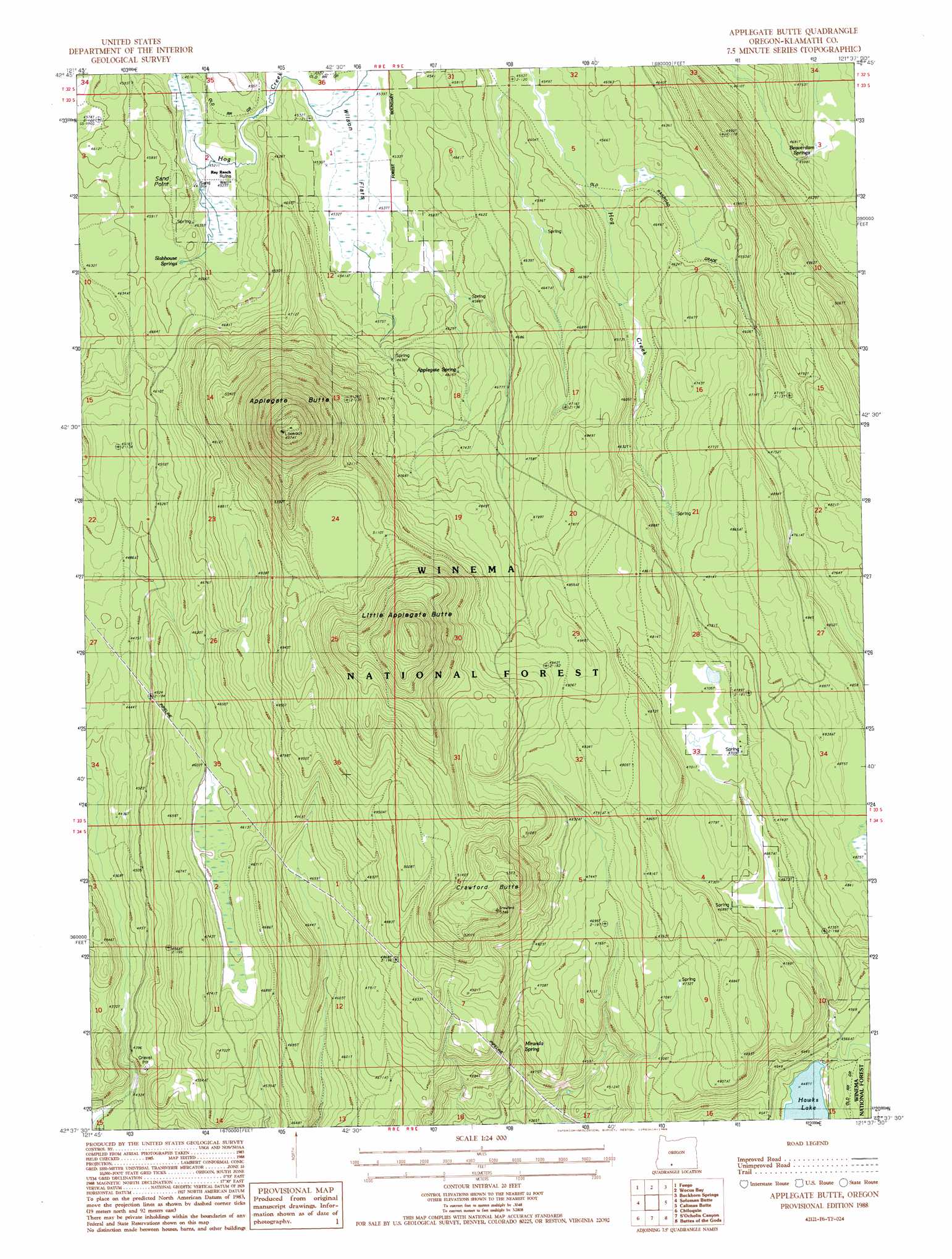
USGS Topo Quad 42121f6 - 1:24,000 scale
| Topo Map Name: | Applegate Butte |
| USGS Topo Quad ID: | 42121f6 |
| Print Size: | ca. 21 1/4" wide x 27" high |
| Southeast Coordinates: | 42.625° N latitude / 121.625° W longitude |
| Map Center Coordinates: | 42.6875° N latitude / 121.6875° W longitude |
| U.S. State: | OR |
| Filename: | o42121f6.jpg |
| Download Map JPG Image: | Applegate Butte topo map 1:24,000 scale |
| Map Type: | Topographic |
| Topo Series: | 7.5´ |
| Map Scale: | 1:24,000 |
| Source of Map Images: | United States Geological Survey (USGS) |
| Alternate Map Versions: |
Applegate Butte OR 1988, updated 1988 Download PDF Buy paper map Applegate Butte OR 1998, updated 2000 Download PDF Buy paper map Applegate Butte OR 2011 Download PDF Buy paper map Applegate Butte OR 2014 Download PDF Buy paper map |
| FStopo: | US Forest Service topo Applegate Butte is available: Download FStopo PDF Download FStopo TIF |
1:24,000 Topo Quads surrounding Applegate Butte
Pothole Butte |
Lenz |
Military Crossing |
Wildhorse Ridge |
Gordon Lake |
Sun Pass |
Fuego |
Wocus Bay |
Buckhorn Springs |
The Bull Pasture |
Fort Klamath |
Soloman Butte |
Applegate Butte |
Calimus Butte |
Fuego Mountain |
Agency Lake |
Chiloquin |
S'Ocholis Canyon |
Buttes Of The Gods |
Cooks Mountain |
Shoalwater Bay |
Modoc Point |
Swan Lake Point |
Sprague River West |
Sprague River East |
> Back to 42121e1 at 1:100,000 scale
> Back to 42120a1 at 1:250,000 scale
> Back to U.S. Topo Maps home
Applegate Butte topo map: Gazetteer
Applegate Butte: Flats
Wilson Flats elevation 1383m 4537′Applegate Butte: Springs
Applegate Spring elevation 1431m 4694′Beaverdam Springs elevation 1402m 4599′
Miranda Spring elevation 1390m 4560′
Slabhouse Springs elevation 1392m 4566′
Applegate Butte: Summits
Applegate Butte elevation 1834m 6017′Crawford Butte elevation 1628m 5341′
Little Applegate Butte elevation 1766m 5793′
Sand Point elevation 1410m 4625′
Applegate Butte digital topo map on disk
Buy this Applegate Butte topo map showing relief, roads, GPS coordinates and other geographical features, as a high-resolution digital map file on DVD: