Sun Pass Topo Map Oregon
To zoom in, hover over the map of Sun Pass
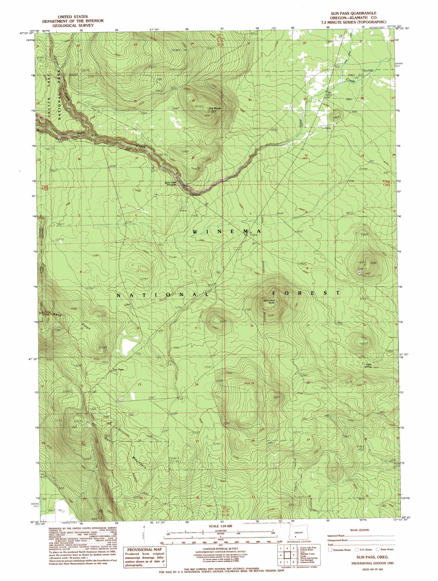
USGS Topo Quad 42121g8 - 1:24,000 scale
| Topo Map Name: | Sun Pass |
| USGS Topo Quad ID: | 42121g8 |
| Print Size: | ca. 21 1/4" wide x 27" high |
| Southeast Coordinates: | 42.75° N latitude / 121.875° W longitude |
| Map Center Coordinates: | 42.8125° N latitude / 121.9375° W longitude |
| U.S. State: | OR |
| Filename: | o42121g8.jpg |
| Download Map JPG Image: | Sun Pass topo map 1:24,000 scale |
| Map Type: | Topographic |
| Topo Series: | 7.5´ |
| Map Scale: | 1:24,000 |
| Source of Map Images: | United States Geological Survey (USGS) |
| Alternate Map Versions: |
Sun Pass OR 1985, updated 1985 Download PDF Buy paper map Sun Pass OR 1998, updated 2000 Download PDF Buy paper map Sun Pass OR 2011 Download PDF Buy paper map Sun Pass OR 2014 Download PDF Buy paper map |
| FStopo: | US Forest Service topo Sun Pass is available: Download FStopo PDF Download FStopo TIF |
1:24,000 Topo Quads surrounding Sun Pass
Pumice Desert West |
Pumice Desert East |
Welch Butte |
Mazama |
Round Butte |
Crater Lake West |
Crater Lake East |
Pothole Butte |
Lenz |
Military Crossing |
Union Peak |
Maklaks Crater |
Sun Pass |
Fuego |
Wocus Bay |
Devils Peak |
Mares Egg Spring |
Fort Klamath |
Soloman Butte |
Applegate Butte |
Pelican Butte |
Crystal Spring |
Agency Lake |
Chiloquin |
S'Ocholis Canyon |
> Back to 42121e1 at 1:100,000 scale
> Back to 42120a1 at 1:250,000 scale
> Back to U.S. Topo Maps home
Sun Pass topo map: Gazetteer
Sun Pass: Canals
Sand Creek Canal elevation 1413m 4635′Sun Pass: Gaps
Sun Pass elevation 1654m 5426′Sun Pass: Ridges
Sand Ridge elevation 1757m 5764′Sun Pass: Springs
Egan Springs elevation 1456m 4776′Sun Pass: Streams
Cavern Creek elevation 1577m 5173′Wheeler Creek elevation 1603m 5259′
Sun Pass: Summits
Boundary Butte elevation 1739m 5705′Dry Butte elevation 1722m 5649′
Sun Mountain elevation 1671m 5482′
Sun Pass digital topo map on disk
Buy this Sun Pass topo map showing relief, roads, GPS coordinates and other geographical features, as a high-resolution digital map file on DVD: