Yamsay Mountain Topo Map Oregon
To zoom in, hover over the map of Yamsay Mountain
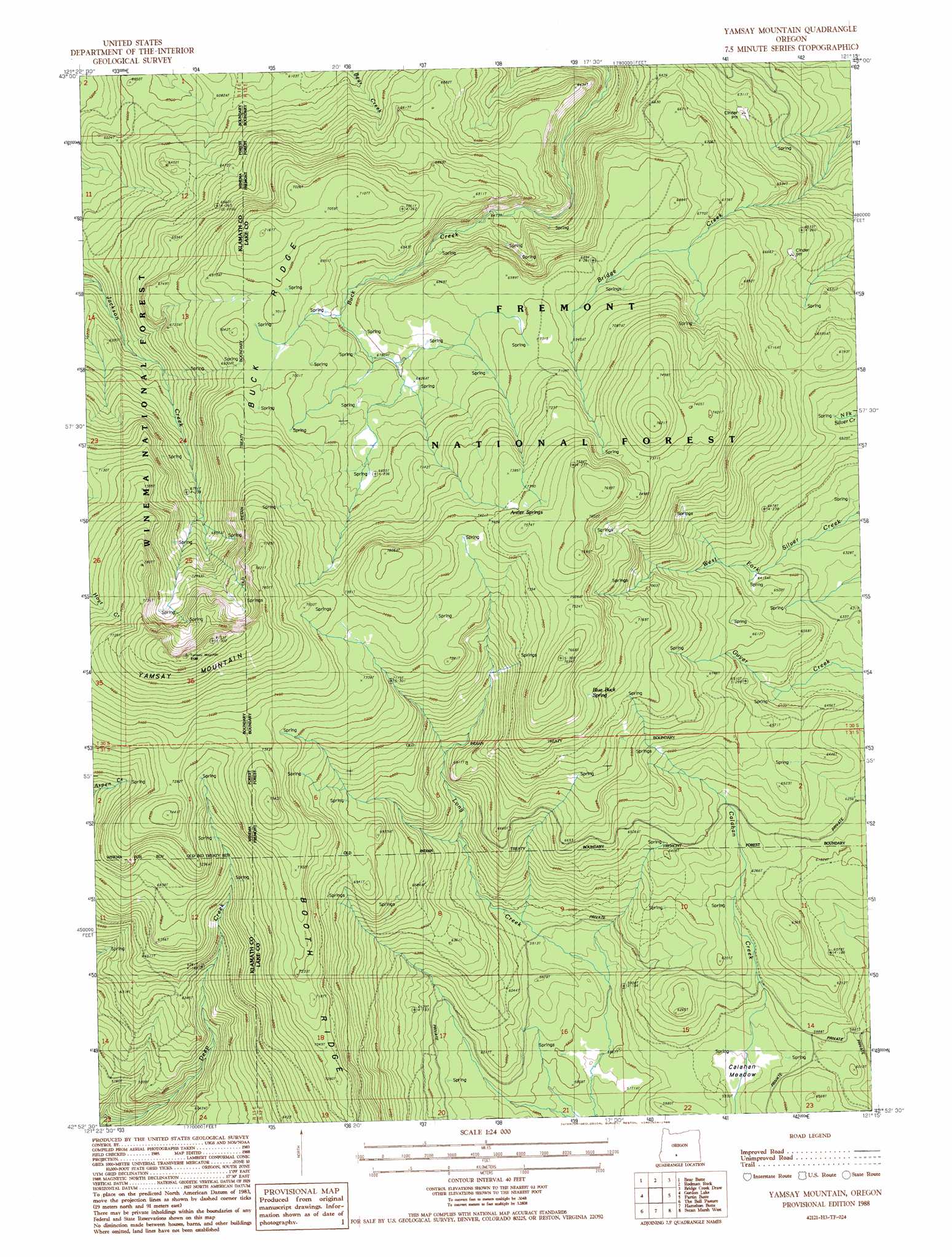
USGS Topo Quad 42121h3 - 1:24,000 scale
| Topo Map Name: | Yamsay Mountain |
| USGS Topo Quad ID: | 42121h3 |
| Print Size: | ca. 21 1/4" wide x 27" high |
| Southeast Coordinates: | 42.875° N latitude / 121.25° W longitude |
| Map Center Coordinates: | 42.9375° N latitude / 121.3125° W longitude |
| U.S. State: | OR |
| Filename: | o42121h3.jpg |
| Download Map JPG Image: | Yamsay Mountain topo map 1:24,000 scale |
| Map Type: | Topographic |
| Topo Series: | 7.5´ |
| Map Scale: | 1:24,000 |
| Source of Map Images: | United States Geological Survey (USGS) |
| Alternate Map Versions: |
Yamsay Mountain OR 1988, updated 1988 Download PDF Buy paper map Yamsay Mountain OR 1999, updated 2002 Download PDF Buy paper map Yamsay Mountain OR 2011 Download PDF Buy paper map Yamsay Mountain OR 2014 Download PDF Buy paper map |
| FStopo: | US Forest Service topo Yamsay Mountain is available: Download FStopo PDF Download FStopo TIF |
1:24,000 Topo Quads surrounding Yamsay Mountain
Tea Table Mountain |
Location Butte |
Antelope Mountain |
Oatman Flat |
Silver Lake |
Sugarpine Mountain |
Bear Butte |
Rodman Rock |
Bridge Creek Draw |
Hager Mountain |
Wildhorse Ridge |
Gordon Lake |
Yamsay Mountain |
Partin Butte |
Thompson Reservoir |
Buckhorn Springs |
The Bull Pasture |
Hamelton Butte |
Sycan Marsh West |
Sycan Marsh East |
Calimus Butte |
Fuego Mountain |
Silver Dollar Flat |
Riverbed Butte Spring |
Riverbed Butte |
> Back to 42121e1 at 1:100,000 scale
> Back to 42120a1 at 1:250,000 scale
> Back to U.S. Topo Maps home
Yamsay Mountain topo map: Gazetteer
Yamsay Mountain: Flats
Calahan Meadow elevation 1791m 5875′Yamsay Mountain: Forests
Fremont National Forest elevation 2216m 7270′Yamsay Mountain: Ridges
Booth Ridge elevation 2163m 7096′Buck Ridge elevation 2123m 6965′
Jackson Ridge elevation 2237m 7339′
Yamsay Mountain: Springs
Antler Springs elevation 2256m 7401′Blue Buck Spring elevation 2155m 7070′
Yamsay Mountain: Summits
Yamsay Mountain elevation 2468m 8097′Yamsay Mountain digital topo map on disk
Buy this Yamsay Mountain topo map showing relief, roads, GPS coordinates and other geographical features, as a high-resolution digital map file on DVD: