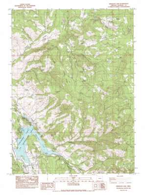
Emigrant Lake Topo Map Oregon
To zoom in, hover over the map of Emigrant Lake
USGS Topo Quad 42122b5 - 1:24,000 scale
| Topo Map Name: | Emigrant Lake |
| USGS Topo Quad ID: | 42122b5 |
| Print Size: | ca. 21 1/4" wide x 27" high |
| Southeast Coordinates: | 42.125° N latitude / 122.5° W longitude |
| Map Center Coordinates: | 42.1875° N latitude / 122.5625° W longitude |
| U.S. State: | OR |
| Filename: | o42122b5.jpg |
| Download Map JPG Image: | Emigrant Lake topo map 1:24,000 scale |
| Map Type: | Topographic |
| Topo Series: | 7.5´ |
| Map Scale: | 1:24,000 |
| Source of Map Images: | United States Geological Survey (USGS) |
| Alternate Map Versions: |
Emigrant Lake OR 1983, updated 1983 Download PDF Buy paper map Emigrant Lake OR 1983, updated 1987 Download PDF Buy paper map Emigrant Lake OR 2011 Download PDF Buy paper map Emigrant Lake OR 2014 Download PDF Buy paper map |
1:24,000 Topo Quads surrounding Emigrant Lake
> Back to 42122a1 at 1:100,000 scale
> Back to 42122a1 at 1:250,000 scale
> Back to U.S. Topo Maps home
Emigrant Lake topo map: Gazetteer
Emigrant Lake: Areas
Acey Field elevation 1222m 4009′Big Prairie elevation 1303m 4274′
Bill Willis Flats elevation 1364m 4475′
Little Prairie elevation 1419m 4655′
Emigrant Lake: Bays
Helms Cove elevation 684m 2244′Emigrant Lake: Canals
Ashland Lateral elevation 1163m 3815′Emigrant Lake: Dams
Emigrant Dam elevation 681m 2234′Emigrant Lake: Flats
Dosier Flat elevation 1286m 4219′Hooper Meadows elevation 1474m 4835′
Rose Flat elevation 970m 3182′
School House Meadow elevation 1320m 4330′
Emigrant Lake: Gaps
Songen Gap elevation 731m 2398′Emigrant Lake: Lakes
Chapman Lake elevation 1219m 3999′Ice House Lake elevation 1157m 3795′
Emigrant Lake: Mines
Barron Mine elevation 1048m 3438′Emigrant Lake: Parks
Emigrant Lake County Park elevation 746m 2447′Hooper Springs County Wayside elevation 1365m 4478′
Songer Wayside elevation 696m 2283′
Emigrant Lake: Pillars
Black Rock elevation 845m 2772′Emigrant Lake: Populated Places
Barron (historical) elevation 707m 2319′Emigrant Lake: Post Offices
Barron Post Office (historical) elevation 707m 2319′Emigrant Lake: Reservoirs
Bounds Reservoir elevation 628m 2060′Emigrant Lake elevation 681m 2234′
Gibson Reservoir elevation 1233m 4045′
Emigrant Lake: Ridges
Big Craggy elevation 1201m 3940′Canyon Ridge elevation 1339m 4393′
Little Craggy elevation 988m 3241′
Salt Ridge elevation 848m 2782′
Emigrant Lake: Slopes
The Slide elevation 1378m 4520′Emigrant Lake: Springs
Cold Spring elevation 1586m 5203′Green Spring elevation 988m 3241′
Green Springs elevation 959m 3146′
Hooper Springs elevation 1366m 4481′
Middle Spring elevation 757m 2483′
Spout Spring elevation 1403m 4603′
Tom Spring elevation 1439m 4721′
Wagner Soda Spring elevation 720m 2362′
White Oak Spring elevation 741m 2431′
Emigrant Lake: Streams
Babe Creek elevation 963m 3159′Barron Creek elevation 692m 2270′
Big Creek elevation 1222m 4009′
Carter Creek elevation 700m 2296′
Cattle Creek elevation 684m 2244′
Dosier Creek elevation 1034m 3392′
Emigrant Channel elevation 610m 2001′
Frog Creek elevation 663m 2175′
Hannah Creek elevation 635m 2083′
Hill Creek elevation 684m 2244′
Ice House Creek elevation 962m 3156′
Murphy Creek elevation 647m 2122′
North Branch Cove Creek elevation 1101m 3612′
Prairie Branch Cove Creek elevation 1189m 3900′
Right Fork Sampson Creek elevation 902m 2959′
Sampson Creek elevation 684m 2244′
Soda Creek elevation 722m 2368′
South Branch Cove Creek elevation 1110m 3641′
Emigrant Lake: Summits
Buck Point elevation 1245m 4084′Green Springs Mountain elevation 1590m 5216′
Henry Mountain elevation 1840m 6036′
Major Butte elevation 1019m 3343′
Rattlesnake Point elevation 722m 2368′
Round Mountain elevation 1453m 4767′
Songer Butte elevation 821m 2693′
Sugarloaf elevation 1463m 4799′
Tom Spring Mountain elevation 1578m 5177′
Emigrant Lake: Valleys
Burns Gulch elevation 674m 2211′Deep Hollow elevation 967m 3172′
Edwards Canyon elevation 1038m 3405′
Ice House Canyon elevation 1085m 3559′
Sweathouse Canyon elevation 930m 3051′
Emigrant Lake digital topo map on disk
Buy this Emigrant Lake topo map showing relief, roads, GPS coordinates and other geographical features, as a high-resolution digital map file on DVD:


