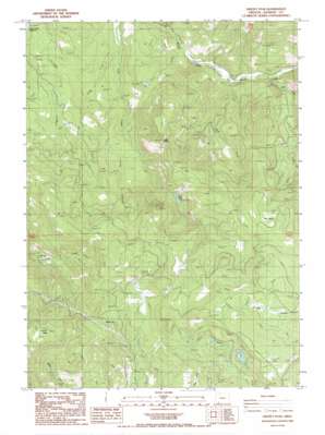
Grizzly Peak Topo Map Oregon
To zoom in, hover over the map of Grizzly Peak
USGS Topo Quad 42122c5 - 1:24,000 scale
| Topo Map Name: | Grizzly Peak |
| USGS Topo Quad ID: | 42122c5 |
| Print Size: | ca. 21 1/4" wide x 27" high |
| Southeast Coordinates: | 42.25° N latitude / 122.5° W longitude |
| Map Center Coordinates: | 42.3125° N latitude / 122.5625° W longitude |
| U.S. State: | OR |
| Filename: | o42122c5.jpg |
| Download Map JPG Image: | Grizzly Peak topo map 1:24,000 scale |
| Map Type: | Topographic |
| Topo Series: | 7.5´ |
| Map Scale: | 1:24,000 |
| Source of Map Images: | United States Geological Survey (USGS) |
| Alternate Map Versions: |
Grizzly Peak OR 1988, updated 1988 Download PDF Buy paper map Grizzly Peak OR 2011 Download PDF Buy paper map Grizzly Peak OR 2014 Download PDF Buy paper map |
1:24,000 Topo Quads surrounding Grizzly Peak
> Back to 42122a1 at 1:100,000 scale
> Back to 42122a1 at 1:250,000 scale
> Back to U.S. Topo Maps home
Grizzly Peak topo map: Gazetteer
Grizzly Peak: Dams
Lost Lake Dam elevation 1126m 3694′Grizzly Peak: Flats
Big Glades elevation 1372m 4501′Grizzly Peak: Lakes
Big Lake elevation 1516m 4973′Lost Lake elevation 1097m 3599′
Grizzly Peak: Populated Places
Climax elevation 1054m 3458′Grizzly Peak: Post Offices
Climax Post Office (historical) elevation 1054m 3458′Grizzly Peak: Reservoirs
Guidottie Reservoir elevation 692m 2270′Shale City Reservoirs elevation 1405m 4609′
Grizzly Peak: Springs
Donsmore Spring elevation 1183m 3881′Red Fir Spring elevation 1052m 3451′
Grizzly Peak: Streams
Charley Creek elevation 677m 2221′Cold Spring Creek elevation 1083m 3553′
Coon Creek elevation 643m 2109′
Deer Creek elevation 619m 2030′
Harrison Creek elevation 866m 2841′
Soda Creek elevation 657m 2155′
Spring Creek elevation 948m 3110′
Grizzly Peak: Summits
Eagle Butte elevation 1300m 4265′Grizzly Peak elevation 1783m 5849′
Grizzly Peak: Valleys
Bybee Gulch elevation 1237m 4058′Lucky Canyon elevation 819m 2687′
Grizzly Peak digital topo map on disk
Buy this Grizzly Peak topo map showing relief, roads, GPS coordinates and other geographical features, as a high-resolution digital map file on DVD:


