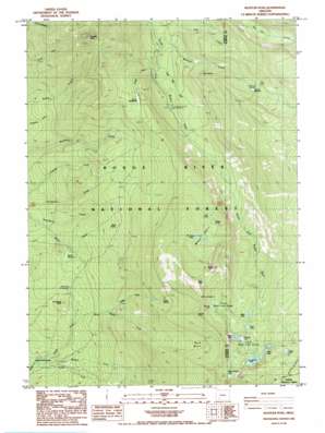
Rustler Peak Topo Map Oregon
To zoom in, hover over the map of Rustler Peak
USGS Topo Quad 42122e3 - 1:24,000 scale
| Topo Map Name: | Rustler Peak |
| USGS Topo Quad ID: | 42122e3 |
| Print Size: | ca. 21 1/4" wide x 27" high |
| Southeast Coordinates: | 42.5° N latitude / 122.25° W longitude |
| Map Center Coordinates: | 42.5625° N latitude / 122.3125° W longitude |
| U.S. State: | OR |
| Filename: | o42122e3.jpg |
| Download Map JPG Image: | Rustler Peak topo map 1:24,000 scale |
| Map Type: | Topographic |
| Topo Series: | 7.5´ |
| Map Scale: | 1:24,000 |
| Source of Map Images: | United States Geological Survey (USGS) |
| Alternate Map Versions: |
Rustler Peak OR 1985, updated 1985 Download PDF Buy paper map Rustler Peak OR 1997, updated 2000 Download PDF Buy paper map Rustler Peak OR 2011 Download PDF Buy paper map Rustler Peak OR 2014 Download PDF Buy paper map |
| FStopo: | US Forest Service topo Rustler Peak is available: Download FStopo PDF Download FStopo TIF |
1:24,000 Topo Quads surrounding Rustler Peak
> Back to 42122e1 at 1:100,000 scale
> Back to 42122a1 at 1:250,000 scale
> Back to U.S. Topo Maps home
Rustler Peak topo map: Gazetteer
Rustler Peak: Basins
Buck Basin elevation 1782m 5846′McKee Basin elevation 1742m 5715′
Rustler Peak: Flats
Parker Meadows elevation 1524m 5000′Sheep Camp Glades elevation 1058m 3471′
Stanley Meadows elevation 1247m 4091′
Wickiup Meadow elevation 1662m 5452′
Rustler Peak: Lakes
Beal Lake elevation 1691m 5547′Blue Canyon Lake elevation 1874m 6148′
Blue Lake elevation 1732m 5682′
Carey Lake elevation 1839m 6033′
Grassy Pond elevation 1705m 5593′
Horseshoe Lake elevation 1748m 5734′
Lily Pond elevation 1735m 5692′
McKee Lake elevation 1767m 5797′
Meadow Lake elevation 1727m 5666′
Mud Lake elevation 1713m 5620′
North Blue Lake Group elevation 1791m 5875′
Pear Lake elevation 1755m 5757′
Round Lake elevation 1788m 5866′
South Blue Lake Group elevation 1738m 5702′
Rustler Peak: Pillars
Blue Rock elevation 2004m 6574′Rustler Peak: Post Offices
Pioneer Post Office (historical) elevation 1649m 5410′Rustler Peak: Springs
Christis Spring elevation 1892m 6207′Dole Spring elevation 1505m 4937′
Gypsy Spring elevation 1697m 5567′
Misfit Spring elevation 1392m 4566′
Onion Spring elevation 1657m 5436′
Wickiup Spring elevation 1622m 5321′
Rustler Peak: Streams
Beaver Fork elevation 1058m 3471′Buck Basin Fork elevation 1169m 3835′
Gypsy Fork elevation 1280m 4199′
Little Billie Creek elevation 1284m 4212′
Little Butte Creek elevation 1290m 4232′
Misfit Creek elevation 1111m 3645′
North Fork Fourbit Creek elevation 1058m 3471′
Parker Creek elevation 1296m 4251′
Salt Fork Fourbit Creek elevation 1185m 3887′
South Fork Fourbit Creek elevation 1058m 3471′
Wickiup Creek elevation 1261m 4137′
Rustler Peak: Summits
Cat Hill elevation 1942m 6371′Rustler Peak elevation 1892m 6207′
Smith Rock elevation 1994m 6541′
Snowshoe Butte elevation 1274m 4179′
Rustler Peak: Trails
Blue Canyon Trail elevation 1802m 5912′Cat Hill Way elevation 1932m 6338′
Goss Trail elevation 1287m 4222′
South Fork Trail elevation 1425m 4675′
Rustler Peak digital topo map on disk
Buy this Rustler Peak topo map showing relief, roads, GPS coordinates and other geographical features, as a high-resolution digital map file on DVD:


