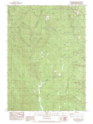
Cleveland Ridge Topo Map Oregon
To zoom in, hover over the map of Cleveland Ridge
USGS Topo Quad 42122f8 - 1:24,000 scale
| Topo Map Name: | Cleveland Ridge |
| USGS Topo Quad ID: | 42122f8 |
| Print Size: | ca. 21 1/4" wide x 27" high |
| Southeast Coordinates: | 42.625° N latitude / 122.875° W longitude |
| Map Center Coordinates: | 42.6875° N latitude / 122.9375° W longitude |
| U.S. State: | OR |
| Filename: | o42122f8.jpg |
| Download Map JPG Image: | Cleveland Ridge topo map 1:24,000 scale |
| Map Type: | Topographic |
| Topo Series: | 7.5´ |
| Map Scale: | 1:24,000 |
| Source of Map Images: | United States Geological Survey (USGS) |
| Alternate Map Versions: |
Cleveland Ridge OR 1983, updated 1983 Download PDF Buy paper map Cleveland Ridge OR 1998, updated 2000 Download PDF Buy paper map Cleveland Ridge OR 2011 Download PDF Buy paper map Cleveland Ridge OR 2014 Download PDF Buy paper map |
| FStopo: | US Forest Service topo Cleveland Ridge is available: Download FStopo PDF Download FStopo TIF |
1:24,000 Topo Quads surrounding Cleveland Ridge
> Back to 42122e1 at 1:100,000 scale
> Back to 42122a1 at 1:250,000 scale
> Back to U.S. Topo Maps home
Cleveland Ridge topo map: Gazetteer
Cleveland Ridge: Flats
Buck Flat elevation 691m 2267′Cleveland Ridge: Gaps
Railroad Gap elevation 1254m 4114′Cleveland Ridge: Populated Places
Asbestos (historical) elevation 657m 2155′Cleveland Ridge: Post Offices
Asbestos Post Office (historical) elevation 660m 2165′Cleveland Ridge: Reservoirs
Lane and Shephard Reservoirs elevation 757m 2483′Cleveland Ridge: Ridges
Cleveland Ridge elevation 1127m 3697′Cleveland Ridge: Springs
Cold Spring elevation 1257m 4124′Snowshoe Spring elevation 1139m 3736′
Cleveland Ridge: Streams
Canon Creek elevation 550m 1804′Chapman Creek elevation 594m 1948′
Chicago Creek elevation 626m 2053′
Coal Creek elevation 672m 2204′
Morrison Creek elevation 546m 1791′
Musty Creek elevation 782m 2565′
Railroad Gap Creek elevation 944m 3097′
Romine Creek elevation 527m 1729′
Walpole Creek elevation 542m 1778′
Wolf Creek elevation 768m 2519′
Cleveland Ridge: Summits
Board Mountain elevation 1104m 3622′Round Top elevation 1418m 4652′
Cleveland Ridge digital topo map on disk
Buy this Cleveland Ridge topo map showing relief, roads, GPS coordinates and other geographical features, as a high-resolution digital map file on DVD:


