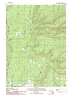
Prospect North Topo Map Oregon
To zoom in, hover over the map of Prospect North
USGS Topo Quad 42122g4 - 1:24,000 scale
| Topo Map Name: | Prospect North |
| USGS Topo Quad ID: | 42122g4 |
| Print Size: | ca. 21 1/4" wide x 27" high |
| Southeast Coordinates: | 42.75° N latitude / 122.375° W longitude |
| Map Center Coordinates: | 42.8125° N latitude / 122.4375° W longitude |
| U.S. State: | OR |
| Filename: | o42122g4.jpg |
| Download Map JPG Image: | Prospect North topo map 1:24,000 scale |
| Map Type: | Topographic |
| Topo Series: | 7.5´ |
| Map Scale: | 1:24,000 |
| Source of Map Images: | United States Geological Survey (USGS) |
| Alternate Map Versions: |
Prospect North OR 1989, updated 1990 Download PDF Buy paper map Prospect North OR 1997, updated 2000 Download PDF Buy paper map Prospect North OR 2011 Download PDF Buy paper map Prospect North OR 2014 Download PDF Buy paper map |
| FStopo: | US Forest Service topo Prospect North is available: Download FStopo PDF Download FStopo TIF |
1:24,000 Topo Quads surrounding Prospect North
> Back to 42122e1 at 1:100,000 scale
> Back to 42122a1 at 1:250,000 scale
> Back to U.S. Topo Maps home
Prospect North topo map: Gazetteer
Prospect North: Dams
North Fork Diversion Dam elevation 803m 2634′Prospect North: Populated Places
Prospect elevation 782m 2565′Prospect North: Post Offices
Prospect Post Office elevation 782m 2565′Prospect North: Reservoirs
North Fork Diversion Reservoir elevation 803m 2634′Red Blanket Reservoir elevation 816m 2677′
Prospect North: Streams
Coffee Creek elevation 988m 3241′Dead Soldier Creek elevation 1077m 3533′
Deep Creek elevation 823m 2700′
Ginkgo Creek elevation 885m 2903′
Graham Creek elevation 831m 2726′
Kiter Creek elevation 858m 2814′
Larson Creek elevation 848m 2782′
Lick Creek elevation 903m 2962′
Lund Creek elevation 815m 2673′
Needle Creek elevation 867m 2844′
North Fork Mill Creek elevation 909m 2982′
Sink Creek elevation 861m 2824′
Prospect North: Trails
Ginkgo Trail elevation 1245m 4084′Prospect North: Valleys
Takelma Gorge elevation 874m 2867′Prospect North: Woods
Mammoth Pines elevation 893m 2929′Prospect North digital topo map on disk
Buy this Prospect North topo map showing relief, roads, GPS coordinates and other geographical features, as a high-resolution digital map file on DVD:


