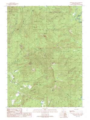
Whetstone Point Topo Map Oregon
To zoom in, hover over the map of Whetstone Point
USGS Topo Quad 42122g5 - 1:24,000 scale
| Topo Map Name: | Whetstone Point |
| USGS Topo Quad ID: | 42122g5 |
| Print Size: | ca. 21 1/4" wide x 27" high |
| Southeast Coordinates: | 42.75° N latitude / 122.5° W longitude |
| Map Center Coordinates: | 42.8125° N latitude / 122.5625° W longitude |
| U.S. State: | OR |
| Filename: | o42122g5.jpg |
| Download Map JPG Image: | Whetstone Point topo map 1:24,000 scale |
| Map Type: | Topographic |
| Topo Series: | 7.5´ |
| Map Scale: | 1:24,000 |
| Source of Map Images: | United States Geological Survey (USGS) |
| Alternate Map Versions: |
Whetstone Point OR 1989, updated 1990 Download PDF Buy paper map Whetstone Point OR 1997, updated 2000 Download PDF Buy paper map Whetstone Point OR 2011 Download PDF Buy paper map Whetstone Point OR 2014 Download PDF Buy paper map |
| FStopo: | US Forest Service topo Whetstone Point is available: Download FStopo PDF Download FStopo TIF |
1:24,000 Topo Quads surrounding Whetstone Point
> Back to 42122e1 at 1:100,000 scale
> Back to 42122a1 at 1:250,000 scale
> Back to U.S. Topo Maps home
Whetstone Point topo map: Gazetteer
Whetstone Point: Basins
Buck Basin elevation 1360m 4461′Whetstone Point: Bridges
Woodruff Bridge elevation 904m 2965′Whetstone Point: Canals
P P & L Canal elevation 801m 2627′Whetstone Point: Falls
Turner Drop elevation 907m 2975′Whetstone Point: Flats
Squaw Prairie elevation 682m 2237′Whetstone Point: Gaps
Grub Box Gap elevation 1340m 4396′Sandoz Gap elevation 1264m 4146′
Whetstone Point: Mines
Al Sarena Buzzard Mine elevation 1053m 3454′Whetstone Point: Populated Places
Persist (historical) elevation 867m 2844′Whetstone Point: Post Offices
Persist Post Office (historical) elevation 867m 2844′Whetstone Point: Reservoirs
Bassett Reservoir elevation 1028m 3372′Persist Ranch Reservoirs elevation 966m 3169′
Whetstone Point: Ridges
Willits Ridge elevation 1212m 3976′Whetstone Point: Springs
Elk Lick elevation 751m 2463′Morgan Spring elevation 774m 2539′
Needle Rock Spring elevation 1369m 4491′
Whetstone Point: Streams
Abbott Creek elevation 904m 2965′Alder Creek elevation 717m 2352′
Brush Creek elevation 694m 2276′
Cedar Creek elevation 1136m 3727′
Cold Spring Creek elevation 722m 2368′
Hop Creek elevation 907m 2975′
Jim Creek elevation 908m 2979′
Littlemile Creek elevation 931m 3054′
Schoolma'am Creek elevation 797m 2614′
Top Creek elevation 909m 2982′
Whetstone Point: Summits
Bald Mountain elevation 1572m 5157′Gravel Butte elevation 1015m 3330′
Halls Point elevation 1380m 4527′
Hibbard Point elevation 1174m 3851′
Lick Rock elevation 1057m 3467′
Needle Rocks elevation 1425m 4675′
Round Top elevation 1573m 5160′
Whetstone Point elevation 1251m 4104′
White Point elevation 1481m 4858′
Whetstone Point digital topo map on disk
Buy this Whetstone Point topo map showing relief, roads, GPS coordinates and other geographical features, as a high-resolution digital map file on DVD:


